thanks for tutorial when I click Basemap it give me Error : No Imaging library available. Image module was not correctly installed. what is the solution ?
Hello, I have 2 issues, 1 issue is the graphic on google map has multi colored blocks, image. 2 before it crash now it does that. And I just install a AMD rx 6800 xt. Help
Since your shape file is a flat polygon, how did it acquire different heights when you imported it into Blender? In theory, all shape files should have the same heights, so how did Blender determine each shape file's distinctive heights if that is indeed the case?
when exporting he toggled 'extrudes height from a field' in that popup window, meaning if you have a field in the attribute table blender can read it and use the number in the field as height for each shape.
I dont understand why did you scale the grid. If you scale it than it is not correctly placed therefore wrong isnt it? I like the video, however as a geospatial expert it pains me to see such a nice visualisation, that is incorect.


As a sometime QGIS and Blender 3D user, you've just blown my mind! Thank you.
Brilliant video. Very clear and concise, thank you! Sincerely.
Thank you for such an informative video
I appriciate this wonderful tuttorial. I have been thinking how to express the shape file data other than QGIS
Can I download the shapefiles for other countries ? Any link you can suggest
thanks for tutorial
when I click Basemap it give me Error :
No Imaging library available. Image module was not correctly installed.
what is the solution ?
Hello, I have 2 issues, 1 issue is the graphic on google map has multi colored blocks, image. 2 before it crash now it does that. And I just install a AMD rx 6800 xt. Help
Since your shape file is a flat polygon, how did it acquire different heights when you imported it into Blender? In theory, all shape files should have the same heights, so how did Blender determine each shape file's distinctive heights if that is indeed the case?
when exporting he toggled 'extrudes height from a field' in that popup window, meaning if you have a field in the attribute table blender can read it and use the number in the field as height for each shape.
Can you select by location in Blender?
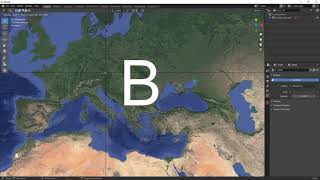
How can we crop the boundary of the area we want from a base map?
Thanks, that was helpful!
Is the GIS module required for Blender to export STL files?
epsg is 3857 not 4326 in my opinion
Shapefiles? One day Geopackage...
Good
I dont understand why did you scale the grid. If you scale it than it is not correctly placed therefore wrong isnt it?
I like the video, however as a geospatial expert it pains me to see such a nice visualisation, that is incorect.
Scaled in only the z axis so all of the heights stay correct relative to each other and their position on the basemap stays correct as well.