Это видео недоступно.
Сожалеем об этом.
Create REMs in QGIS for Flood and River Analysis (Detrended DEMs)

HTML-код
- Опубликовано: 16 авг 2024
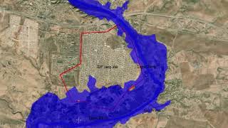
- Relative elevation models (REMs; also referred to as detrended DEMs) are extremely useful for river analysis. And they make really cool visualizations and maps. This tutorial will demonstrate how you can make and display REMs for FREE using QGIS.
Sign up for my email list to get EXCLUSIVE CONTENT: geospatialscho...
Step-by-step instructions: opensourceopti...
This video was adapted from this article: dancoecarto.co...


Great explanation. These channel migration visualizations have wrinkled my brain for a while now. Looking forward to playing around with this.
Very nice explained!! That helped me so much with my thesis! Thank you a lot!
Glad it helped!
Thank you for a clearly explained workflow.
You are welcome!
Thank youb
waooo 💪👏👏👏👏👏 bien
Hi! Does this method also work using SAR data? I do not have LiDAR data for my area of interest. Thank you in advance.
It will work with any elevation data, though the results may vary depending on accuracy and resolution
@@geospatialschool Thanks for the answer!
Does this mean that if i already have river stage at all the cross sections for 1D river reaches, then I can probably use this method and eventually stamp 2D floodplain stage onto 1D? At least I won’t have to worry about clipping the 1D component in the 1D-2D linked model.
Thanks for your video, it was really a mighty craic!
If you have 1d cross sections and a justice model then you can use that to see if this method will let you move to 2d. You'll just want to check your 1d cross sections against the rem to make sure everything lines up