Inserting and Scaling Aerial Images in AutoCAD

HTML-код
- Опубликовано: 18 авг 2016
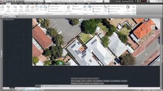
- This tutorial walks through the steps for exporting an aerial from Google Earth Pro, inserting that aerial into AutoCAD and scaling it to the actual size of the site.
For more tutorials, visit www.copytolayer.com