OS MAPS APP

HTML-код
- Опубликовано: 28 авг 2024
- How to use the OS Maps App on a Smartphone. Create routes easily and follow them on an OS Map on your Smartphone while hillwalking.
Learn hints and tips to use the OS Maps App to search or create routes. View more navigation articles at www.ultimatenavigationschool.co.uk


I would also recommend putting your phone in airplane mode whilst on the hill to save battery. You can always turn on the phone signal if you need to make a call.
Thanks for this. One shortcoming of the OS app is the route-plotting which is 100% manual. Compare that to Komoot where you mark locations (or a round trip) and it plots the route using pathways for you. Much smarter and less time-consuming. Only downside is that Komoot, whilst it has most paths it doesn't have all of them. For actual mapping, you can't beat the OS.
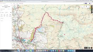
Would have been good to know if the rout would have snapped to the path you chose had you left the feature on
Thanks good job 👍🏻
Thanks very much for this helpful video. I'll now buy the OS app.
Thanks for this Ultimate Nav.
I set up a premium account and can upload routes to my pc and phone but even selecting a route from 'my routes' all I get is a grey screen. The other frustrating thing is downloading maps either fails completely or show 'qued' and never proceeding. On the FAQ it says the grey maps might be something to do with 'my location or find me' being enabled when I save the route, this definitely is not the case as by default my preference is set to 'UK overview".
To be honest I'm finding the lack of support for the app really frustrating, I can't find any forums for the app just to get some advice.
Sorry to bombard you with questions but I really want to get to grips with the app, thanks, Mark
thanks for the video very helpful I've recently purchased premium OS I've always been a bit sceptical about this type of format but I recently went a walk with a fellow walker and he had it and was showing me the pros and cons I was exited about it so I went for it . So my first walk i put a route in and started to proceed and notice my triangle just stayed at the same position is there something I'm doing wrong IE compass function not switched on.
Does it have analysis of walk speed elevation etc?
Hi, is it possible to use the flythrough feature on my phone? I'm able to use it on my pc but can't find it on my Samsung.
How many GB does the full version of "UK Maps" app take up? That costs over £100?
I've downloaded my map, with a route I created. But my mobile phone doesn't show the route? I have had this problem ongoing for sometime. Why can't I see the route?
I am using the OS maps on Android.
How do I mark on the map for instance the campsite I am staying on so I can navigate back to it later in the day.
Because it is hard to find where you are staying just by looking at the map and type in the postcode.
You can use the app to give you a grid ref, but it also gives you another set of coordinates, in eastings and northings - any idea what format or sort of coordinates these are? Thanks
Hi Mike, The Eastings and Northings given when you enter a waypoint marker are just the numerical eastings and northings. OS use a transverse mercator projection using the OSGB36 datum. This is simply a fixed point from which to base the OS Grid. The Grid is split into 500km and 100km squares denoted by letters as you know. e.g. SK. This datum uses a false origin so eastings are always positive and northings never exceed 1000km. The conversion is done for you on the screen. Take Kinder Downfall in the Peak District as an example- SK 98297 88959 is EASTING 408297 NORTHING 3888959. The SK is automatically converted to Easting 40xxxx Northing 38xxxxx with the last part being the later digits of the OS Grid ref (easting ..8297 and northing ..88959) If you look on the edges of explorer maps for example you can see the numeric eastings and northings in the edges - Hope that helps? best regards Ultimate Nav.