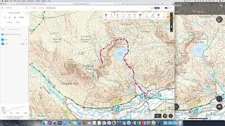
OS Maps - Route planning

HTML-код
- Опубликовано: 28 авг 2024
- Learn how to plan your own route on OS Maps. Plan your route on the desktop version, then follow it using the OS Maps app on phone or tablet.
Includes planning a route using the 'snap to path' function in National Parks, and how to set your speed preferences for accurate time estimates.
Find out more about OS Maps at osmaps.co.uk


Is it possible to delete lots of waypoints in one go ? I'm trying to split a large route up into smaller routes but deleting each waypoint one by one takes forever.
So you have to subscribe and pay for a service i cant use ? Because we have internet blackout when the military train , and they train a lot here ! Its back to paper maps
Hi, am I right in understanding that when planning a route you have to mark every turn if you do not have premium and using a particular area?
yes
My route ends with walking back on the same track that I walked out on, however when creating a route it will not let me do this, I can only go as far as the last point on the way out
Just to confirm, do you mean when you are plotting a route down a footpath for example, you are unable to place way points where a way point has already been placed? If so, you'll need to just place the waypoints you are plotting to the side of the original waypoints you have placed (you may have to plot these off the path). Hope this helps Mandy but let us know if this doesn't solve the issue or if you have any other questions.
With the maps downloaded onto a mobile device, can 'pins' be added to maps to mark places I may wish to visit? I can add pins to Google Earth and they remain there for future reference. Thanks.
Unfortunately, OS Maps at present will only handle routes not individual points. Our developers have been looking into creating the ability for users to place individual markers, but there's no timeframe for when this may be implemented. Apologies for any inconvenience.
@@ordnancesurvey No worries, thanks for the reply.
I've got the same problem as Lorna, but on the app (iOS), not the website. I can't move waypoints or add intermediate ones; I just get a new line from the endpoint to where I touch the screen. Is the function available in the app? How do I do it?
Hi Tim. Whilst in editing mode on the web service, you can add additional points to the end of the route by clicking on the map. You can add intermediate waypoints by clicking on the route or move existing waypoints by clicking and dragging them. You can also delete waypoints by switching to 'Delete' in the toolbar and clicking on them. Click save from the toolbar to keep your changes or cancel to discard them. Editing an existing route will override the original route details, not create a copy.
Here is a link to our support page which details this and more: www.ordnancesurvey.co.uk/shop/os-maps-faq.html#routes. Hope this helps.
How do I see bridleways for bike riding??
Bridleways are marked on the Explorer 1:25000 scale maps as a green dashed line and on the Landranger 1:50000 scale they are marked as a pink dashed line. Hope this helps!
At last i've worked out how to plot and print out a route on OS website.... thanks OS.. saves me having to fold my maps up and ruin them..
Are there any tips for Route planning when im on a walk? Please reply if you can. :D
Our support page should be able to help you: shop.ordnancesurvey.co.uk/os-maps-quick-start/#planroute. If you have a specific query, please send us an email at customerservices@os.uk.
Sorry, this did not help at all! How do you change or alter a saved route by adding waypoints. I just keep getting a line from my end or start point!!!! I find this route mapper very frustrating and clunky. It just doesn't respond.
Lorna, sorry to hear you are having issues with the routes. As both have different functionality when editing routes, please can you advise us if you logging in to the OS Maps app or OS Maps via a browser?
@@ordnancesurvey hi, I'm logging on via a browser on my laptop.
@@lornawallace2566 Thanks for getting back to us. Sometimes if you miss the line it assumes you are adding a new point to the end of the route and draws the line from there, which sounds like what you've described. We would advise that after going into edit mode, zoom right in as this makes clicking on the line a lot easier. Hope this helps.
This map is useless if you want to make a long ride though as it will take you hours to plot 100 miles of route!
So annoying why there is no mapping for Northern Ireland 👎😑☹
There is an Ordnance Survey of Northern Ireland that should be able to help you. Here is a link to their website: www.nidirect.gov.uk/campaigns/ordnance-survey-of-northern-ireland
@@ordnancesurvey Thanks for getting back to me but OSNI is only an online mapping shop that has none of the usefull features currently available on your site. Typical Northern Ireland always playing catch up. 🤔
Hi! I’ve created a circular route. It says the total distance of this is 46 miles. Is there anyway I can calculate the distance between two desired points along this route? Thanks
out-of-date 😞