Terrain Modelling from contour lines in Rhino - Tutorial

HTML-код
- Опубликовано: 17 дек 2020
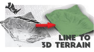
- This video tutorial goes through the step of how to create a 3d terrain model from a series of contour lines in Rhino. I have included the timestamps below so you can skip ahead to any relevant sections:
0:20 - Vertically spacing out the contour lines
2:28 - Using the Patch command to apply a surface over the top of our contour lines
3:10 - Patch surface options and terrain accuracy
5:20 - Trimming the edges of the terrain to match the site
6:05 - Making the terrain surface into a 3d object


this is much better than meshing those lines using "loft" , this looks much cleaner than a mesh 👌
Nice, succinct, great time stamps, exactly what I needed. I hadn't done this in years and you made it easy, thank you :) Keep up the awesome work!!
Thanks, I am glad it was useful
I prefer the Patch method because when I import contours from AutoCAD, they are already offset on the Z axis according to their height.
To avoid the issues with Patch, first add points to your curves by "dividing" them, then use Selection Filter to select points only, and use the points for Patch. The result is surprisingly clean!
Thank you very much for creating this.
However, I am wondering if there is a way to put the contour lines in their correct z-direction a much quick way?
Attention : do not enter 200x200 u v values if you dont trust your computer.
😂good thing I saw this first