Very High Resolution DEM and Contour from Google Earth || Q GIS 3.14 || Detailed Hands-on ||
US
Войти
Application of Q GIS in Urban Science || Analyzing and Downloading GHSL Using GEE & GHSL S2 Plugin
14:00
How to Draw Contour in QGIS without visiting site | (English)
15:57
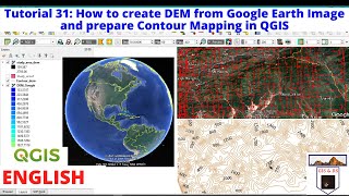
How to create DEM from Google Earth Image and prepare Contour Mapping in QGIS
22:28
Stray Kids Answers 30 Questions As Quickly As Possible
05:56
THE AMAZING DIGITAL CIRCUS - Ep 4: Fast Food Masquerade
23:20
Tornado touches down in Santa Cruz County, several injured
06:04
Very High Resolution DEM and Contour from Google Earth || Q GIS 3.14 || Detailed Hands-on ||
Geography Lab (GIS & RS Guide)
Подписаться
852
Скачать
Готовим ссылку...
Просмотров 47 тыс.
0
0
Добавить в
Мой плейлист
Посмотреть позже
Поделиться
Поделиться
HTML-код
Размер видео:
1280 X 720
853 X 480
640 X 360
Показать панель управления
Автовоспроизведение
Автоповтор
Опубликовано: 3 янв 2025
Комментарии • 28
Следующие
Автовоспроизведение
14:00
Application of Q GIS in Urban Science || Analyzing and Downloading GHSL Using GEE & GHSL S2 Plugin
Geography Lab (GIS & RS Guide)
Просмотров 2,8 тыс.
15:57
How to Draw Contour in QGIS without visiting site | (English)
Learn & Explore
Просмотров 30 тыс.
22:28
How to create DEM from Google Earth Image and prepare Contour Mapping in QGIS
RS and GIS with Dr. Manoj
Просмотров 19 тыс.
05:56
Stray Kids Answers 30 Questions As Quickly As Possible
BuzzFeed Celeb
Просмотров 425 тыс.
23:20
THE AMAZING DIGITAL CIRCUS - Ep 4: Fast Food Masquerade
GLITCH
Просмотров 38 млн
06:04
Tornado touches down in Santa Cruz County, several injured
NBC Bay Area
Просмотров 275 тыс.
17:26
Blox Fruits ALL Changes in Dragon Rework Update
MeEnyu
Просмотров 2,5 млн
13:21
OSINT At Home #9 - Top 4 Free Satellite Imagery Sources
Bendobrown
Просмотров 1,6 млн
18:57
Create Accurate Maps with Blender GIS and QGIS
Nicko16
Просмотров 16 тыс.
24:59
Making GIS Map using Google Earth Pro and QGIS
Dr. Nilutpal Mahanta
Просмотров 42 тыс.
19:26
How did the Enigma Machine work?
Jared Owen
Просмотров 10 млн
12:13
Мария Захарова, Дюжев и пьяная (путана) Чичерина - этот номер порвал зал
Канал Смеха
Просмотров 200 тыс.
12:17
How to Create 3D Terrain with Google Maps and Blender!
CG Geek
Просмотров 2 млн
13:25
Extracting Elevation Data from Google Earth
GeoDelta Labs
Просмотров 256 тыс.
1:10:08
An Absolute Beginner's Guide to QGIS 3
GeoDelta Labs
Просмотров 1,3 млн
7:03
Google Earth Contours vs LiDAR (How to Extract Contours from Google Earth and How they Compare)
Equator Studios
Просмотров 32 тыс.
01:15
Дорого и холодно: Украина остановила транзит российского газа #shorts #shortsfeed #shortsvideo
Телеканал ОНТ
Просмотров 75 тыс.
00:37
спидран по ютуб шортс 102 | Топ конфеты на нг
i11ushenka
Просмотров 2,6 млн
00:12
Syringe Needle Drilling
YT Object
Просмотров 5 млн
00:12
I'm getting on my dad's nerves 😁
Ospenarium
Просмотров 7 млн
00:16
Новый Год через 365 дней, а я уже готов 🥳 #shorts
Владислав Шудейко
Просмотров 690 тыс.
00:18
Когда есть младшая сестра!
Victoria Portfolio
Просмотров 884 тыс.
4:45:27
ПЕРВЫЙ СТРИМ ШИМОРО В 2025! - ПОЛНОЕ ПРОХОЖДЕНИЕ ШЕДЕВРА MiSide
SHIMOROSHOW
Просмотров 73 тыс.
00:36
Самара и волшебная картина! Часть 4 #shorts
Настя AmyMyr
Просмотров 182 тыс.