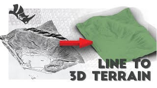
1. create working area 2. select the shape and create 'Planarsrf' 3. select the surface and 'Rebuild' i. select point count 4. type in 'PointsOn', select surface to turn points on, press enter 5. you now have points that you can move to create your topography i. you can multi select points 6. @4:05 make a solid form for the topography 7. @5:25 make contour lines 8. use Rhino 2D Symbol Library 9. @7:25 Make 2D end of part 1
Hey, very clear tutorial ! I think that the reason why some parts of the topography didn't show up when you did Make2D is because they were hidden by the terrain surface. Make sure you either hide the surface or toggle "show hidden lines" before doing Make2D, that should solve it.
Yes that's right, this video is just for creating unique custom terrains for renderings! If you are modeling a real building, you would download a GIS contour map and trace to model the actual site. Or you can get a civil survey (dwg) and import into Rhino.


I know you don't make videos anymore but this seriously just saved me on my latest assignment haha. You're better than my uni classes on this stuff.
1. create working area
2. select the shape and create 'Planarsrf'
3. select the surface and 'Rebuild'
i. select point count
4. type in 'PointsOn', select surface to turn points on, press enter
5. you now have points that you can move to create your topography
i. you can multi select points
6. @4:05 make a solid form for the topography
7. @5:25 make contour lines
8. use Rhino 2D Symbol Library
9. @7:25 Make 2D
end of part 1
thank you so so much !!! you have no idea how much it helps me for my architecture studies ! please please please , don't stop !!!
really great tutorial! clear voice, quick and to the point
Hey, very clear tutorial ! I think that the reason why some parts of the topography didn't show up when you did Make2D is because they were hidden by the terrain surface. Make sure you either hide the surface or toggle "show hidden lines" before doing Make2D, that should solve it.
Thank you so much! More videos like this! Great job!
Lov u,really solved my homework trouble
LEGEND! THANK YOU
The best tutorial !! Thank you
Nice and simple, exactly how I like it, thanks.
so helpful dude this is gonna be monumental for my project thx
Thanks! long time ago when Rhino 5 there is not have Sub D tools
Thank you! Great video and explications.
You can also instead of ctrl c ctrl v just hold alt key and on the gumball drag an arrow
really great video, thank you so much!
Its weird as when i do points on and try to move the dots only poly lines move not the actual surfsace
HONESTLY THANK YOU
Hi, you can try our Lands Design plugin in Rhino, for topography and all operation on terrain.
Thank u very much!!
Thanks superly!
damet garm
How can we make sure that the holes and heights on the ground are precise?
Thanks a lot.
hey thank no sabia sobre la libreria 2d de rhinos siempre buscaba bloques de autocad 2d y me era un poco dificultoso
it doesnt let me select only one side to create the planar surface, what should i do?
Hi, not sure why but when I rebuild, the points don't show up at all, any idea how to fix this? Thanks for making the video btw!
Pointson is the command to adjust the points after rebuild!
Isn't Topography if you create the terrain by your head and not using a survey data.
Yes that's right, this video is just for creating unique custom terrains for renderings! If you are modeling a real building, you would download a GIS contour map and trace to model the actual site. Or you can get a civil survey (dwg) and import into Rhino.