Это видео недоступно.
Сожалеем об этом.
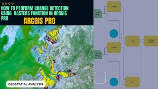
Accuracy Assessment of classified image using ArcGIS Pro Tutorial P2

HTML-код
- Опубликовано: 10 сен 2023
- #esri #esrisaudiarabia #deeplearning #imagesegmentation #dl #machinelearning #imageclassification #computervision #imageprocessing #spatialdata #ml #algorithms
Accuracy Assessment of classified image using ArcGIS Pro Tutorial P2
@Accuracy Assessment uses a reference dataset to determine the accuracy of your classified result. The values of your reference dataset need to match the schema. Reference data can be in several formats:
A raster dataset that is a classified image.
A polygon feature class or a shapefile. The format of the feature class attribute table needs to match the training samples. To ensure this, you can create the reference dataset using the Training Samples Manager pageto read and write the dataset.
A point feature class or a shapefile. The format needs to match the output of the Create Accuracy Assessment Points tool. If you are using an existing file and want to convert it to the appropriate format, use the Create Accuracy Assessment Points geoprocessing tool.
To perform accuracy assessment, there are two parameters that must be specified: the number of random points and the sampling strategy.


![Create Accuracy Assessment Points using Arc Map Arc gis [ Step by Step Explanation ]](/img/1.gif)
Nagaan mana kanaf ha ta, u baga nagaan dhufte sanyii ofii wow bayyee namati tola jabadhu itii fufi wan bekan ira walif qodun garidha jabadhu waqayyoon jalalaa nuf ha kenu biyyaa kenyati nagaha nuha busu 🙏 ❤
A very straight foward tutorial ,thnks
Thank you for your comment 🙏
Thanks for the video
I want to ask a question
I have classified my Sentinel 2 satellite image using Random Tree
However, I don't know how to calculate the area in sqkm or hectares because the attribute table Is showing red, blue, green column values.
Please how do I go about it?
Convert the classified raster image to vector, then calculate geometry of the classes
@@geospatialanalysis1891 thanks so much sir