Basic Hydrologic Analysis in ArcGIS Pro

HTML-код
- Опубликовано: 8 сен 2024
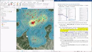
- Here we learn how to use the basic ArcGIS Pro hydrologic tools to analyze how water flows across the landscape surface. We will examine the three ways to generate flow direction rasters, named D8, MFD (for Multiple Flow Direction) and DINF (for Infinite Direction). From this flow direction raster, we will see how to identify stream paths, watersheds (also known as catchments or drainage basins), flow accumulation rasters and the Topographic Wetness Index (TWI). We will also learn how to use the stream path to build a network, from which we can calculate the shortest distance between two points while constrained to the hydrologic flow paths.
Lab Exercises:
Lab 1: Calculating Areas from Raster Datasets; • Hydrology in ArcGIS Pr...
Lab 2: Problems when creating Watersheds without filling the DEM; • Hydrology in ArcGIS Pr...
Lab 3: Filling Sinks in a DEM; • Hydrology in ArcGIS Pr...
Lab 4: Calculating an Accurate Flow Direction Raster; • Hydrology in ArcGIS Pr...
Lab 5: Generating an Accurate Watershed; • Hydrology in ArcGIS Pr...
Lab 6: Creating a Flow Accumulation Raster; • Hydrology in ArcGIS Pr...
Lab 7: Generating a Stream Network using Strahler Stream Orders; • Hydrology in ArcGIS Pr...
Lab 8: Aspect Statistics within Watershed; • Hydrology in ArcGIS Pr...
Lab 9: Slope Statistics within Watershed; • Hydrology in ArcGIS Pr...
Lab 10: The Topographic Wetness Index (TWI); • Hydrology in ArcGIS Pr...
Lab 11: Finding the Shortest Path Through the Stream Network; • Hydrology in ArcGIS Pr...
Extra Materials:
Word Document with walk-throughs of lab exercises: docs.google.co...
Data for Lab Exercises: drive.google.c...
Manuscripts discussing TWI: drive.google.c...


Wow. Your directions were very simple to understand; you explained with only as much detail as I needed! Your graphics were very well done and high quality. This was an excellent video!
Thanks so much Gabe! I appreciate you letting me know. Today is a better day now!
Thank you sir for these videos related to GIS Hydrology. Excellent work!
Thanks so much Mansour! Your message was a good way to start the week!
Hi Jenness, your teachings are just amazing!
Any chance you can show some insights into hydrochemical analysis. Perhaps estimating predominant factors of Alpine rivers using ARCGIS pro.
Thanks in advance.
Thanks Felix! Hmm; that's an interesting question. As far as water chemistry goes, that's a tough one to pick apart. If your rivers are primarily spring-fed, then the chemistry is highly affected by the minerals present in the aquifers, plus how long the water is underground. You can get very different water chemistry measurements from springs that are right next to each other, if the aquifers producing those springs are not connected. So it can be tricky to predict water chemistry without a good understanding of the aquifers, and that kind of data is hard to get.
Your question is a cool idea, though. We do a lot of water chemistry analysis of spring ecosystems at the Springs Stewardship Institute (springstewardshipinstitute.org/) so I have a lot of data I could work into a lesson. And my Forestry students would appreciate a decent lab exercise on the topic as well. Thanks for the idea!
@@jennessenterprisesadventur5081 Well said!
Sourcing hydrochemical data is sure the major challenge but with several open national repositories, it is doable.
Again dependent on the area of interest, perhaps one can use representative data to insight on such analysis.
I will be looking out for that lab. Can't wait:)
هل بسطاعتك عمل تحليل في مزرعتنا نحن بحاجة كبيرة للمياه نحن في جفاف لسبعة اعوام ارجو منك مساعدتي
أتمنى لو أستطيع! لكنني أظن أنه يمكنك القيام بعمل أفضل مما أستطيع فعله لمجرد أنك تعرف مزرعتك. ليس لدي أي طريقة للتنبؤ بالمكان الأفضل لحفر البئر، لأن ذلك يتطلب معرفة طبقة المياه الجوفية الأساسية. إذا كان لدينا نموذج تفصيلي للارتفاع، فيمكننا أن نوضح أين ستتدفق المياه على السطح، ولكن مرة أخرى أظن أنك ربما تستطيع رؤية ذلك بنفسك من خلال تواجدك هناك. أنا آسف لأنني لا أستطيع تقديم المزيد من المساعدة! لكنني لا أعرف ما الذي يمكنني فعله، ولا يمكنك القيام به بشكل أفضل.
@@jennessenterprisesadventur5081 هل تسطيع عمل تحليل هيدرولوجي للمنطقة التي اعيش فيها