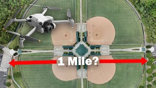
Turn ANY Drone into a 3D SCANNER And Make 3D Models w/ Photogrammetry

HTML-код
- Опубликовано: 21 ноя 2024
- Turn your drone into a 3d scanner. Create stunning 3d models with any consumer drone. Learn how to make reliable and accurate 3d models and maps with any consumer drone through a process called photogrammetry.
Models from this video:
www.aerialmode...
www.aerialmode...
Flight planner tutorial: • Mission Planning Tutor...
Flight planning website: www.waypointma...
Model Creation Service: www.aerialmode...
Drone photogrammetry photogrammetry drone mapping photogrammetry drone drone photogrammetry tutorial drone survey drone. Photogrammetry business photogrammetry tutorial photogrammetry software drone drone business drones drone map drone business ideas drone photogrammetry software. Drone photogrammetry dji mini 3 aerial photogrammetry dji air 3 photogrammetry dji mini 4 pro photogrammetry how to start a drone business drone mapping tutorial.


new sub! Very excited about where this is going! Does it do volumetric measurement or is it under future development?
10:24 - question answered
Have you tried using Dji Terra, I am still learning . This is the future .of mapping remote areas and archeological cites.
Thanks and please keep on sharing new ideas! Subbed!
Consultation: what happens if I can't complete the mission if the drone's batteries run out? Thank you for your help
Dumb question... Assuming you have a giant sd card, many batteries, could the quality improve further, or is there a limit to diminishing returns kinda?
With the Minie 3 sdk release a few months back, will you be developing anything for 3rd party autonomous flight?
Wouldn't you want concentric circles, starting from ground level going up or vice versa? Staying at altitude cannot be accurate for modelling.
It was an intro to people who have never done it before. I was looking to make the best looking model.
not with the dji mini 3 pro?
Will it work on older drones such as the mini 2?
Yes, you will need to take a bunch of pictures manually or find flight control software.
The first stuff on this channel was awesome and entertaining. Now its all drone stuff.
I have a dji mini 4 pro. I want to get a picture from (~100ft) that is much larger area than one picture covers.
Will your mapping program do that?
Yes, take a look at the links in the description. There is an option to download an Otho from the viewer.
Which aspect we should use 16 :9 or 4:3 ?
Will this work with a DJI Mini 3 Pro? Thank you.
Is DJI Mini 3 compatible?
one word "luma labs"... ok that was two words but you get the point
excellent vid, the trial version let you upload only 25 pics????mmmmmm
It’s pretty expensive to do this for free as it is.
I have DJY Mini first version... I can't do this please ? Thanks.
You just manually fly the drone to take pictures but you can?
@@JaysTechVault Ok greate ... I'll try :-)
Thanks a lot.
This is great to play with, but you need to know that this data is not accurate. Unless you are using RTK or PPK for accuracy, the data can be off by as much as 10 meters absolute, and 3 meters local and relative.
That's why you can get a rtk module @jay...it is enormous what Jay has done
That’s why I have www.anydronertk.com
@@JaysTechVault how did you get it early? It is only in pre-order state
… I created it
@@JaysTechVault oh, I see. You wrote it like it was obvious, but it is not =) Thanks for such cool devices though, definitely need to try when it comes out
A helix path would be useful
Can your waypoint app work for the mini 3 pro?
Model generation yes, flight planning no
I’m assuming this goes for the mavic 3 (Standard) as well?
Mavic Air 1 can do this?
Should be able to, not the flight planner but you can take pictures in a circle around a subject
I use the original DJI mavic air to create photogrammetry scans and have no issues. You can use anything that takes photos to create photogrammetry scans.
I’ve used meshroom (Free)
And 3DF zephyr (very expensive)
To create scans from photos/video.
What pc are you using with zphere , for some reason i cant see any 3d scan on my laptop . @BarrySmoother
@@JAYTHEGREAT355PC I built myself.
If you’re having issue with zephyr try meshroom maybe.
Depending on the laptop the hardware might not be capable of creating 3D scans. Zephyr is a bit more intense compared to meshroom in my opinion.
But could be that the laptop just can’t handle the scans.
Maybe try meshroom? Or different photos or a smaller less detailed scan.
If you wanted my computer specs they are.
RAM: 16gb ddr3
CPU: I7 3770k
GPU: GTX 1080
@@BarrySmoother thank you , it's my laptop it just won't handle zephyr I will give mesroom a try thank you .
In the military world, this is terrifying. Imagine getting a 3D scan of an enemy base, and then using that to preprogram a drone to deliver ordinance, of which the drone could maneuver around obstacles to deliver an accurate payload.
Military has radar for drones and can detect them long before they're close enough to model or scan the base, plus jammer guns
We don't need drones for scanning...satellites do a pretty good job of that on their own...😏
Sats already do that
48mp, photoshop batch to 50% downres. Alot of detail.