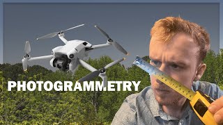
How to Take MASSIVE Pictures (Maps) with ANY Drone

HTML-код
- Опубликовано: 5 окт 2024
- Want to make maps with your drone? Want to take pictures from higher up than legally possible? Want to capture huge images of huge areas? In this video I show you how to make maps with your drone.
Model/Map from this video: www.aerialmode...
Model/Map creation service: www.aerialmode...
Flight planner for DJI Mini 4 Pro, Mavic 3 family, and Air 3: www.waypointma...
AnyDroneRTK module: www.anydronert...
drone how to fly a drone drone mapping how to make a drone map drone video how to make drone. controlled by phone how to make a drone drones how to make drone pdf make an aerial map with a drone make money with drones make money with your drone how to make fake drone shot how to make fake drone video how to drone in a city. drone map how to drone in cities how to use drone drone survey drone surveying drone photogrammetry drone panorama panorama.


Looking forward to the KMZ installer! I haven't been able to transfer the KMZ to my mini 4 pro.
Hi there! Any update on this? Also, is the KMZ supported in terms of dji? Can we void the guarantee with it?
Good work, thank you for the extra super powers. I look forward to using the kmz loader.
Are you able to add an option to get the measurement units in feet?
Nice way to make maps, but is there a way to put scale on this tiff map later with other tool? Like it would say 1cm -> 1m or something like that and it would work when we print it...
By default when using the ortho optimization 1 pixel = 1 cm
LOL, thumbnail was bogus. You can see the cars. Even at 15' long, is the thumbnail photo 350 car lengths? Nope.
Can this be done using the DJI mini 3 pro?
Yes
is your RTK compatible with AIR 3 drones?
Yes
@@JaysTechVault How can I buy one?
My drone has a way point fly in the app the drone is s24 black
It's better to take pictures manually and use lightroom to stitch it... Using your website will produce bugged pictures with low quality probably until you buy premium... That sucks
You didn’t even try it did you?
why are you so handsome
Or you can just use Google maps what a waste of peoples time...
Google maps does not have the resolution a drone does.