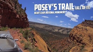
Skyline Drive, The Backbone of Utah

HTML-код
- Опубликовано: 16 окт 2024
- A high altitude ride along the Skyline Drive, following the crest of the southern end of the Wasatch Mountains crossing nearly one quarter of the state all in Aspens and Pine Trees.


Just wondering why you didn't buy a Tacoma instead of a tundra do you also tow with it? if not you made the wrong choice 😂
The long term plan was to tow. I haven't gotten there yet, s*it is expensive. But if I get there, believe me I'll have things to show you...
Tacomas are garbage in comparison to the 4runner and the Tundra. I've owned all 3 latest generations. The Tacoma is the least desirable of the 3.
Should have bought an F-150 ...support American companies
@@barrya.6212 if they made a quality truck I would I've owned 3 they are junk!!
@@mattbenson2497There's hundreds of posts with F150's with over 300,000 on engine with zero internal engine work needed...all makers have some poor years with flukes...the second gen Tundra's had snapping camshafts!...the current one is the worse gas pig of all makes ...and boring interior...
You have some great photos. I got into one of those metal plants years ago and it really hurt stay away folks. Im looking to take a drive on skyline in a couple weeks.
I use to live in Price , Ut. 1981& 1982. Loved the mountains ❤
Awesome video. I love Skyline Drive!
How long did this journey take?
Wow. What a great trail!
The dog was trying to herd your truck 😂
Do you air-down your tires on more technical forest roads?
A lot of it depends on how easily I can air back up afterwards; I don't like to drive more than 30mins at paved highway speeds on low tires. But if I know I'll be on dirt for a while I'll air down just a bit to cushion some of the impact of the bumps and rocks. But not so much that it's creating a bigger footprint or causing too much sidewall bulge.
What are you using for GPS signal input for the GiaMaps?
I bought a Mad Elf receiver and plan to use that, just curious if you were using something different.
It's just the built in smartphone GPS. Same with the tablet, it has it's own internal GPS. I did have a Bluetooth GPS receiver a long time ago for when I used a laptop for all my mapping but it was such a PITA it was easier just to make sure the tablet I bought had GPS.
@@exploresouthwest I was anticipating marginal cell service in the area and wanted to ensure accurate navigation so I went with the GPS receiver.
Your videos are great and I hope to do some of the same routes this summer!
Where is the best place to start? I live near Bountiful but can’t find real answers anywhere
Thanks for the memories ... My daughter was born in Prove at Utah Valley Hospital and we had many years of camping on the Skyline ... We camped with our friends who had sheep and it was always fun..
Sorry I didn't spell check my first comments. PS. Other than the axle shots it is a fine video with some excellent videography
4 1/2 years and I’m on my way west
Videos like this keep me going till then
Nice job with the video. I didn't see, but which app do you use for the off roading? My wife and I are heading to Southern Utah the end of April to early May. We are looking forward to the trip, especially now since I was just released from the hospital yesterday after covid and Pneumonia. I think most of our trip will be side road drives instead of walking trails now. Thank you.
At this time it was an app called "Backcountry Navigator" but now I use "GaiaGPS" I think it has a easier interface, and it's got better map layers you can use, especially if you pay for the full version.
@@exploresouthwest thank you. I’ll have to check that one out also. I’ve been looking at the OnX off-road.
Planning our trip to UT for next month. Any chance you could share your track for this video? Using your Onion Creek track too in addition to what we have planned. Thanks!
Do you think this is a trail you could do in a subaru?
Fantastic video as usual, actually pausing so I can enjoy the remainder with my wife over dinner tonight. This trail is going in the book for sure....along with Onion Creek and others. Thanks for including all the cool things along the way and the history which is so important. Fine work sir, fine work
Nice video, we enjoyed watching; looks like a cool area to drive and explore. Thank you for sharing
Enjoyed your video. I noticed that at the beginning of the video you put your vehicle in high 4. In your opinion,during dry weather is this road passable with a high clearance two wheel drive truck? I'm gonna check out the rest of your channel. Thanks👍
I'd say if the road is dry, about 95% of it is passible in 2WD with decent clearance. And the other 5% is probably still passible but you might just need to do a little more thinking and effort to over the bumpy bits.
I've driven this when it got REALLY muddy. Those slippery parts with the sheer-drop offs were nerve-wracking. At one point I actually stopped to dig out a better path for us. Some good ATV riders came by who knew the trail and gave me good advice on how to navigate the next few miles. We finally dropped off Skyline Drive into Spring City, and, for once, I was totally grateful for asphalt! But now I've got to finish Skyline Drive from south to north. Thanks for the video!
My Great Grandfather was in the CCC and helped dig the contours there and along the Wasatch front. He passed down some pretty good stories about the time he spent there.
I'm always fascinated whenever I see the CCC groves in mountains. I think it's sad so many people now have forgotten how much the CCC did for the country.
Maaannnn... that shot of the moon...nice.
Can you share details about the GPS (cell phone?) that was showing USGS quad contour mapping at the beginning of video?
That was Backcountry Navigator but now I use GaiaGPS (both on Android). Both have the ability to download USGS maps from Caltopo. Both are very similar but I think the learning curve for GaiaGPS is a bit better and seems to have better features and developer support. www.gaiagps.com/
@@exploresouthwest THANKS! It looks to be a good app. I’ll check it out right away. BTW, I am a HUGE fan of places in the SW. Lived in White Mountains of AZ several years and did some fine exploring in AZ, NM, UT, NV, CA, and CO. Anxious to get back (as soon as health permits). I really enjoy well done YT channels like yours. Please keep up the good work!
4:00 what was that yelling / what are you close to at this camp? (just curious about the surroundings outside of the camera view)
Wow. The alpine zone is all cirqued [sic.] up. A gift of the Pleistocene ice times. Spectacular cirque amphitheaters with near vertical head walls on each side of the ridge road all were once filled with actively moving ice. The climate warmed before the glaciers could erode headwards and form a knife-like alpine ridge or arete between (re Alps or Tetons). If one pauses the video one can see the valleys these glaciers carved on their flow into the intermontaine basins below. Just gorgeous. Thanks for the maps. And the views.
What is the app you use to record trails?
Currently GaiaGPS. Before it was Backcountry Navigator but I think GaiaGPS has well surpassed it.
Great video. A twelve volt compressor and ARB deflator with low pressure gauge will conveniently increase the ride comfort and reduce stress on the suspension components at @ 15psi tires.
I'd actually thinking of getting a 12v Compressor. I've had a CO2 tank from decades ago that I always use but I don't like the weight or bulk of having to carry it. Compressors are a bit slower and there is a duty cycle to work around but I think it's fine and the few minutes saved aren't enough to worry about it.
@@exploresouthwest I am using the cheap “high volume” PepBoys compressor for filling 33’s on my Tundra. It’s about 15 minutes to fill all four from @ 8psi. Well worth the 15 minute refill for the reduced fatigue from washboard and ruts. I enjoyed the Moab video too! I am looking forward to some road trips this summer. Thanks!
I am interested in taking the Skyline drive. Do you know where I can get a map of it? Also, I am curious how you did your animations of the hilltops. Did that require special software? Love the video. Thanks for sharing.
Check Gaia GPS
Very well done . Thank you .Beautiful part of Utah.
Do you think I could drive this trail from Fairview to Manti without 4x4 assuming there's no deep mud? I have a Chevy truck with a manual that has a granny low (6.35:1) if needed. I can do the squaw peak road no problem.
Oh, yeah no problem, your truck is probably over qualified. Except for a few spots that see less traffic this trail is only a small step below the quality a maintained rural gravel road.
So the road until the fork that goes to fairview lakes isn't too bad it seems. Looks Im gonna take my VW golf lol.
Don't know what it is about this video, but I lub dis one more all dee rest. Best gall dang video you eva made, just keep coming back to it. Say, what's with the bottom of your truck, think I'd rather be looking out at the scenery!?! Really good... Why if I was 10 minutes younger I'd be going back to Utah in a flash of an eye!
Wonderful video share! How many hours is this drive from end to end? Are there exit and entry points along the entire traverse allowing for numerous day trips versus one end-to-end trip? Thanks!
How you draw the lines and waypoints on the Google Earth? Thank you.
I record the tracks on GaiaGPS and export the files from their website. Then I can import them into Google Earth with a Drag and Drop.
There are manual drawing tools in Google earth but they're a bit clumsy.
I have a cabin about a mile down from where the pavement ends on the Sanpete side.
That road through there is really bad. Beautiful country though.
You make great videos! Thank you.
What app was that?!
I’m sorry that you get told what truck you should have purchased... What country do we live in? Thanks for the wonderful video, beautiful scenery and info about the area. Maybe someday I’ll get the chance to drive that route and see it for myself..
Excellent video. For me the worst part of Skyline Drive is after Snow Lake and before 12 Mile Canyon. There's a mile or so that's pretty much a one-lane road drop off on west side and a cliff on the east side.
Have you rode any of the Boulder Mountain Roads?
Nice vid. The machine room at 18:10 in the video = that was a vertical pump going down into some type of well ( natural or man made ). Mounted on top of the pump is a angle gear drive with the drive shaft coming out which was driven by some type of combustion engine hence the fuel tank on the right side. Most likely a diesel engine. As old as that looks , new vertical pumps are pretty much the same today used in municipal & the oil industry. I repaired them for a living for a while & it is not uncommon to see them 60' long for well water, cooling water for power plants &, used to pump fuel/oil on fuel/oil barges/tankers & in tank farms.
Thanks for the preview and taking us along for the adventure. Part of Skyline we will cover in 2018 on a 5 day, 600 mile ATV backcountry trip. Very helpful.
Thanks!
nice video
Does anybody know what the clearance is on that one concrete tunnel??
Stinging nettles, a very tasty and nutritious edible wild plant.............
Do you have a way of sharing your route? I saw you recorded it, any way to export that?
Yeah, here's the link to the track file.
drive.google.com/file/d/1eh9n3ftyhDKgEPU_9hPjnQxqYXMO_h7B/view?usp=sharing
Nice video, however you didn't highlight much of the beauty at all!! I guess those that watch need to experience it for they selves
I'm trying to get better at the beauty shots B-roll, but absolutely people need to get out here to see it themselves!
Is there any chance you could share that google earth route with these stops? I'm new to off-roading, I don't know about this route even though I live fairly close and would like to do this route this spring. I would totally appreciate it. Thanks for the video
Oh man that was inspiring- Thanks so much for posting- I can hardly wait to move to Utah- this hopefully will be my first trail- I have a 1967 IH Scout to do it in- Thanks again
Did you carry extra gas with you for your truck on this awesome trip?
Yeah I did. I wanted to make it all in one trip without having to take any of the side roads to stop in the towns below the mountain range. But even without carrying gas it would have been really easy to head into the town and be back up in the mountain in a couple hours. That was my "emergency escape plan" if anything went really wrong.
But it's fun to pack all the gear for a long continuous trip that's almost all off road, even if you have to wind through the paved civilized areas.
What time of year did you film this video? I’m looking at doing some exploring this summer and this might have to be on my list.
Is the route marked down to I-70? I want to ride my dualsport motorcycle from the north end of South Skyline down to I-70. Tried a few days ago but the gate was closed on the north end due to snow drifts still on the road.
I'd make sure to map it out beforehand just in case, but for the most part it's well marked. The problem is the last little bit isn't really "skyline drive", the official trail FR150 stops being marked in the mountains and most people head west down into the city on forest road FR001. FR009 continues south and ends at I-70, it's a definite intersection where you choose which way to go (west/south) so it won't sneak by you as a tiny unmarked side trail.
The whole route was well traveled trail so if you keep going south on trails that are substantial and not tiny ATV tracks you should be ok.
As for snow, I believe it. It's surprisingly high altitude and you're on the ridge most of the time so those cornices that take forever to melt are always nearby.
Awesome video. That area is on my list. What GPS app are you using? Thanks
Thanks!
I'm using BackCountry Navigator on Android, they have a Trial version and I think it was $10 for the full version.
I love the USGS 7.5 minute Topo maps and it automatically pulls them from the Caltopo database when you have signal or you can download areas through the app before hand and use those when you're out data range.
Plus you can import .kml files which means ever Google Earth and Goole Maps route you make can be imported and it will overlay that on your topo.
It's my #1 main navigation aid when offroad. I still like to carry paper maps, mostly because I'm a map nerd, but I've never really needed more than this app.
What month and date did you take this trip? I'm planning one starting on 17 June. Wondering if the mud will be gone by then.
Could you share the Google Earth map you made of this?
I'll try to remember to put more of these online, especially if they're long trips where getting lost is a possibility.
drive.google.com/file/d/1eh9n3ftyhDKgEPU_9hPjnQxqYXMO_h7B/view?usp=sharing
Is that a very low hanging gas tank without a skid plate ???
I've seen this video awhile ago. just gotten my vacation for next year and planning our 3 week trip. Unfortunately we are missing Colorado but hitting Utah and the North rim before coming home back to Alabama through Texas. Do you happen to have the gpx route of this trail? I wouldn't mind adding it to our trip. Great video
Did Skyline Drive in October 2016 in a 73 VW Beetle. Saw one of the largest rattlesnakes at that old mine site you stopped at too.
Sweet video what are you using to navigating I have a hard time trying to find any Maps Back Country Roads ?
Great video, I'd love to do this but my Ford Focus is not quite up for it though I have driven many miles through the San Rafael Swell and many other places off road.
lol
I wish you woulda mentioned the 'Larson Tunnel'. It was an engineering wonder that was completed, and provided water to Ephraim in 1937. The CCC engineers came from all around USA to provide the labor. I believe the Skyline Drive is one of Utah's best kept secrets. My Nana told stories about Indians who'd come down from the mountains when they needed extra food around 1920's. So sad about the beetle kill of the evergreen. One day I fear a lightening strike.
Great video. Really liked those old pics too and the sheep dogs!
Nicely done. I'm doing the south end next week. Thanks for the info.
Nice video - thanks for posting it. Last year, 3 of us on ATVs rode the length of Skyline, starting at I70, headed north. We went to Strawberry reservoir and returned (4 day, 3 night, approx. 200 miles round trip) . We were caught in torrential rain, and I can definitively say your truck would not have made it through the mud near Ephraim.
Was all imagery done in Google Earth? How do you record your path and move vantage points?
Nice video! Thanks for doing that! It seems you took 3 days/2 nights? It doesn't look like a lot of people come on this trail? Most of the way I did not see anyone try to pass you... some of those places would be hard to pass on.. especially cliffsides. I am so new to this kind of adventure driving!! I love your vehicle set up!! Tent on top of the flatbed. So cool!
I recognize your name from the GSE&A group on FB!! :D
nice video, it would be a lot more enjoyable if it wasn't all the videos of your rear axle. Five or ten seconds would be interesting. mAnything more is a colossal wastem of vieing time.
Cant wait to do this drive this summer.
YIKES! WAS that drive 8 miles or more? Pssst Husbsnd & I drove a SCENIC/ SKYLINE ROAD?( 3 mile Road in) COLORADO!
OMG SCARIEST RIDE (such as yours eek!)IN MY LIFE! LIKE A ROLLER COASTER RIDE IN A CAR WITH NO ROOM FOR ERROR YIKES! WHEW THE LAST .05 MILES SEEMED LIKE AN ETERNITY OUCH LOL! 3 MILES OR LESS IS ENOUGH FOR ME! I ENJOYED YOUR EXPERIENCE 😎
on the list!
Beautiful drive, was thinking if this road is sedan friendly, I got the answer now. lol
Is it?
trees dead near tunnels had chemical defoliant used on them
I also want to do this drive. Nice job on the video! I like the way you edited the video switching from the dash cam, the under carriage cam, and shots from a tripod. And the Google Earth maps(?) Looks professional and I'm sure it took some time to put together. I also enjoyed your narration. Thank you!
that dogs all hear
ding you
Molly must have left an impression on the early settlers.
Yeah, she really got around-saw three different ones in and around the Grand Canyon, too!
What navigation app are you Using?
I've been using "Backcountry Navigator" for a while but just recently have been switching over to Gaia GPS. Recent improvements have skyrocketed the learning curve of Gaia to the front. But I technically haven't been on one long trip with Gaia yet, I'm going to a real run down for real this spring.
Well done
what app do you use?