Hi Andy. Apologies this question is a bit off topic but have you done any RUclips videos on using some of the Disto ranges? Your BLK videos are priceless and I wish there was content available of a similar value for the Disto’s.
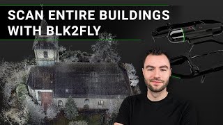
Hi Trevor, We wouldn't suggest using the BLK2FLY to capture land for elevation mapping. The BLK2FLY is primarily designed to be used for capturing buildings and structures. It has a shorter range and the ability to safely fly close to objects which makes it ideal for capturing smaller details, rather than larger swaths of land. Feel free to direct message us on social or send us an email and we'll be happy to talk about possible solutions.
Может ли сам квадрокоптер быть стабильным при большем количестве ветров, как это сделал DJI? Может быть, есть крепление сканера для квадрокоптеров DJI?
Hi there! We know autonomous airborne laser scanning isn't for everyone. While it may not be suitable for every project, it provides a huge boost in terms of efficiency and cost-saving for larger projects!


Congrats to the team, excellent job! I'm proud to be part of Leica 😀👍.
Hey Andy! Great show!
What does the BLK stand for?
Hi Andy. Apologies this question is a bit off topic but have you done any RUclips videos on using some of the Disto ranges? Your BLK videos are priceless and I wish there was content available of a similar value for the Disto’s.
Can this blk2fly be used to scan land and land elevations
Hi Trevor, We wouldn't suggest using the BLK2FLY to capture land for elevation mapping. The BLK2FLY is primarily designed to be used for capturing buildings and structures. It has a shorter range and the ability to safely fly close to objects which makes it ideal for capturing smaller details, rather than larger swaths of land. Feel free to direct message us on social or send us an email and we'll be happy to talk about possible solutions.
@@LeicaBLK but can it be used to measure the volume of soil deposits in a small area?
Nice video Andy!!!
Может ли сам квадрокоптер быть стабильным при большем количестве ветров, как это сделал DJI?
Может быть, есть крепление сканера для квадрокоптеров DJI?
I am eagerly waiting for the device to arrive in Turkey !!
about 120,000 usd?
@@philipmikheikin circumstances are difficult for us but there is always a way..
Poor Battery life
Wayway way toooooooo expensive…not worth it
Hi there! We know autonomous airborne laser scanning isn't for everyone. While it may not be suitable for every project, it provides a huge boost in terms of efficiency and cost-saving for larger projects!