Это видео недоступно.
Сожалеем об этом.
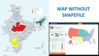
Study Area Map Using Shapefile & Base Map

HTML-код
- Опубликовано: 25 авг 2022
- Hello everyone, Welcome to GIS and RS Solution RUclips Channel. You will learn how to make study area map using shapefile and existing base map of ArcMap which is completely free of cost. You just need your country shapefile to prepare the study location map. You will find this video tutorial concise and straightforward.
GIS Shapefile of any Country: • GIS Shapefile of any C...
Shapefile download (Country, Road, River, forest cover, buildings, Land use) of any Location: • Shapefile download (Co...
I have also three other tutorial on how to make study area map. Below are the link of those videos;
Study Area Mapping | Create Map Layout in ArcGIS: • Study Area Mapping | C...
Study area Map using QGIS: • Study area Map using QGIS
Create Study Area Locator Map without Shapefile using ArcGIS: • Create Study Area Loca...


Sir how we apply grid on base map without layout
Hi, I want to know the difference between landsat collection 1 and collection 2,and difference between collection level 1 and 2 in each collection, which one should I use?
Hello! This is very helpful video. I would like to know how to acquire satellite image of watershed which is covered by forest canopy in remote sensing
খুব ভালো।
thank you
Big fan of your video sir
Thank you Sir. I am also a big fan of you Sir. Miss you Sir ❤️
Brother, how do I export a specific part of an area? For example, if my study area is Nijhum Dwip, as it is in Hatiya Upazila when I'm trying to select Nijhum Dwip by using a rectangle, polygon, or lasso, the whole of Hatiya Upazila is being selected, but I need to select only the Nijhum Dwip area.
How to solve this issue?
Hello, I also have the same concern. Have you been able to figure it out already? Would you mind, if I ask you for this?
Amr study area Turag River...DIVA and bbbike er waterway of bd r attribute data r attribute table teke turag river extract hocce na..If it is possible plz provide me certain shape file or relent data that would be helpful....
Thank you sir for this video.
You are most welcome 2 Sir 😁
Can you please show how to calculate net radiation in ArcGIS for Landsat 8 images ?
Plz make a video on Coastal Vulnerability Index(CVI) in ArcGIS
I already downloaded upazila shape file, but need Bangladesh Union map shapefile.
islamshafiquldm@gmail.com
my landsat8 data gets hollow after cutting study area 😢
Assalamualaikum sir. Can you please share the union shape file data?
বলছিলাম যে আপনি Slum Area identification কিভাবে করতে হয় Google Earth Pro theke, change কিভাবে হচ্ছে Slum Area ta 10 বছর পর পর , আর ওখান থেকে কিভাবে ম্যাপ create করবো একটু যদি দেখান তো খুব ভালো হয়। নমস্কার নেবেন।
Thanks for your suggestions. I will try to make a tutorial on it. Please keep in touch.