Garmin UHD 93SV Master marking waypoint with simulator

HTML-код
- Опубликовано: 27 сен 2024
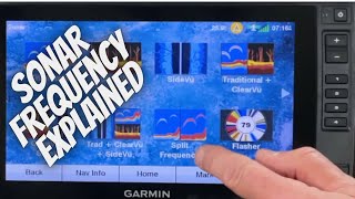
- This video explains some of the features included with the Garmin 93SV UHD sonar units while in simulator mode, marking waypoints, sorting waypoints, setting map orientation and other tips. This video was revised from the original video released 1 week before. Thank you Johnny for spotting the error!!!!
Link to Garmin sonar series playlist!!
• Garmin Sonar Series


Link to Garmin sonar series playlist!!
ruclips.net/p/PLVvIAKByPmU4MDJw5rrEQ6qwHj1FlJ8HL
Just bought a Garmin fish finder for my boat. I'm learning a lot from your videos. Thanks for the helpful info.
Glad to hear it!!! I think you’ll really like it, get the transducer mounted correctly and the picture is amazing. There’s a video for that in the Garmin sonar playlist. Thank you for the comment!!!
Great vid, thanks. I just picked up this fish finder and the Panoptix. It's been cold and windy but I've hit the lake a few times just to play with the setup. I marked waypoints and it occurred to me I wasn't sure how to navigate back to them so your vid will help. I'm going to take a few days during the harsh weather to do nothing but cruise around and marking my lakes so I'm ready for Spring.
Smart man!! Thanks for watching and supporting the channel.
Buddy like I said before I am binge-watching all your Garmin tips😋😋 these are very awesome thank you for making these videos😁😁😁👌👌👌👍👍👍👍
Thanks Fredo, if you have any questions holler!!!
Thank you and I sure will Sir😁👍👍
Thanks for all the info 👍
Glad to help!!
Got my spreadsheet. Thanks alot. I subscribed and rang the bell. Mike in Lincoln, Nebraska
Thanks Mike!!
Wow! Easy when you know how. I've tried to do that a lot and never could figure it out. Thanks for the info!
Don’t feel bad many of us (me too) when I started didn’t understand the mark button was boat position, thanks for watching!!
Did you sign up for the newsletter? That’s an older video, we have over 300 Garmin users I send out a monthly newsletter to. I also made a spreadsheet with basic settings I can send you if you don’t mind sharing your email send an email to doubletfishing@outlook.com
That helps! I finally know how to mark point property. Will do that on the water
Garmin really should make it clear that the mark button on the bottom of the screen is the boat position. Lots of us made that mistake as new users, thanks for watching!!
Good job
Thanks Curtis!! Have a great holiday!!
Really helpful, thanks!
Appreciate it Bob!! There’s over 40 videos on the Echomap series in this playlist
ruclips.net/p/PLVvIAKByPmU4MDJw5rrEQ6qwHj1FlJ8HL
My son had mine in simulater mode & i was freaking out.i was like oh man my buddys are going to be mad when i come back with a boat load of fish.then i realized it was in simulater
Ha ha, that’s funny stuff, thanks for watching and have a great weekend
Thanks for the lesson..
Good info but for a techno not ( me) if you could slow it way down I wouldn’t have to back it up 45 times
Thanks for the feedback Mark, I’ll work on that!!
Can you do a U tube video on how to set front and
console units to work off the same transducer when tied together
Thank you for all the Awesome info
Thanks for the comment Dewayne!!! Check out these two videos in my “Garmin sonar series” playlist should cover what your looking for.
Setup screens to go fishing and Garmin echomap network.
Link to playlist: ruclips.net/p/PLVvIAKByPmU4MDJw5rrEQ6qwHj1FlJ8HL
I’m running a GPSMAP 1042sxv. I am marking small underwater structures (stumps, logs, etc.) in 5-8’ of water. I am scrolling out to mark the precise location of the object. It is very difficult to find that object when I come back days later. My LS Forward Facing distance is set to 20’. I have a Combo Screen setup with charts on the top and Forward Facing LS below. Can you provide any tips that may help? Thanks for the helpful videos.
Keep in mind the GPS antenna is in the chartplotter which may be 10’ or more from the transducer. If you mark it driving one direction then come back from the opposite direction the mark could be 20’ off. Small object can be tough to relocate especially in shallow water because the sonar cone is small your not seeing much of the bottom surface. Might try setting your LS distance to 30 or 40 until you locate the structure. Have a great day!!
Thanks for the speedy reply. Your comment about the waypoint originating at the head of the unit helps when looking at the boat icon as it approaches the waypoint. But shouldn’t the waypoint be set at the location of the cross section of the two lines when it is marked manually by scrolling?
I appreciate your help.
Dan Ayo
The cross hairs are based on the sonar image from the transducer. I actually asked the Garmin technician to confirm awhile back. Wrote an article in my newsletter about GPS accuracy. Kinda a hard concept to wrap my head around
@@DoubleTFishing Please send link to article mentioned above.
Is it correct to assume that when the crosshairs are placed out and away from the boat that the waypoint will be marked at the location of the crosshairs?
Not sure how accurate the GPS is side to side from the boat. It would depend on the depth (cone angle) and sonar type. Side vu would be pretty accurate. Here’s the link requested
eepurl.com/is-X1o
I haven’t got my unit yet. I’ve pretty much made my mind up on the 93sv with a LVS32. Not quite decided on the transom transducer. Based on value I’ll probably go with the 54. Thoughts?
The GT56 gives you 20% more reach on clear and side vu along with more definition. It depends a lot on your fishing style. If you fish allot of open water deeper than 60’ it may be worth the extra. I use it more for locating structure, ledges and weed lines in 10’ to 50’ of water so the GT 54 does the trick for me. One other consideration is expansion, the 93sv has been discounted for months at $650 to $700 with a GT54. The latest 9” UHD2 has the upgrade WiFi, I honestly don’t know future capabilities but might be something to think about. Here are a couple videos might help
ruclips.net/video/5YSoKbIx1zQ/видео.html
ruclips.net/video/Qn9thYqEcr0/видео.html
Do the Waypoints show up on the map?
Yes sir!! They show up immediately, thanks for watching!!
@@DoubleTFishing Awesome! Thanks for fast reply!
Anytime Billy, did you get a copy of the settings spreadsheet and file structure for Echomap beginners? If not send me an email and I’ll reply with the spreadsheet attachments
Doubletfishing@outlook.com
When I get home tonight
How do you change the GPS FORMAT to enter correct coordinates
I’m at the classic this week as a marshal so not near my boat but on the active captain app go to settings/units/position to change the GPS format. If you the “units” on the menu that’s where it should be. Thanks for the comment, have a great day!!!!!
How Can or will this unit pick a safe travel route on it on?
You need to purchase specific lake chips or map upgrades if they are available to get safe routes. All you can do is set up your map shading to color low water contours but keep in mind the depths on the map represent the water at full pool!!! Make sure you check the actual depth when you get on the water. Doesn’t compensate for current conditions or tides. Also the maps don’t show all hazards, stumps, trees, sand bars. Always get the quick draw community downloaded, sometimes others may have marked them in the past. The unit won’t keep you from tearing your boat up on water your not familiar with 😞. Thanks for the comment!!!
@@DoubleTFishing thanks buddy for the info 👍
This may be a stupid question but I just bought the 93sv to match my console for the front deck. When I go to is it reading the front deck garmin so I know exactly how far I am from that spot? Want to know where to cast to. Makes sense?
When I’m going to my marked waypoint I pay attention to the map and the trail marks so I have an idea which direction the waypoint is from me. A couple things that help are to set the orientation to “course up” and don’t go too slow went traveling to the waypoint. If you set the orientation to “north up” it will make your head spin!!!
Thanks for the comment
If you have them networked together via Ethernet cable, only one SD card not two and both on maps the units should show the same waypoints. You can turn on the heading line to get a better idea of distance and direction
After I mark a WP at the teardrop I can’t find the brush …???
Hmmm the only problem I’ve had in the past is the objects look much different when I’m on top of them, the GPS is normally within 3-6 feet. I’m not sure buddy.
Are you trying to find it with clear vu or traditional? Clear vu is a pretty narrow cone, might go to traditional and widen your search area
Is there a way to see all your waypoints on a map instead of just a list?
They are on your map automatically. Zoom into the lake and they are there even if you don’t name it the sonar unit assigned it a number and icon. When you select the waypoint off the list a menu on the right pops up, select “go to” and a map should come up with a line from your current position to the waypoint or just pull up you map on the screen and zoom into your lake and the waypoint should be there.
This video kinda shows how you can see my old waypoints on multiple lakes as I pan around west Texas.
ruclips.net/video/xpHxqlrdpJI/видео.html video
Ok thanks, that's very helpful it wasn't shown in this video. Thanks for clearing it up.
Thank you for being really responsive. I really appreciate that.
Having a challenge to get my (93sv UHD) simulator to show up just blank screen with no images. In my setting it shows simulator is on.
I had the same problem until I updated the software, not sure why. Many of the first videos I had to shoot on my older 93SV plus unit. Check for any updates that might do the trick. I have a video in the "Garmin Sonar Series" playlist on performing updates both with Garmin Express and active captain. Thanks for the comment, have a great day!!!
Can you mark waypoints while in livescope vertical or perspective mode?
Great question!! I’m not sure? I haven’t purchased live scope. The Garmin support network has been a great resource for me in the past setting up my networking between units, you might contact them 800 800 1020, once you get through the menu it only took me a couple minutes to be connected to a quality technician both times. Thank you for the comment sorry I couldn’t help
Sometimes when I mark a waypoint and try to find it later on, I will see it on GPS and go over it but it doesn't show up on my downview. I have marked the same brush pile two different times because I will go over the waypoint but not see the same brushpile until several feet away from the original waypoint. Suggestions?
Thank you for your videos!
That is a great comment and a subject I hope to tackle in 2023. As far as advice if you hadn’t done it turn on your WAAS/EGNOS satellites to improve your GPS accuracy.
Beyond GPS accuracy I have a theory…the GPS signal is received by the unit position, the image is generated by the transducer which could be 20’ away from the unit. Traditionally you would turn around a come back from an opposite direction compounding the distance inaccuracy. Just a theory I want to check out using a couple marker Bouys. Have a great rest of the weekend!!
I found the answer to my question. Figured I would share it here just in case somebody else is doing the same thing. I don't mean to come on your channel and give advice so if this is not right then please delete my comment.
When marking a brush pile on either down view or side view, pause the screen, put cursor on brush pile (or whatever you want to mark) and then press the CURSOR tear drop button in upper right corner of screen. DO NOT PRESS THE MARK BUTTON in the menu selections. When you press the MARK button you are creating a waypoint directly UNDER the boat (and like Double T fishing explained) it will say Waypoint created at BOAT.
Again, I apologize if I over stepped on your channel. I have wanted to throw my unit in the water several times because I couldn't find the waypoint I just created. Watching your video and then seeing someone also explain it, NOW I know what I was doing wrong so hopefully this helps someone else.
@@DoubleTFishing How do I turn on the WAAS/EGNOS satellites? Is that a standard feature on the 93sv? Thank you!
Go to your Home Screen hit “settings” at the bottom menu then go to “system” and select “GPS” it’s in there. Have a great evening.
Send me an email and I’ll send a spreadsheet I made with the settings file structure
Doubletfishing@outlook.com
U do really well I was doing my waypoints wrong until I watched your video. Thanks you
It’s very common, I still find myself hitting the bottom menu “mark” button once in awhile instead of the teardrop. That’s why I emphasized reading the screen to make sure it marked the cursor and not boat position. Thanks for watching, have a great weekend!!! If you didn’t see the playlist there’s 20+ videos on the echomap link below
ruclips.net/p/PLVvIAKByPmU4MDJw5rrEQ6qwHj1FlJ8HL
Thumbs up. Is there a way to get rid of the checkered flag or make a smaller one? Thanks
You can manipulated the size of the icons, I’m not sure if it affects the flag. Check out this video and see if Navaid settings help
ruclips.net/video/fnGFNSS9XSc/видео.html
Good morning very good video I encounter a problem when I mark a waypoint, I have a lot of trouble getting back to it what is the best setting to stay on course?
I set it to course up but still makes it tough. I’ve found heading in a straight line and traveling a little faster helps.
@@DoubleTFishing ok thank you I will try racing up. and in the other tab there is, auto, heading followed and heading GPS tracking what to select
THANKS
@guillaumevescovi6395 👍🏼
I’m looking into buying one of these. Thank You for your video. I’m trying to choose which unit would work best for me, alil confusing to be honest.
Take a look at this video, thanks for watching. There’s a Garmin playlist on my channel with tons of information. Have a great day!!
ruclips.net/video/_S5YCJDCguQ/видео.html
This was realy helpful.i bought this unit 3 mo augo.finaly learned how to read side view & set up my contrast, brightness ect.... But had no clue how to mark.& navigate to certain areas.this defintly helped me.thanks alot.
Go to my channel and check out the Garmin sonar series playlist. Lots of good stuff on how to set things like angle markers and bottom lock. Have a great day!!
I have another question for your brother so are we going to be able to access 1700 Maps For like pre-Planning a fishing trip to a lake that is on the G3 from home probably not but just wondering still waiting on my unit Thanks in advance
Not sure I totally understand the question but You will have access to look at any lake covered in the lake vu maps package that comes with the unit. Once you register your unit you will have access to view the lake map, mark waypoints and if you do it on your computer or phone just download the info into your sonar unit. Google earth is a great resource also. Here’s some links to other videos on the topic
ruclips.net/video/iqMcMtCLEKU/видео.html
ruclips.net/video/znqofz9nFrk/видео.html
ruclips.net/video/SPsYd8FeIFQ/видео.html
@@DoubleTFishing No the question was I’m going to be going to Michigan from Kentucky and I’m just wondering if I’m gonna be able to access the lake map in Michigan that is for sure on the unit to do some pre-waypoint marking or am I going to have to do it all from the lake thanks in advance
You will be able to look at the lake in another state and mark waypoints👍🏼 on your unit. Thanks,
I thought of another tip I use when anchoring up on cats or sturgeon, when you have a waypoint marked and thats where the fish are and you want to get pretty close you can touch the waypoint on the chart and then in the upper left corner it will show you how far from that waypoint in feet you are. So I can set my anchor and then drift back until I am well within casting or jigging distance to the foot without guessing or spooking the fish.
Yes that is a handy feature, I’m going to try and get another video put together soon. Got this wrote down, the screen menu, and if I can get decent footage I’d like to breakdown the map orientation settings on the water. I use the “course” up because I’m directional challenged, which do you use or have you changed it? Again thanks for your help with the waypoints, the edits are a bit choppy but turned out ok.
@@DoubleTFishing I think I use course up? Whatever keeps the screen from spinning 😂 the video edits turned out good 👍. I would like to find a setting to have the current track hilighted without going in and changing the track color every time.
@@DoubleTFishing I wish I could get my boat out but I will have to settle for ice fishing instead 😥
I feel your pain, I travelled 500 miles last week to catch some Bass lol. Got 65mph winds predicted tomorrow but might be able to get out Sunday. Water temps are still in the 30’s. Been picking up a few walleye all small.
Always great content!
Thank you!!!
Good info, thanks for sharing.
Thank you for the comment, I appreciate it, good luck on the water!!!!
Thank you thank you thank you you have made my life so much better thank you thank you thank you I cannot thank you 🙏🏽 enough you have no idea I have been struggling with that😃🙏🏽
Your very welcome glad you are enjoying😀
@@DoubleTFishing if you don't mind me asking what area are you in of the United States I'm in Northeast Texas do you give on the water lesson😃
I live in the Texas panhandle, I was just in Mt pleasant last week fishing Welsh.
I’m no expert, another good channel is MG Marine Tech, he does some nice videos on this unit, if you have any other specific problems let me know if I can help.
@@DoubleTFishing Did you go to Bob Sandlin Lake I'm about 35 or 40 minutes away from there.