Это видео недоступно.
Сожалеем об этом.
Image segmentation process in ArcGIS Pro

HTML-код
- Опубликовано: 8 сен 2023
- Welcome, everyone, to my channel dedicated to Space, Remote Sensing, and GIS. Today, we have an intriguing lecture in store for you, focusing on the fascinating topic of Image Segmentation.
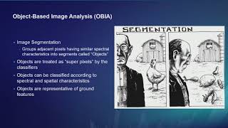
Segmented rasters play a pivotal role in the workflow of object-based image classification. It's crucial to understand that poorly segmented rasters can significantly impact the accuracy of classification results. Image segmentation serves as a powerful tool to simplify and reduce variability by grouping nearby pixels into segments based on specific shape, spectral, and spatial characteristics. These segments can then be amalgamated into distinct classes, representing real-world features on the ground.
Throughout this lesson, you will gain valuable insights into the art of creating well-segmented rasters, ultimately leading to cleaner and more precise image classification outcomes.


![Gunna - today i did good [Official Video]](http://i.ytimg.com/vi/ulGLk8TaXcI/mqdefault.jpg)


Great information, thanks
Glad it was helpful!
Great info!
I have a multiband raster (8 bands) that include sentinel-2 (RGBI), and several LiDAR derived datasets. I see the mean shift output is only 3 bands. Can I still perform segmentation on an 8 band raster or is it best to segment the sentinel-2 data first and then make a composite and then perform RF?
I am creating a predictive wetland layer and I have been using a pixel based approach but I would like to try object-based classification but I haven’t been getting good results when doing it on an 8 band raster.
Thanks
Given your multiband raster with 8 bands comprising Sentinel-2 (RGBI) and LiDAR-derived datasets, performing segmentation on the entire 8-band raster is possible. However, it's important to consider the nature of the data and the segmentation algorithm being used.
If you're encountering issues with object-based classification on the 8-band raster, it might be beneficial to perform the segmentation on the Sentinel-2 data first, create a composite, and then apply the Random Forest (RF) algorithm. This approach could potentially yield better results as it allows you to focus on the spectral information from the Sentinel-2 data before integrating the LiDAR-derived datasets.
Here's a suggested workflow:
1. Segment the Sentinel-2 data using a suitable segmentation algorithm to create objects based on spectral information.
2. Create a composite of the segmented Sentinel-2 data, combining bands as needed to capture relevant information for wetland classification.
3. Integrate the LiDAR-derived datasets into the composite, ensuring that the additional information enhances the spectral information without overwhelming it.
4. Apply the RF algorithm to the composite to classify the wetland areas.
By segmenting the Sentinel-2 data first and then integrating the LiDAR-derived datasets into a composite, you can potentially improve the classification results by focusing on the spectral information relevant to wetland classification while leveraging the additional information provided by LiDAR.