DragonOS FocalX Offline Maps w/ QGIS + GeoServer (Signal Server GUI, PhotonMap, R28)

HTML-код
- Опубликовано: 1 авг 2024
- In this video we'll take a look at adding QGIS and two additional plug-ins to an upcoming DragonOS FocalX R28 in order to create a GeoTIFF map file for GeoServer.
*for some reason there’s audio distortion after making small edits to the video, unfortunately on my local copy too.
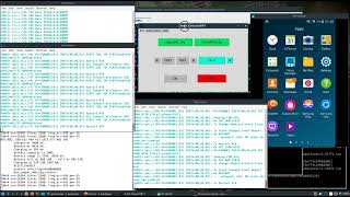
I also show the Dragon Spectrum Awareness Manager, which currently is just used to help start up and configure the various applications talked about in this video.
After creating a GeoTIFF file for a certain area, I show how to load it into GeoServer. Currently manual configuration to both Photon Map and DF-Aggregator's files are needed to add or remove map layers. Once a map layer is added, simply restarting the application will then allow it to pull the corresponding layers from GeoServer.
Towards the end of the video I show how to pull a KMZ plot from Photon Map and show it on the map created in the beginning of the video. Once I get a few more things figured out, it should be fairly easily to create maps and have them available for use with DF-Aggregator and the KrakenSDR - for complete offline radio direction finding.
Follow @cemaxecuter on Twitter for more DragonOS and SDR info.
Become a patron @ / cemaxecuter  Наука
Наука


I use the map layer horizontal and vertical resolution values of 0.5 in Tile+. This gives me good surface details in the resulting GeoTIFF file and it allows me to navigate around on the offline map without problems.
Thank you for showing how to use the Lat Lon Tool plugin for QGIS. I was not aware of it before.
I wasn’t sure why my map was longer left to right after I made it? I maybe had too big a section when I was creating it?
@@cemaxecuter7783 I am using the same approach as you do - just select "Map Canvas Extent" in the Tile+ plugin export settings.
I used this video as a reference to create proper GeoTIFF files with GoogleMaps satellite images:
ruclips.net/video/ImkJcD8VV0g/видео.html
The person in the video "How to download Georeferenced Google Sateagery on QGISlite" uses slightly different settings in the "Save Raster Layer as" menu from what you use in your video. You can see the settings at 5:37 at the URL in my above comment.
@@user-fu6it4cm7x I’ll load it up and watch, it should help if I do another video with remote KrakenSDRs!
@@user-fu6it4cm7x thank you, loading and checking it out now.
Nice, thanks
No problem, hope it helps.
Sorry for coment in other video.
I can use only HackRF board to send SMS automatically(bts like osmoBts or other)?
I want only send sms to conected cellphones, no sniffing.
I'm live in Brazil, in here a limeSdr costs 8k ~, medium salary is 1k
Hackrf won’t work, it’s not full duplex.