Quadrotor 3D Mapping and Navigation (ROS MoveIt! & Gazebo)

HTML-код
- Опубликовано: 7 май 2016
- Quadrotor 3D Mapping and Navigation (ROS & Gazebo)
8 May 2016
www.wilselby.com/research/ros-integration/
Wil Selby
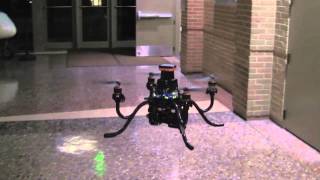
This project focused on simulating a Kinect sensor and a quadrotor to develop a 3D map of the environment and subsequently using the map for localization, path planning, and obstacle avoidance. This video tutorial briefly covers the following topics:
- General overview of the ROS MoveIt! framework for motion planning
- Demonstration of developing a 3D occupancy map based on octrees using a simulated Kinect sensor mounted on the simulated quadrotor
- Using the MoveIt! RVIZ plugin to set a desired goal pose, plan a trajectory, and send the desired trajectory to the quadrotor for execution.  Наука
Наука


Excellent video. Gives a glimpse of how to 3D map a room with a quadrotor
Nice job!!!
Nice
Hi, I am really impressed by the video. I am currently using 3 external stereo cameras for obtaining depth and point cloud map of a room. I am also using a Parrot A.R. Drone and wish to do obstacle detection and avoidance and move the drone around.
My question: Can this setup you used, work for me as well ? The main difference here is that the point cloud and 3D map are provided by the external cameras in my case.
I think it should work if you can get RGB-D information and pointcloud information from your sensors.
Thank you for your video. I have one question: Is the room map build by the Kinect just an object map(other than collision map)? If so, how can you transfer the object map into collision map (which robot will see it as a collision when navigation) ?
The octomap that is created is a collision map. Toward the end of the video, you can see that MoveIt! creates a trajectory around some of the obstacles identified in the ocotmap.
Thank you so much for your reply. I have created a 3D map by point cloud2. However the PR2 arm dosen't consider it as collision object . Do you know the reason?
That I'm not sure of unfortunately, sorry.
Thank you for your reply. I fix it by reference this link docs.ros.org/indigo/api/pr2_moveit_tutorials/html/planning/src/doc/perception_configuration.html
Great work there. I was trying to use moveit for quadrotor navigation myself. But I did not find good moveit tutorials for dummies, hence I am stuck. Could you lend me some help?
Anurang,
Check out my tutorial here:
www.wilselby.com/research/ros-integration/3d-mapping-navigation/
It should enable you to recreate the video above and provide detail on the code so you can apply it to your own project.
Good luck!
Hi Sir, i am working on Robotic arm with Moveit i done all work for path planing but i don't know how to create Octamap, may you help me . i even check octamap website but can't get it , so please show me the right way where i can learn or how i can learn .
Check out my detailed tutorial here:
www.wilselby.com/research/ros-integration/3d-mapping-navigation
The Occupancy Map Updater is the primary component of MoveIt! that deals with 3D perception. You can use the PointCloud Occupancy Map Updater plugin.
Can we do 3D navigation for a 4 wheeled robot?. We are actual working on that but unable to find any package for it
I think you could use the navigation stack packages for a ground robot.
Hello. I am trying use
lidar YDLIDAR G4 to do 3D reconstruction of a room. Could you please assist me how to contruct the code? Really appreciate your help.
A detailed tutorial is available here:
www.wilselby.com/research/ros-integration/3d-mapping-navigation
Wil Selby thank you so much for your help. Can we do this based on Arduino?
The link provided is not working? Any alternate links? Please help
www.wilselby.com/research/ros-integration/ works for me currently
@@wilselby The url shows the following error: Warning: mysqli_set_charset(): Error executing query in /app/public.built/wp-includes/wp-db.php on line 756
Warning: Cannot modify header information - headers already sent by (output started at /app/public.built/wp-includes/wp-db.php:756) in /app/public.built/wp-includes/pluggable.php on line 1223
excuse me if you are an academic person is there a way for contact? I am from Egypt and want to complete my post graduate study at this field .thank you for your attention
Mohamed,
You can find an email for me at www.wilselby.com
I do something similar by georeferencing but there are some slipping I guess it is because of the delay between the time odometry and point cloud are obtained. How can your map be that precise?
This is in simulation, so there are no errors in any of the measurements.
I also get ground truth odometry from gazebo but I can not synchronize point cloud and odometry messages
I tried Time Synchronizer of message_filters but I get an error which may be related to boost libraries.
Here's a more detailed tutorial which might help:
www.wilselby.com/research/ros-integration/3d-mapping-navigation/
Hi can we utilize moveit with a 8 motor holonomic submarine ? Is there any packages for this?
Following, any updates ?
@@nirajpudasaini4450 ended up using nav2 with a pid to control z axis. Version 2 of my system is from scratch tho: first spline interpolation to create poses then following said poses with velocity commands
@@nikolaiphilipenko9210 thanks for such a prompt response. I am trying to work around with moveit and ros melodic for the past 3 months for my bachelors thesis. I am still not able to succesfully execute the path planning.
I would appreciate if you can share any resources that you have made public. I will try to switch to nav2 if it works.
Fyi: i am using bluerov2 as a robot, and have successfully assembled and tested its built in functionality.
hi if I want to test algorithm for path and attitude planning than how can I test it ??
Ritesh,
If you want to use one of the provided algorithms in MoveIt!, follow this tutorial:
www.wilselby.com/research/ros-integration/3d-mapping-navigation/
If you want to use a custom algorithm, look at the MoveIt! API:
moveit.ros.org/code-api
-Wil
ok so for that I need to run sitl inside the simulator
Hi
Wanted to know if there is anything for 2-D mapping ?
Thanks for help.
Check out my 2D mapping and navigation video here:
ruclips.net/video/orYNS6ntjnY/видео.html
It has links to a tutorial on my website with sample code.
Thanks for help!
Another question: Can I use a bumper sensor to bump with everything in a room and then store the coordinates of all those points. Then I know which all point have an obstacle.
So can something like this be used to map a room.
Thanks again!
Raghav,
I don't have any experience doing this but here is the link to a bumper sensor:
wiki.ros.org/evarobot_bumper
and you can use this package to convert the bumper data to a pointcloud which can then be an input into a costmap for gmapping:
wiki.ros.org/kobuki_bumper2pc
-Wil
Thanks a lot!
sorry for late reply.
Hi,
sorry for bothering again but do you know of any Path Planning Algorithm I can use for traversing a room in best possible way with a known boundary.
Thanks a lot for help.