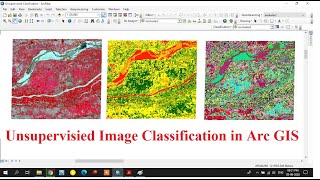
Supervised Image classification in Arc GIS

HTML-код
- Опубликовано: 26 авг 2024
- Supervised Image classification in Arc GIS
How to Download Landsat satellite image / Earth explorer/ USGS = • How to Download Landsa...
Create and Edit Shapefiles = • How to Create and Edit...
How to do Dissolve / Union / Intersect / Merge in Arc GIS (Geo processing) = • How to do Dissolve / U...
Mosaic Raster data sets in Arc GIS/ Merge Raster Data sets In Arc GIS = • Mosaic Raster data set...
Drainage Extraction in Arc GIS using Digital Elevation Model (DEM)/ Automatic Drainage Extraction = • Drainage Extraction in...
Importing Excel Data in Arc GIS/ How to Do interpolation (IDW) in Arc GIS = • Importing Excel Data i...
How to create Slope, Contour, Aspect and Hillshade in Arc GIS using Digital Elevation Model (DEM) = • How to create Slope, C...
Projection of Raster and Vector files in Arc GIS (Spatial Referencing) = • Projection of Raster a...
Layout preparation in Arc GIS and exporting in JPEG = • Layout preparation in ...


Thank you for your nice video. How can we download the video to follow.
Thank you so much
can you make a tutorial using sentinel 2b l1c data preprocessing and supervised classification?
what about landsat 5 whitch band can composite?
Sir can you plz🙏 share the 3D map, point Dem, morphometric videos
very useful bro
Thank you ben
@@gisandremotesensingbasics6791 IGTV layum share pannunga
@@pxledit5630 sure ben
Can u help me in data collection for flood
TEST STUDY AREA RECTANGLE HOW?
Yeah bro... Need to know that