Cheaper alternatives to DroneDeploy and PIX4D (YDQA EP 29)

HTML-код
- Опубликовано: 27 сен 2023
- Welcome back to another episode of "Your Drone Questions Answered"! In today's episode, we answer the question "How can someone get into mapping when DroneDeploy is expensive per month?" To shed light on this, John brings in David Young, the founder of Drone Launch Academy, who shares some insights and alternatives for affordable mapping software.
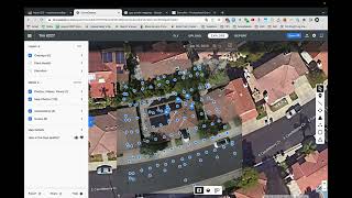
David starts by addressing the rising costs of DroneDeploy and PIX4D and points out that DroneDeploy is now even pricier than before, with an annual subscription costing $6,000 or $600 per month. He suggests that there are alternatives, which might not be as well-known but are more budget-friendly.
First, David mentions Maps Made Easy, a California-based company that offers a pay-as-you-go system. You can start small, and as you need more capabilities, purchase credits for processing. Maps Made Easy is a great option for beginners who don't want to break the bank.
Next, David introduces Birdi, an Australian company with a similar pay-as-you-go model. Birdie offers affordability and flexibility, making it an excellent choice for those starting out in mapping or looking to save money.
David also touches on other alternatives like Reality Capture, primarily for 3D visualizations, and free software tools like Google Earth Pro and QGIS for basic analysis.
For students, David highlights the fantastic student pricing offered by PIX4D, making their powerful software much more accessible. Students can get PIX4D Mapper for just $100 per year, a significant discount compared to the regular price.
In conclusion, if you're looking for affordable mapping software options, there are alternatives to the pricey DroneDeploy and PIX4D. David's insights provide a roadmap for drone enthusiasts and professionals to find the right solution for their needs.
Don't forget to subscribe, like, and share this episode if you found it helpful. If you have your own burning drone questions, submit them at YDQA.io or through the Drone Launch Connect private community. We're here to help you navigate the skies of knowledge!
Stay tuned for more insightful episodes, and we'll see you in the sky!  Развлечения


Great information! I'll go with the Pix4D. I currently teach at a local college!
Great episode. Please continue the output. Cheers.
WebODM is another good one.
Yes! Very true. Forgot to mention that one
How does Dronelink stack up with these platforms mentioned? I’m interested in flight planning with processing for orthomosaics.
Wanting to take drone photos and overlay blueprints for construction site. What would you recommend
Guys great video - but one thing that no one’s talking about is once you’ve processed the map - is how do you share your map online say with an embed code?
We just got a license for pix4d mapper - but cannot figure how to share our maps! So difficult to find information!
What is your export? A geotiff? What are you trying to show? Just a demo? Or does client have specific things they want to see?
@@DroneLaunchAcademythank you for the reply!
I don’t know much about different file types but yes right now I’m looking at a Geotiff.
However, whatever the format, all I’m trying to do is upload a map (geotiff, kmz, whatever format works) to an online app that gives me an embed code that I can add on my site for clients to see the map relative against say like an esri or Google map and can do basic very basic measurements on the ortho.
I am paying 500
what is with this subscription model that you people are going with. I have zero interst in subbing for software
Pix4dmapper student 75 bucks
Steve @ River City Drones is no longer is business just 7 MONTHS after asking this question. He should have went with a tried and true drone mapping software. If he was a skilled pilot, he would be making $1000+ per map.. That would have paid for the subscription 10x over
What about Skyebrowse?
Like any Every American products always overprice