Right on Rob! A Valuable lesson to share with the team. We see that default -99,999 out of CAD all the time and when the boy's setting out with the gun on local coordinates, there is no problem. Its when we staking out imported points with the GPS to watch out for this scale error. Awesome, This is some great content, Possibly the best Surveying content out there. Thanks for making great videos.
Happened to me once trying to tie in to a Delaware state plane job control but had the elevation default to around 1500' , paid attention to the vertical ever since.
Magic Robert should be your name . Is so nice to hear words as orthometric high and all of that. Some big field stations , where the goal is to have accurate hights an such can be out quite a lot after u perform Helmert transofrmation or any custom 3d best fit or whatever the math people do to get some proper elipsoidal dist. Some people don t get it and I dont know why. A note about what to define small and big specialy in this marvelouse case study u have explained. Would u consider fix STN 1000 and shoot STN1001 with bearing only , so to have a othometric high coming from flat or plan surface that the instrument build on your fix ? PS. Land surveyors don t take just mesuraments , we deal with them and their residuals . We are not lasers or setting out engineers , we transform and create models for ground features . 2) we don t just go and press buttons , we check things out, shoot check shots and check our stations and others when and where informations are given. We deal with flat and curved distances. Thanks a lot Robert !
Easy button is to setup scale factor 1 and roll in this situation. I wish all surveyors understood more about the measurements they are taking. Their boundary decisions are based on those measurements.
This is a great presentation and introduction to the rabbit hole of geodesy. Thank you, Robert. Cheers from the bitter cold northeast. Edit: Did you pull a tape between the two GPS store points? If so, how did the distance check?
Not quite related, but I always enjoyed helping the guys running 3D machine control that didn’t understand why their distances from the lines were off by several hundred feet. …data exported from the office with no heights… 😅
One of my early grade setting jobs was building dams for waste water treatment ponds literally at sea level (behind levies), so I was dancing all over the place in negative and positive elevations pulling grade from offset hubs with a tape and a laser... Lol It was funny pumping water from below sea level to also below sea level so we could build a pond to hold water back below sea level, but it would be above sea level when it filled up. Yes, I am still confused! ;)
This is a flat earth situation. Everything is easier if the earth is flat, reality means nothing. (UTM, ellipsoid, Geoid & Geodesy does not exist so don’t need to be considered) Great video, thank you.
Personally I only use a local reference frame and peg my "Don't Care" elevations at 1000' which is my defined project reference height. So I would never run into this. But, I thought no one uses State Plane reference frames now that we have the High Resolution Reference Frame Network for GNSS. At least that's what I read.
@Surveying with Robert Got a question for you, not at all a criticism. I’ve noticed on several of your videos you set the TS below your own eye level. Only reason I can think why a seasoned professional and business owner would do so is maybe because your used to training shorter guys or to minimize vertical error? Do you have a particular reason for setting up so low? In union surveying we were trained to set instrument at eye level, +/- depending on the relative elevation of what we are shooting in relation to the instrument (You want the scope lower to shoot into a pit, for example).
Greetings from Brazil! 🇧🇷 I'm surveyor and I found your video by recommendation from RUclips. Similar error I found in my daily work when a take the job from another surveyor... Make a video commenting about error from free station or resection (I don't know how you guys call this at USA) vs. backsight - forwardsight using total station after stakeout points from GNSS... Sometimes my angle don't close but my distance is fine...
I don't work with Trimble so I need to ask: the difference shown in the video is the software trying to bring the total station shots to grid using or the GNSS shots to ground or because you have made the stake out with GNSS and using -99.999 elevation? I've got a little bit confused in what's going on. I don't know NAD83, but he distortion is not enough to be needed to convert the projected coordinates to PTL before settting out? Thanks
The software is looking at those elevations and creating a slope distance. Think of it as standing on a cliff. Only a few feet away but a long way down. Does that help?
Rob, did you ever get a chance to try defining your null elevation in Trimble Access? Would be very curious to know if that would circumvent this issue.
Am I just crazy but why wouldn't you put an elevation that is near the project for the calculated points. Also, if you shot the points with GPS, why not use both points for your TS and Backsight? When I started with GPS back in the day ('94), I was told/trained to put at least an approximate elevation. If you do that then this wouldn't be an issue.
@SurveyingWithRobert I understand that there are always new people out there. It's hard to believe that they didn't get told that on the second or third day. I enjoy your videos. There have been some very informative videos and I have learned from them. Thats the best part, you have to learn something new everyday.
@@SurveyingWithRobert Hi Robert. (Bob?) Wanted to ask you about your total station set up procedure. If I staked out 2 or 3 CP’s via GPS and occupied with the TS, my procedure for BLDG layout would be to collect the BS point again with TS. So for instance, if my BS point was 1001, I would setup TS, station set up and then average 2 180 degree rod shots and store as 1002 (or whatever). Then break setup and station set up again with the new BS point. That way I’m holding instrument CP for relative accuracy with a tighter setup but with the advantage of absolute accuracy; hopefully within 0.03’ or so, or whatever is the quality of GPS CP 1000 stake out positioning. I first used this method to layout structural steel for utility helipads who’s locations were required to be within 0.05’ of design specs. The utility had some crazy regulations they had to follow regarding pads distance from transmission lines and the 10 or so steel structures had a survey tolerance of 0.01’. The LS in charge at my old firm came up with the procedures used on that job. Had to walk gps,TS and staking materials up the side of several mountains, while the client took a chopper, dead middle of summer in the rugged terrain of far east San Diego County. Some jobs you NEVER forget.
Good morning, I have one quick question. Is it possible to transfer information from one TSC7 to another? Through some form of Bluetooth or over-the-air. Without using a usb stick
Wow! That literally just happened to me 4 days ago. I set my stns with a tremble C5, when I went back with my R10 and held the exact points I was out 1.3' I checked other stns in the area and I was still getting the 1' error. I put away the gps and switched back to the total Station, and guess what.. I was right on the money... 0.002 I was so confused as to what had happened, I wasted about an hour trying to figure out what happened. Thanks for the video, I normally set my design points to default at 0' But now I know better... Thanks Robert
This is a great example of why I prefer to use a scale factor only job for Total station work. Things get messy when using the bot in a job with a calibration or a projection.
@@SurveyingWithRobert yes, state plane has a scale factor, but I meant using a job set to scale factor only and setting it to 1.0 I am curious tho if the software still compensates for the horizontal distance if you are setting up on a point with a 0.00 elevation vs a point with a 1000.00 elevation.
Robert, I have to start by saying how much I enjoy and appreciate your videos, they have taught me many many things. I do have a question to ask to help clear things up in my mind: -You mention a few times that this is something to watch for when using State Plane Coordinates. Would it be fair to say it is not so much the coordinates to watch for so much as if you are using the SPCS with your GPS equipment to stake out the points? I do not believe I would have this issue if I went out with my Total Station using a scale of 1.000000 and staked the same points, I may not be understanding what you are saying so please correct me if I wrong. Thanks, Bryan
You won’t have the problem discussed in this video if you keep your scale to 1.0000 For small construction sites it doesn’t matter. Your method is commonly used by several other surveyors I know.
I'm sitting right now.. having every problem.. data link issues, switched controller, robot, antennas. Now my vertical is out .52'.. I checked everything..
I am a firm believer in keeping your GPS separate from you Total Station. 2 different job files. I always use "scale factor only" for my coordinate system with the scale set to 1.0 when using the robot.
Bad news you’re screwing up. Your GPS and Total station will never tie together. Your on two different scale factors. I really need to get a video out on this. You need to bring your GPS to ground if you want a scale factor of one. Where do you survey. What is your average elevation?
@@justinaz282 always when using state plane in your case. You want your GPS and TS on the same scale. Keep them both grid or ground but don’t mix or nothing will fit together.


Right on Rob! A Valuable lesson to share with the team. We see that default -99,999 out of CAD all the time and when the boy's setting out with the gun on local coordinates, there is no problem. Its when we staking out imported points with the GPS to watch out for this scale error. Awesome, This is some great content, Possibly the best Surveying content out there. Thanks for making great videos.
😊😊
Happened to me once trying to tie in to a Delaware state plane job control but had the elevation default to around 1500' , paid attention to the vertical ever since.
Magic Robert should be your name . Is so nice to hear words as orthometric high and all of that. Some big field stations , where the goal is to have accurate hights an such can be out quite a lot after u perform Helmert transofrmation or any custom 3d best fit or whatever the math people do to get some proper elipsoidal dist. Some people don t get it and I dont know why.
A note about what to define small and big specialy in this marvelouse case study u have explained.
Would u consider fix STN 1000 and shoot STN1001 with bearing only , so to have a othometric high coming from flat or plan surface that the instrument build on your fix ?
PS. Land surveyors don t take just mesuraments , we deal with them and their residuals . We are not lasers or setting out engineers , we transform and create models for ground features .
2) we don t just go and press buttons , we check things out, shoot check shots and check our stations and others when and where informations are given. We deal with flat and curved distances.
Thanks a lot Robert !
Easy button is to setup scale factor 1 and roll in this situation. I wish all surveyors understood more about the measurements they are taking. Their boundary decisions are based on those measurements.
This is a subject that can be taught monthly and youd still have it happening with field guys.
This is a great presentation and introduction to the rabbit hole of geodesy. Thank you, Robert. Cheers from the bitter cold northeast.
Edit: Did you pull a tape between the two GPS store points? If so, how did the distance check?
Not quite related, but I always enjoyed helping the guys running 3D machine control that didn’t understand why their distances from the lines were off by several hundred feet.
…data exported from the office with no heights… 😅
One of my early grade setting jobs was building dams for waste water treatment ponds literally at sea level (behind levies), so I was dancing all over the place in negative and positive elevations pulling grade from offset hubs with a tape and a laser... Lol
It was funny pumping water from below sea level to also below sea level so we could build a pond to hold water back below sea level, but it would be above sea level when it filled up.
Yes, I am still confused! ;)
This is a flat earth situation. Everything is easier if the earth is flat, reality means nothing.
(UTM, ellipsoid, Geoid & Geodesy does not exist so don’t need to be considered)
Great video, thank you.
I’ve had this happen before. Always have a local elevation on those suckers
Thank you for sharing 🎉❤ I particularly loved your explanation.
Shalom 😊
Personally I only use a local reference frame and peg my "Don't Care" elevations at 1000' which is my defined project reference height. So I would never run into this. But, I thought no one uses State Plane reference frames now that we have the High Resolution Reference Frame Network for GNSS. At least that's what I read.
Pretty much every surveyor I know uses state plane so I am not sure where are going with this. Please explain if you don’t mind.
@Surveying with Robert
Got a question for you, not at all a criticism. I’ve noticed on several of your videos you set the TS below your own eye level. Only reason I can think why a seasoned professional and business owner would do so is maybe because your used to training shorter guys or to minimize vertical error? Do you have a particular reason for setting up so low?
In union surveying we were trained to set instrument at eye level, +/- depending on the relative elevation of what we are shooting in relation to the instrument (You want the scope lower to shoot into a pit, for example).
@@AngelSanchez-du8ze 6’4” tall. Can’t tell you how long it took me to set up at around 5’4” tall. If I set it up for me most can’t see through it. 😳
Greetings from Brazil! 🇧🇷
I'm surveyor and I found your video by recommendation from RUclips.
Similar error I found in my daily work when a take the job from another surveyor...
Make a video commenting about error from free station or resection (I don't know how you guys call this at USA) vs. backsight - forwardsight using total station after stakeout points from GNSS... Sometimes my angle don't close but my distance is fine...
So for example how to run a traverse properly?
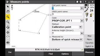
I don't work with Trimble so I need to ask: the difference shown in the video is the software trying to bring the total station shots to grid using or the GNSS shots to ground or because you have made the stake out with GNSS and using -99.999 elevation? I've got a little bit confused in what's going on. I don't know NAD83, but he distortion is not enough to be needed to convert the projected coordinates to PTL before settting out? Thanks
The software is looking at those elevations and creating a slope distance. Think of it as standing on a cliff. Only a few feet away but a long way down. Does that help?
By the way this is not a Trimble issue. This is a surveying issue. Software doesn’t matter.
Rob, did you ever get a chance to try defining your null elevation in Trimble Access? Would be very curious to know if that would circumvent this issue.
Am I just crazy but why wouldn't you put an elevation that is near the project for the calculated points. Also, if you shot the points with GPS, why not use both points for your TS and Backsight?
When I started with GPS back in the day ('94), I was told/trained to put at least an approximate elevation. If you do that then this wouldn't be an issue.
That’s the point of the tutorial. Keep in mind we have new users all the time.
@SurveyingWithRobert I understand that there are always new people out there. It's hard to believe that they didn't get told that on the second or third day.
I enjoy your videos. There have been some very informative videos and I have learned from them. Thats the best part, you have to learn something new everyday.
@@jimletzring1685 I say if you don’t learn something new everyday you must have been sleeping 🤣
@@SurveyingWithRobert Hi Robert. (Bob?) Wanted to ask you about your total station set up procedure. If I staked out 2 or 3 CP’s via GPS and occupied with the TS, my procedure for BLDG layout would be to collect the BS point again with TS. So for instance, if my BS point was 1001, I would setup TS, station set up and then average 2 180 degree rod shots and store as 1002 (or whatever). Then break setup and station set up again with the new BS point. That way I’m holding instrument CP for relative accuracy with a tighter setup but with the advantage of absolute accuracy; hopefully within 0.03’ or so, or whatever is the quality of GPS CP 1000 stake out positioning.
I first used this method to layout structural steel for utility helipads who’s locations were required to be within 0.05’ of design specs. The utility had some crazy regulations they had to follow regarding pads distance from transmission lines and the 10 or so steel structures had a survey tolerance of 0.01’. The LS in charge at my old firm came up with the procedures used on that job. Had to walk gps,TS and staking materials up the side of several mountains, while the client took a chopper, dead middle of summer in the rugged terrain of far east San Diego County. Some jobs you NEVER forget.
Great Info!!! Thanks a ton brother!!
Thank you hope it helps!
Nice, hold one closes to the site. Push error to backsite. Measure/Calc new BS Point
Can you do a video about traversing with the total station? How to do it the correct way , burning of the points etc
@@isaaccasarez4299 been wanting to do that. Wanted to use traverse kits but they are 2k each.
@@SurveyingWithRobert how about a brief summary?
Good morning, I have one quick question. Is it possible to transfer information from one TSC7 to another? Through some form of Bluetooth or over-the-air. Without using a usb stick
Good question. For sure a wireless transfer can be done with DC and your phone, I’ve never tried 2 DC’s.
Yes it is
Wow! That literally just happened to me 4 days ago. I set my stns with a tremble C5, when I went back with my R10 and held the exact points I was out 1.3'
I checked other stns in the area and I was still getting the 1' error. I put away the gps and switched back to the total Station, and guess what.. I was right on the money... 0.002
I was so confused as to what had happened, I wasted about an hour trying to figure out what happened.
Thanks for the video, I normally set my design points to default at 0'
But now I know better... Thanks Robert
This is a great example of why I prefer to use a scale factor only job for Total station work. Things get messy when using the bot in a job with a calibration or a projection.
If you use state plane, you are using a scale factor. This error was based on scale factor.
@@SurveyingWithRobert yes, state plane has a scale factor, but I meant using a job set to scale factor only and setting it to 1.0
I am curious tho if the software still compensates for the horizontal distance if you are setting up on a point with a 0.00 elevation vs a point with a 1000.00 elevation.
I wonder in what condition will the software not do any compensating or adjusting.
@@justinaz282 At 1.0 SF your 1:1 on horizontal distances.
Robert, I have to start by saying how much I enjoy and appreciate your videos, they have taught me many many things. I do have a question to ask to help clear things up in my mind:
-You mention a few times that this is something to watch for when using State Plane Coordinates. Would it be fair to say it is not so much the coordinates to watch for so much as if you are using the SPCS with your GPS equipment to stake out the points? I do not believe I would have this issue if I went out with my Total Station using a scale of 1.000000 and staked the same points, I may not be understanding what you are saying so please correct me if I wrong.
Thanks,
Bryan
You won’t have the problem discussed in this video if you keep your scale to 1.0000
For small construction sites it doesn’t matter. Your method is commonly used by several other surveyors I know.
one of the hardest things to try and teach noobies
What would happen if you didn’t enter your instrument height and backsight height? In other words nulled out the vertical in your station setup?
You have to enter a value for station setup. However, I can’t recall atm if you can enter 0.00 and proceed with the setup.
I'm sitting right now.. having every problem.. data link issues, switched controller, robot, antennas. Now my vertical is out .52'.. I checked everything..
0.52 is the distance between the true height and bottom notch.
@@SurveyingWithRobert Yes your exactly right.I eventually changed that setting in the tablet and it checked much better. Thanks for the response 😀
What's the tape called you used for measuring the IH?
Pocket Rod is what I have always called it. Basically it’s a level rod.
I am a firm believer in keeping your GPS separate from you Total Station. 2 different job files. I always use "scale factor only" for my coordinate system with the scale set to 1.0 when using the robot.
Bad news you’re screwing up. Your GPS and Total station will never tie together. Your on two different scale factors. I really need to get a video out on this. You need to bring your GPS to ground if you want a scale factor of one. Where do you survey. What is your average elevation?
Central Arizona about 1000-2000 ft. Question. In what scenario is it useful to scale your total station measurements?
@@justinaz282 always when using state plane in your case. You want your GPS and TS on the same scale. Keep them both grid or ground but don’t mix or nothing will fit together.
What if you use the "fix scale factor to 1.0" option in the site calibration. Would GPS then match total station? @@SurveyingWithRobert
How can I order That Shirt ?
I have some SWR shirts on my website.
Those errors can cost a lot of money and time
Absolutely!
i like your shirt where to buy it
It a Trimble shirt. Got it from the Trimble store. Thinking about how to give away some shirts.
"This Video is going to be long" lol man, you could be saving me hours by spending 25 minutes. We'll live.
@@anthonyscott4422 ya, this stuff is hard to explain in 5 mins. lol
Don’t survey in the devil’s living room