Getting Started with Model Builder in ArcGIS Pro

HTML-код
- Опубликовано: 3 янв 2024
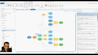
- Do you want to revolutionize your geospatial workflows? In this video, get introduced to ModelBuilder, the ultimate tool for creating and automating geoprocessing models! We will use two geoprocessing tools to build and run a model. This video was recorded with ArcGIS Pro 3.1.2 in July 2023. For further ArcGIS Pro training on ModelBuilder, check out Esri's ArcGIS Pro: Essential Workflows course: go.esri.com/arcgis-pro-course.
Follow #Esri on social:
X: / esri
Instagram: / esrigram
LinkedIn: / esri
Facebook: / esrigis
Website: www.esri.com/  Кино
Кино


Thank you for watching! If you have questions about our products or services, make sure to visit community.esri.com/. Is there a general topic you'd like us to cover in a future video? Let us know in the comments below!
Great video, I'm looking forward to more advanced applications of the Model Builder.
Thank you very much, waiting for the next one on Model Builder.
Important video: How can I obtain the program? Are its tools available within ArcMap? Thank you prof.
Thanks for a straightforward video, with a complete clear message, which is not the case in many ESRI videos.
Clear, concise, and more importantly well articulated! :) Thank you!
why did you chose to not dissolve the buffer output? Do you have a specific reason for that?
In ArcGIS Pro, deciding whether or not to dissolve a buffer around a river when analyzing its distance to an urban area involves considering several factors. Here are some reasons why you might choose not to dissolve the buffer:
1. Preserving Individual Features: If the river has multiple segments that are buffered, not dissolving allows each buffered segment to be analyzed independently. This can be important if different segments have varying levels of impact or relevance to the urban area.
2. Accurate Distance Measurement: Non-dissolved buffers can more accurately represent the actual distance from different points of the urban area to the nearest point on the river. Dissolving would create a single shape, potentially oversimplifying the spatial relationship.
Like 👍
nice video
Yes. That is a good video 👌👏👍