Chartwork Tutorial: Compass Rose
US
Войти
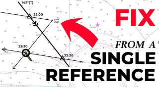
Chartwork Tutorial: Running Fix
4:36
How To Correct Magnetic Compass Bearings
9:18
Navigation - Plotting with Triangles
10:19
The History of Super Mario’s Hidden Ending
51:11
THE AMAZING DIGITAL CIRCUS - Ep 4: Fast Food Masquerade
23:20
BABYMONSTER - 'Love In My Heart' M/V
03:52
Chartwork Tutorial: Compass Rose
Refresh Maritime
Подписаться
57 тыс.
Скачать
Готовим ссылку...
Просмотров 23 тыс.
0
0
Добавить в
Мой плейлист
Посмотреть позже
Поделиться
Поделиться
HTML-код
Размер видео:
1280 X 720
853 X 480
640 X 360
Показать панель управления
Автовоспроизведение
Автоповтор
Опубликовано: 6 янв 2025
Комментарии • 80
Следующие
Автовоспроизведение
4:36
Chartwork Tutorial: Running Fix
Refresh Maritime
Просмотров 25 тыс.
9:18
How To Correct Magnetic Compass Bearings
Refresh Maritime
Просмотров 35 тыс.
10:19
Navigation - Plotting with Triangles
Northeast Maritime Institute
Просмотров 194 тыс.
51:11
The History of Super Mario’s Hidden Ending
Summoning Salt
Просмотров 636 тыс.
23:20
THE AMAZING DIGITAL CIRCUS - Ep 4: Fast Food Masquerade
GLITCH
Просмотров 38 млн
03:52
BABYMONSTER - 'Love In My Heart' M/V
BABYMONSTER
Просмотров 11 млн
01:34
The White Lotus Season 3 | Official Teaser | Max
Max
Просмотров 1,3 млн
6:58
How to use the Portland Porter
Mike Whitehouse
Просмотров 83 тыс.
6:37
Easy Tidal Predictions: The Rule Of Twelfths
Refresh Maritime
Просмотров 11 тыс.
6:05
Chartwork Tutorial: How To Measure Distances On A Nautical Chart
Refresh Maritime
Просмотров 14 тыс.
5:16
Chartwork Tutorial: Course To Steer
Refresh Maritime
Просмотров 55 тыс.
6:23
Ep 36: Navigation: The Magnetic Compass
Carpe Diem Sailing
Просмотров 34 тыс.
8:36
Radar Plotting: Complete The Plot
Refresh Maritime
Просмотров 92 тыс.
5:59
Chartwork Tutorial: Nature Of Seabed
Refresh Maritime
Просмотров 4,2 тыс.
15:09
5 Position Fixing Techniques
Refresh Maritime
Просмотров 119 тыс.
6:39
Why Do Fat Ships Wobble?
Casual Navigation
Просмотров 510 тыс.
00:15
Блогеры поют таба лапка #arinazhulina #табалапка #табалапкавтренде
Arina Zhulina
Просмотров 114 тыс.
00:37
Бабушка всегда спасет #aminkavitaminka #aminokka #memes #аминкавитаминка
Аминка Витаминка
Просмотров 465 тыс.
01:00
БАТЯ И НОВОГОДНИЕ ПРАЗДНИКИ😂#shorts
BATEK_OFFICIAL
Просмотров 754 тыс.
12:13
Мария Захарова, Дюжев и пьяная (путана) Чичерина - этот номер порвал зал
Канал Смеха
Просмотров 540 тыс.
00:54
Surfing on 3.5 Million BBs!
Mark Rober
Просмотров 21 млн
00:32
Cheater vs $1,000 Tight Spam!
DashTime
Просмотров 4,8 млн
00:59
Праздничная закуска из помидоров, моцареллы и руколы с соусом из тунца
Юлия Высоцкая
Просмотров 254 тыс.
01:26
🔥СРОЧНО🔥 Ужасная трагедия в небе над Россией🔥 Спец выпуск Россия сегодня🔥 Россия 24🔥
10 minutes ago
Просмотров 118 тыс.