Cheap Tablet Chartplotter | Sailing Kittiwake - Extra

HTML-код
- Опубликовано: 16 окт 2024
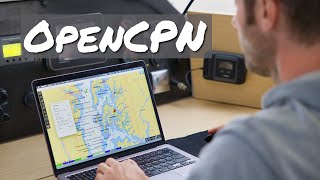
- In Cheap Tablet Chartplotter we talk about our current set-up: a £79 Android tablet, which we've used for navigation from the UK to south Portugal. This is the cheapest way to get yourself a chartplotter, which you can use in conjunction with a laptop (or two!) and paper charts.
SUBSCRIBE for more sailing videos and tips.
**SUPPORT US ON PATREON**
If you like our videos and would like to support our production, we're over at: / sailingkittiwake
**OR BUY US A BEER ON PAYPAL**
paypal.me/ElenaBusinessItaly
*HIRE US**
www.wanderbysa...
We offer services such as copywriting, web design, blogging, and videography.
**OUR BLOG**
If you’d like to find out more about us or Kittiwake, check out our blog: sailingkittiwake.com. In our Sail Cruising Tips section you’ll find some advice on how to set off cruising on the cheap yourself, as well as ideas on how to make money along the way. Let us know if we can help in any way!
**WE’RE ALSO ON**
Facebook: / sailingkittiwake
Instagram: / sailingkittwake
Twitter: / svkittiwake
Follow us for live updates, plus extra videos and pictures.
**CAMERA**
Canon EOS M


![ARGENTINA vs. BOLIVIA [6-0] | RESUMEN | ELIMINATORIAS SUDAMERICANAS | FECHA 10](http://i.ytimg.com/vi/C3wPtKNbAOA/mqdefault.jpg)


I like short videos that give usable information.
Great info, and for me, very timely. I am debating on purchasing a boat that has its original electronics package from 1988. Learning about Open CPN is incredibly helpful. Thank you!!
You’re most welcome Tim. Open CPN also works on a laptop with a GPS “dongle”.
Reading your comment made making this video worthwhile 😊 Fair winds!
I love your videos guys, very entertaining and informative.
I was sad to see you guys not stopping at my home port of Ribadesella in Asturias , very happening town with a marina and safe up the river port, maybe in another time.
Here I'm in Dallas Texas. Watching your videos
Thank you! Unfortunately we can't stop everywhere as we have a seasonal "schedule" - we needed to get further south for the winter. Stay safe in Texas - we hope Marco will disintegrate before it gets to you 😔
Fabulous and informative
Loving the videos guys, keep up the good work. I do a lot of motor yacht deliveries (I'm an engineer) for large British motor yacht manufacturers. I see all manner of different systems used by skippers. Mainly on tablets. By far the best system I've used is Isailor. It uses the Transas charts which is commercial grade acuracy and the charts update free for life. Useful features are X track course plotting so if your tacking up wind you can have little guide lines shown on the chart to keep to. The other plus is if you have it on a cellular tablet and within data signal range it will give you AIS feed via the Internet.
Hi Steve, great info - thanks. I think it’s really worthwhile for delivery skippers as at least you know what you’re getting and can use something you’re familiar with. What internet AIS do you use, and do you find it reliable?
The AIS feed is actually part of the Isailor app, so it gives you the vessel locations but also shows you their course vectors overplayed on the charts so you can plot pending collision risks easily with your own course vectors. Tides are also shown on the overlays. I agree tho it's good to have your own familiar charts to use on deliveries. Often as we deliver boats destined for far reaching places (USA and Far East etc) to containers ships. Often boats plotters are loaded with only USA charts etc. Some don't even have plotters fitted! So it's good to have your own portable charts with you.
I have an old iPad with a GPS puck as my backup. Tablets are fine, so long as you have charts and a back up of some kind, which you stated that you have, so great! The trick to avoiding the overheat shutdown, is to not let the sun hit the glass display directly. My iPad runs just fine in 95F degree temps down in the cabin, but will shut down in 65F degrees out in the cockpit if the sun is beating directly on the display. Cobble up a little sun hood for it.
Thanks for the tip, a sun shade would work great - we've just had a shade made up for the cockpit so hopefully we'll be able to keep the electronics out of the Mediterranean sun this summer!
Thanks diffrent and intresting, when you look at the cost of a sat nav compared to chart plotter (I know waterproof, waypoints, charts ect..) they are expensive but hey the word marine does that. Looking forward to your next update happy crusing.
Cheers Al! It’s always lovely to read your comments 😊
Sailing Kittiwake thanks guys
Enjoy your videos and would really like to see how you provision on a budget, store food with your limited refrigeration and and how you go about preparing and cooking meals
Cheers Stephen! We are planning on doing a video or two about it. Stay tuned 😊In the meantime, here’s what we cook: sailingkittiwake.com/meals-on-a-boat-whats-cooking-in-our-galley/
Our staples are yoghurt, cereal, salad, beans, sprouts, eggs, and vegetables.
Bear in mind that food is our biggest monthly expense, as we like to eat healthy and cook each meal ourselves 😊
we use similar system - only difference is that we use a laptop+portable gps antenna. Open CPn on it - works just fine.
We also do that 😊 we do that inside the cabin so we have 2 systems in use 😊
Great video, is it possible to add AIS overlay?? Possibly from a VHS radio with AIS function,
Thanks
We do that on the laptop via a USB cable and GPS dongle.
You can also get a nice cheap NMEA to WIFI dongle like the Yakker or Yakbak from eBay. Then you can connect with your phone or tablet to the network and AIS data will be overlayed onto OpenCPN. If you connect your AIS and GPS to the device you can save your phone/tablet battery life by not having to use its internal GPS anymore
I use navionics with an external Bluetooth GPS. Works fine! In the begginning i was thinking o using OPENCPN because it has the ability to connect to an AIS. Where did you find charts for Portugal to OpenCPN?
Hi Paulo, good to hear about Navionics - their charts look great and sometimes I double check things on the navionics free chart viewer online for a second source. OpenCPN's AIS facility is great, it's a revelation to see other boats live on the chart, and it had a radar function too. There's a few different sources for charts - best to have a google around on the internet or check the OpenCPN webpage.
As youve sailed in tidal areas, how do you plot a course to steer on a tablet to take into consideration tides? Sadly I'm old school paper charts and trying to move on to navionics
I haven't used Navionics but I don't think it will calculate CTS for you, so I work it out on paper then put the course into the chart plotter to follow. Of course the easy way is to just ignore the currents if the effect is small and monitor your course to check you don't stray too far. This worked for us crossing the Channel from the Scillies to L'Aberwrach just fine.
@@SailingKittiwake That's great thanks for the info. Have a good season
iPads have to be the cellular model as others do not have built in GPS and would need a iOS compatible bluetooth GPS.
I use transas isailor app on iPad and also on android tablet. Its very good and has been 100% reliable also charts are updated free regularly. Once you have the app you can use it on my iPhone as well which is great especially at anchor as the anchor drag alarm will definitely get you attention, and having it on the phone as well gives a good back up if you need to recharge the iPad. I alternate between the two on a longish trip. Will check out the open cpn cheers.
Hi Ian, thanks for the info and good tip on the cellular iPad. I'll check out the isailor app, sounds good. I think OpenSeaMap is another source, they're working on providing depth data but I don't think it's there yet - they do show water distribution points on shore though which is handy for filling up the jerry cans!
Useful video and comments. Can you comment on the battery life while you have the tablet in navigation mode.
Hey Norman, cheers. That will depend on the tablet itself and how you use it. Ours lasts all day during day sails, as we only use it to navigate. However we installed an outside socket for it, so we can plug it in as long as it’s not rainy. It works great on longer passages. We also have a battery unit that we can put inside the waterproof case to charge it. It can charge a phone or tablet to 100% 2.5/3 times. Hope this helps 😊
Sailing Kittiwake Yeah I was after the specifics of your tablet in navigational use only. I use the Navionics app on both iPhone and iPad and when either of those devices is in use for navigation only - I have to recharge them after about six hours .
Norman Boyes ours lasts abouts 6 hours too. It depends on how much we use the screen though. Having a plug for it nearby, we don’t worry too much about battery life.
Love your videos. Very informative.. Thanx ❤
Thanks a lot 😊
Hi, I am in the final stages of building a boat and will be following in your wake soon (hopefully:) What map are you using and does it show depth contours? I downloaded Open CPN a while back but all the raster charts I looked at did not show the depth of water...
Where did you get your uk and spanish opencpn charts. Visitmyhabour?
This is my question also
I can't see how the marine manufacturers can warrant the super high prices for their 10" touchscreen plotters anymore. £1000-£1500 at least. An equivelant tablet is less than £200. Surely adding a waterproof enclosure doesn't cost the difference. Another 'marine' rip off.
True! Our Samsung tablet costed £79 and we simply stick it in an old waterproof map case which we had from our hiking days.
Robustness is one thing they offer. They have built in water proof capability, and most importantly have screens that can be read in the sunlight. So I don't think tablets will take over anytime soon. But if price is an issue then they are great, just get one or two as backups!
I have been using both iPad and android tablets as chart plotters for years now. Navionics on the iPad with an Armor-x waterproof case and bespoke mount and a huge Samsung tablet with Marine Navigator software and charts from Visit My Harbour.com (based in Cowes) which is mounted in its case which is screwed onto a bulkhead. I also feed AIS into this. It is just brilliant. Contact Steve at VMH for great info.. Peter K
Interesting, how are you using gps? Through Bluetooth, wired or built in?
Also what samsung tablet is it?
Any tablet now has built-in GPS. It's an old video, so it's an old tablet not available anymore. It was the cheapest Samsung at the time with GPS and 3GB of RAM.
I'm curious as since a heavenly twins is a small yacht how are you finding it and if you could would you upsize?
Hey Wesley, we love our little boat. It has everything we need - a big galley, a rectangular bed, lots of deck space, a decent heads,... We know it has limitations, but every time we turn back to look at an anchorage, we never see a boat better suited to us. We wouldn’t be able to maintain or moor a bigger boat.
Of course if we were wealthy we’d upgrade - who wouldn’t? 😉 A boat with more headroom that goes a little faster would be nice.
Next Monday’s video will be about why we chose a small cat, advantages and disadvantages 😉
I use Navionics on my smartphone most of the time. Have it on my iPad as backup as well as a couple of old fashioned GPSs as backup. The app has frozen on the phone before - coming into an unfamiliar anchorage which was a bit, erm, annoying! I think perhaps because the phone has lots of other apps and a fullish memory. But I keep the iPad very clean. I'm keen to put OpenCPN on my laptop too. Can't have too many backups. Thanks for the video.
Cheers Paul. Yes, we've heard good things about Navionics. As many backups as possible is great. We have a GPS, paper charts, and 2 laptops with GPS receiver and OpenCPN installed on them. Hehe. Backups!
What about Almanacs? When in tidal areas are you chancing your trips just with highs and lows or have you got digital Almanacs.
Hi The Andrew, we have a paper almanac that we used from the UK to Gibraltar. The Reeds one, it was excellent. Doing something like the Raz de Seine or the entrance to Morbihan first time without one would be too scary for us!
On Sabreon we have a Garmin bottom end chart plotter. An iPad with Navionics. We also use old GPS unit, Garmin, iPad, 3 x phones for lat/long for our paper back ups. We also have a portal power bank which we keep charged, just in case boat electrics fail, meaning we can still use our iPad if coastal for about 3 days of constant use, or the phones for weeks if used purely for GPS fixes. We are looking to get a hand held GPS again as a back up. I've been trying to get the hang of OpenCPN but cannot seem to locate 'free' UK charts?
tablets are great fro running chartplotter, internet, weather info, lots of utilities, tides, anchor watch.... great with a bluetooth keyboard.
But if you run OpenCPN on a cheap old low-power netbook like the eeePC series, you can stick in a 12 quid DVB-T receiver RTL-SDR stick and you get full AIS reception with display and collision warning in OpenCPN. That will work with Windows or linux. opencpn.org/OpenCPN/plugins/rtlsdr.html
Unfortunately this would be tricky on a tablet, because of the need to use the single usb port for power and the OTG cable with the RTL-SDR stick.
also check out a very nice small LINUX distro Navigatrix www.navigatrix.net and the Openplotter project around the Raspberry Pi at www.sailoog.com/openplotter, very promising I think, and dirt cheap :)
Thanks for the tips Gerd! I've heard that the AIS can be broadcast using wifi too, with the NMEA connected to a little wifi transmitter, might work with tablets and laptops etc.
did not know that - does that not assume that you have an AIS identification which means that you have a VHF with AIS already? I do think the Raspberry Pi/Openplotter project is interesting for low power/low budget small boats, as i can work headless and then display on tablets or phones via its own network.
I have done this with stripydog kplex, RPI with a wifi dongle as AP, audio card in the other USB connected to old vhf on channel 88 for ais
Gerd Müller nice tip, I'm designing an RPI based system at the moment running OCPN. Did not know AIS was possible
Hi Ryan, you mentioned you have a backup gps, is it like a garmin gpsmap 60csx?
Hi, we have an ETrex hiking GPS, any battery powered GPS unit that'll give you your co-ordinates will work, and it'll point you to a waypoint so the 60csx would be ideal.
@@SailingKittiwake , thank you, so any gps unit with waypoints will do? I agree with some of the posts that everything with marine in the name, gets a built in premium....
Yep 😊
My Samsung S7 Active has an IP68 rating. But when I do my boat build I am going to add radar/sonar/AIS and will probably buy a fairly pricey setup to make sure it is integrated. Course that plan is 5 years out, so who knows what will be available by then.
five years from now, news headline: The transportation of the ocean's waters to the new floating vacation resort on mars has been successful! Hoorays all around!
cruising may be banned by then. ..........do it sooner
Can you show in a step by step Video how you download a map, how you add it to Android, how you addit it? There are so many Vids on Windows but none on Androidapp.
What's the problem to my Opencpn version? When i open the system it will force close the whole version.
I find android can freeze or crash sometimes. I would have navionics as a backup on tablet. But i am planning on having a low power laptop with opencpn on it as opencpn can also record all nmea data and replay it as well as weather routing and polar file creation.
Anything can crash sometimes :)
seriously though, might be worth checking to make sure you're on the latest version and checking to see what's running. For navigation I'd suggest a device that only runs your navigational software (still way cheaper than anything marine that does the same) and not using the device for anything else. That should solve a lot of the crash problems. I've been strictly android for the last decade and in that time have had 1 device crash on occasion due to a poorly programmed app that was running in the background.
What charts are you using? O-Charts ?
CM93 on the tablet
Hi just wondering how you maintain connectivity to the gps satellites without wifi or cell signal? Or does the gps still pick up the gps? Warren
Hi Warren, the GPS doesn't need a data connection - it's a separate GPS. Most phones have that too.
When a GPS device does not have Internet connection, it needs more time to pick up the gps signal, as it has to map the satellite constellation by itself. With internet connection, then it can use the "assisted gps" function, downloading the satellite constellation from internet (this is why smartphones get gps signal so fast).
Saludos desde Sevilla, España!!! Cheers from Sevilla, Spain!!
Cheers Borja. We don’t have a SIM for the tablet and we never hooked it to a Wi-Fi, but it works perfectly fine without the internet. Once it’s on with the Open CPN app open, it’s all good 😊 if we turn off the screen to conserve battery, it takes a couple of seconds to update our position on the map.
Sailing Kittiwake So I guess I should have known that! I have a couple of different handheld gps that work fine. I guess most Apps on phones/tablets like the cell connection to work right ( like Siri that does not work without cell connection). I'll have to try it out driving around today.
, so is this a use for an older cell phone? Thanks Warren.
warp21drive it really depends on the phone. Check the phone specs on the internet or try an app that uses the GPS with your data turned off.
Has anyone tried out the DIGINAV chartplotter on PC? I have read good feedback about.
Do you happen to know if Android is preferrable to say a windows tablet ?
That is based on your own preference. Open CPN works on Android and not iPads. Not sure if it works on Windows tablets.
Personally I'd say: "yes, it is". Not because of any fanboy thing but because windows wasn't originally designed to run mobile devices. Android and IOS were. That said, if you've got a windows tablet that you'd like, try it. See if the regular windows opencpn install runs on it and if it does, if it runs smoothly enough for you. No need to go out and buy a new tablet if you've got a perfectly good tablet already. (and yes, there is a chance an apple or android fanboy will jump on this and will tell you should buy fanboy's preference because.... fanboy's preference :D )
Hi, Does the tablet have GPS?
Hi Peter - it certainly does. I think most of them do now (except really really cheap ones), but it's definitely worth checking.
I think you have to have a tablet with GPS otherwise will not track your course etc? I have the old Tesco Hudl 2 which works well for the UK via visitmyharbour
You can always add a Bluetooth or USB GPS. I have a 11.5 inch and 7 inch windows tablets that I use a USB, but want to get a Bluetooth GPS unit for it. The iPad does not have built in GPS unless you get one with a cell sim card, but you don't have to have service for the gps to work.
We have a GPS dongle for our laptops too - it’s great 😊
only Chart plotter???? waited a week for this.
Hey Symon, sorry to disappoint you. We post 2 episodes per month, plus some extras here and there.
Each episode takes us 40+ hours to edit, and of course there’s also the time we put into the upload, the copy for the description, and the promotion of it.
Having to work to make a living, as well as filming and sailing or doing boat work, we simply don’t have enough time to release weekly episodes. Sorry 😐 We gotta make money to eat 😁
damn it! more free videos NOW. NOW they say! more free videos! whats wrong with you?! How dare you be skimpy with your free videos! we want scheduled releases and 20 mins of in depth soul wrenching fascination! .... ;) love you guys
I make decisions on you-tube videos whether I become a "Patrons" or not by what I see. And with comments like yours Moby Mory-yoko Its not helping (Sailing Kittiwake)
Of course Symon 😊
Just in case you (or whoever reads) think we’re not good value, we never charge patrons for extras (not even the long ones). We strictly charge for episodes only.
We post a couple of free extras and a couple of blog posts per month, hoping to help other people looking for this sort of information.
That’s the best we can do at the moment 😊
Elena’s been working really hard on her videography skills over Christmas, so hopefully that will show in the new season’s episodes. You’ll be the judge 😉
Falmouth is where *Usain Bolt* is from... Yes random lol
he is from Jamaica
Thats fake news
To be honest, the video that I was watching must have ended and this one began. Best guess... But now its funny. Well I think its funny. Anyway
What were you watching guys?