Это видео недоступно.
Сожалеем об этом.
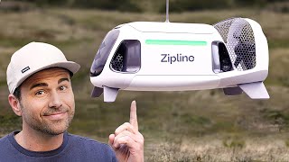
eBee Explained - Planning & Flying A Drone Mapping Mission

HTML-код
- Опубликовано: 23 апр 2015
- In part one of this two-part guide, senseFly's Chris Thomson explains how to assemble our eBee mapping drone, plan its flight, then launch, fly and land. Learn more about the eBee at www.sensefly.c...
Coming soon - In part two, Chris details how to process and use the data that the eBee collects.


Very clear explanation of a great technology.
Excellent video production, too. Whoever produced this video has earnt their fee.
Good stuff!
Great flight demo Chris, well done! Brilliant product too.
I love it :) Great product demo !
does the landing affect the propellers since it is somehow long and the bottom of the drone has no landing pads?
Hi Tony - the answer is no, since they are designed to pivot on making contact with ground, dissipating the impact energy.
Awesome!,,,, best for aerial photograph interpretation for different purposes...i like it.
Another excellent video! :) Thumbs up from me! :)
Does it use stereo jacks to connect the ailerons's servos?
super platform but the launch manouver is scary,nice way to cut of your...
Hello! Thanks for your comment. Since 2009, all our eBees are hand-launched. It's really easy once you try!
so i buy this ebee and i can run my own business? "agricultural drone" i know a couple of farmers that might be interested. but how do i learn more about the software, like how to use. gaining some knowledge about it. i dont need to go to college or anything? i could just advertise my service to people that might be interested????
Great, but what is the next step. How does the captured data come out? Do we need to post-process?
palmak1000 Hi there, that's what part two of this video - coming soon - will explain in full. (In the meantime, you can learn more about data outputs and file formats via the Drone Output Compatibility Guide on this page (scroll down): www.sensefly.com/applications/surveying.html)
Interesting design and simple setup. Dangerous and hazardous during engine on and launch though. Gotta be a better and safer way to launch so someone doesn't accidentally snag the front of someone's clothing or body part. Imagine launching on a much colder day with a big poofy jacket on....or just take the jacket off and tuck in their front shirt or blouse and be cold for a few minutes.
CONSULTATION. AT THE MOMENT OF LANDING THE DRON THERE ARE NO PROBLEMS OF BREAKING THE WINGS OR ANY ACCESSORY?
PLEASE IF YOU SEND ME A QUOTE EQUIPPED FOR TOPOGRAPHY WITH PRICE OF SEND TO PERU
Hello. Wing damage is very rare, due to the shock-absorbent nature of the eBee's construction. For pricing info, please contact your in-country distributor via this page: www.sensefly.com/about/where-to-buy.html Thanks!
Is the map data geo referenced?
Buen vídeo,perdonen que mi comentario sea en español,pero no soy muy bueno escribiendo inglés.Me gustaría saber el precio que tendrá cuando salga,supongo que entre 100 y 200€.
great video - can you map magnetic anomalies?
EvilDick FromTheShacK Not currently, no. (FYI - our full list of available camera payloads is here: www.sensefly.com/drones/accessories.html )
ty - is there a possibility of geo magnetic mapping being added in the future?
also, have you thought about implementing a system for landmine detection?
Great point. A year on, have you examined the possibility of a built in mine-detection capability? That would be a ground-breaking application of this technology.
what software is that? It does not look like mission planner.
nice, but too expensive :( what is it, some ir camera, gps, motor, styrofoam - it should by like 1-2k euro max.
6cm is also to bad for good data in my humble opinion
MrZiemwit I think for the price. I think they should've of made the drone out of carbon fiber lol. Did you see the landing on it. Not good for styrofoam. It will last for like 4months on a daily use. but after you will need to buy more and i can't imagine the price on that lol
Juan Reyes you have milions of materials to choose, this styro is coatet with something and it can be really cheap ang good
***** if you read blogs and forums about self made drones you can find milions people around the world who buil they drones for like 300-1500$, the software can also be open source or buy in saas model
i dont even know if this drone can use RTK gps data for such a price
don't be mad - i thing it is very nice hardware but I can't afford it :( and when i look at the components it look like kickstarter project :)
***** can you say why?
ebee is better or cheaper or easier ?
***** thanks for txt :)
i have seen pix4d - thats a pice of soft
Was this reversed thrust on the final approach?
+David Kaden Yes David - one of the eBee's standard automated features. Ensures a soft landing and accuracy of +/- 5 m.
cong you guys
Great Demo!
Amazing! What is the average hourly price a pilot asks for agriculture data collection.
4000k ;)
ANYONE HERE OWN ONE??? ??????????????????????????
fanny video