Chicago's Lost Freight "L" | The 606 Elevated Rail Path Explained

HTML-код
- Опубликовано: 7 фев 2025
- Go to www.hometitlel... and use promo code itshistory to get a 30-day FREE trial of Triple Lock Protection and a FREE title history report! #hometitlelock #triplelockprotection #titletheft #titlefraud #deedfraud #mortgagefraud #housestealing #preventhousestealing
The 606 Trail, also known as the Bloomingdale Trail, is an innovative urban park and elevated greenway in Chicago that stretches for 2.7 miles along the city’s northwest side. This linear park sits atop the repurposed Bloomingdale Line a former rail viaduct built in the early 1900s to alleviate congestion and increase safety by elevating freight trains above street level.
Originally constructed as part of the Chicago & Pacific Railroad, the Bloomingdale Line served as a bustling corridor for industrial freight, weaving through the neighborhoods of Wicker Park, Bucktown, Logan Square, and Humboldt Park. Over time, as Chicago's industry shifted and rail traffic declined, the line fell into disuse by the late 20th century. The elevated tracks, once a symbol of industrial progress, were left abandoned, overgrown with vegetation, and became a quiet yet looming presence in the urban landscape.
In the early 2000s, community groups and urban planners reimagined the viaduct as a public green space that could connect neighborhoods, provide recreational opportunities, and offer a unique vantage point of the city. The transformation into the **606 Trail**, named after Chicago's area code, was completed in 2015. The project not only preserved a piece of Chicago’s industrial heritage but also gave it a new life as a vibrant public space.
Today, the 606 Trail is a beloved destination for walkers, joggers, bikers, and families, featuring landscaped pathways, art installations, and access points to adjacent parks. It seamlessly blends urban history with modern design, offering a dynamic way to experience Chicago’s neighborhoods while paying homage to its past.
Support us on the Patreon 👉 / ryansocash
Support the Channel by becoming a member 👉 / @itshistory
IT’S HISTORY - Weekly Tales of American Urban Decay as presented by your host Ryan Socash.
• IT'S HISTORY 🔥 Trending
» Subscribe: / @itshistory
» Listen podcasts: ffm.bio/itshis...
» CONTACT
For brands, agencies, and sponsorships: itshistory@thoughtleaders.io
Click here to book a sponsorship with me thoughtleaders.io/reserve/its-history
» CREDIT
Scriptwriter - Brent Mackesey
Editor - Karolina Szwata
Host - Ryan Socash
Music/Sound Design: Dave Daddario
» NOTICE
Some images may be used for illustrative purposes only - always reflecting the accurate time frame and content. Events of factual error / mispronounced word/spelling mistakes - retractions will be published in this section.


![Blox Fruits Dragon Rework Update [Full Stream]](http://i.ytimg.com/vi/EqDAp8udhm0/mqdefault.jpg)


Go to www.hometitlelock.com/itshistory and use promo code itshistory to get a 30-day FREE trial of Triple Lock Protection and a FREE title history report! #hometitlelock #triplelockprotection #titletheft #titlefraud #deedfraud #mortgagefraud #housestealing #preventhousestealing
That laid up bridge on the river bank is actually a vary unique swing bridge.
I worked as a locomotive engineer (Soo Line) a few times in the mid 1990s on the Bloomingdale line (it was a high seniority job, so I worked it "off the board"). One time when we were going up to Peerless Candy to deliver a tank car of corn syrup we came up on a row of new townhomes. Everyone living in these townhomes had their trash container on the tracks (the tracks ran through the street). I slowed down the Soo GP7 locomotive but the conductor on the job said, "keep going, we're bowling for dollars!" We knocked over about 10 plastic containers filled with trash. It was sort of fun to be honest. Best part of it was when we returned, the containers were all back in place for more "bowling for dollars" but at least they were empty.
Awesome!
@@WAL_DC-6B What number was that GP7.
@@eggballo4490 OH, "Heavens to Gimbles" I don't think I have that information anymore. In fact, now that I think about it, that incident may have taken place when I was a student engineer and consequently, I didn't record the engine number for the job. I'm pretty sure the conductor's name was something like Emile and the actual engineer on the job was Pete Crocetti (not sure on that spelling either).
I worked in Lincoln Park in the early 90's, and the highlight of my week was when you guys came to switch out Peerless, in the patch-job Milwaukee Road units.
I'm an engineer for the CP, and we used the Bloomingdale line to switch out cars for the various industries that we'd service until it was closed down.
Ryan, I loved this. Trains, abandoned tracks and neighborhood upgrades are fascinating.
This is great! I love all your videos especially the historic significance with the Chicago railroads.
Is it possible you can do one about the Great Western Trail? It use to be once an old railroad line that went through towns like Berkley, Elmhurst, Villa Park, Lombard, etc.
Keep up the great work!
10:30 That's not a removed bridge lying on the riverbank. It's a swing bridge left in the open position. On Google Maps you can see the curved support at the SE end of it, also visible from Elston Ave streetview.
Thanks for the video!
Old Plank Road Trail was another rail to trail in Chicagoland with the old Michigan Central. Cal-Sag Trail opened the same day as the 606 (and is even cooler!)
Also, you’re not on Instagram so how do I get in contact directly to send you some Chicagoland history links?
The second part of the 606 is in the planning stage. It starts at the east ending point (next to the Kennedy Expressway) and continues to the Chicago River under the expressway. It will use that unused rail bridge.
@@ValMacher and then go where after that. Down Kingsbury avenue. I mean there's really nowhere to go after the 606 ends Right before Ashland avenue.
@@johnb2146 Plans have been pushed back at least a year on the eastward trail extension as of Jan 20, 2025. Original plans were to connect it into the Lincoln Yards development on Goose Island. Your guess is as good as mine how that project pans out or if it even does.
Neat! I remember with the success of the high line in NYC ( another street level rail operation that was elevated for safety reasons then made obsolete by trucks) they planned this and naysayers said it would fail. The high line on nyc led to incredible gentrification of the west side from the west village to the mid 30s, sounds like this did the same thing.
You could probably do a fun video on most/all of the railroad tracks in Chicago being elevated above street level. Fascinating history of city hall shenanigans combined with massive infrastructure projects by every railroad to get it done.
Both the C&P and the CM&StP were known colloquially and popularly as The Milwaukee Road. The ordinance that created the grade separation (elevation) applied to all railroads operating within Chicago city limits. There are only a handful of grade crossings in Chicago, most of which are on Metra's line (former Milwaukee Road) leading west/northwest out of Union Station between Canal and Racine, south of Kinzie. The grade separation ordinance forced the Chicago & North Western (now Union Pacific) railway to elevate a triple track mainline from their Chicago Passenger Terminal (now Oglivie) west to the Des Plaines River, a distance of 10 miles. The railroad had to do the same thing on their North, and Northwest mainlines. An amazing feat of engineering. You should do a video about it.
These tracks did used to go straight to goose island on that swing bridge. Last used in 2018 or so
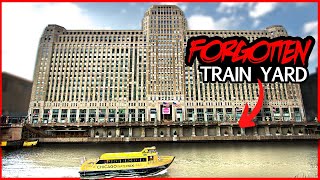
Actually, the Milwaukee Road ran north from Good Island past Wrigley Field and terminated at the Wilson C.T A. station. In what is now a parking lot behind a cemetery there were three tracks with electric overhead lines so that they could interchange mostly coal cars for delivery to the north side. It also ran south from to Merchandise Mart with one of it's biggest customers being Montgomery Wards at Chicago Avenue and the river.
And it kept going, north.
Yeah, that was part of the old Chicago, Evanston, and Lake Superior Railroad that opened in 1885.
I run on this trail every week! Lots of history along the line. The factory at the west end used to make Lincoln Logs, invented by Frank Lloyd Wright's son! Lots of furniture companies too, taking advantage of the rail to get their lumber in. As far as the neighborhood goes, it has caused a lot of gentrification which has its up and downs. There are plans to build similar linear parks from abandoned rails in Kenwood and Englewood.
I lived along the Aurora Elgin line in Villa Park before I moved to Phoenix. The railroad infrastructure was completely completely removed and turned into a bicycle path all the way out to the fox river, and continued up north to Elgin and south to Aurora.
Ryan, you have such a way of finding little GEM's of history that are so overlooked.....
9:06 Hey, there’s my house!
I live near this and its a huge quality of life improvement
At first I thought this was gonna be about how the L transit network used to haul freight. Used to be a connection to the red line that passed right by Wrigley Field.
That was a Milwaukee Road freight line. Never part of the L. Addison Street did have a streetcar for decades though.
@mkmcclure it connected with the l red line
Bro that bridge in 10:35 I found it when I when looking at tracks down from union station and got bored when I found that bridge I was so interested in it but never found anything about it I'm really glad to know more info a little about it thanks I was in high school when I found it and got really interested in abandon rail lines and stuff
Hello and thanks for another good video. At 7:54, the name of the railroad is "Sue Line:. (rather than Sew line. I think that it may trace back to Sault St. Marie in Michigan. .
This is wonderful!!! All the old rail lines should be converted to these type trails 👍👍👍
You can see an active bloomingdale line from honore st in the movie, "call northside 777"
7:30 Dude has some good reflexes.
7:29 Crazy driver. Almost caused an accident. Check your mirrors before pulling out into trafic!
You should do something on the weber spur
Awesome thanks for posting this 👍
Glad you enjoyed it
So what my boss says is that the bridge still works and the city comes to move it every couple of years . Also fun fact the 606 is cleaned by the Chicago Park district but maintained by cristy Weber
Chicago Was a Very interesting place! Thanks Ryan!
Sue Line not So Line
Soo
@@Memphisdoug Or Sew
Its SOO line.
@Dodener Yup SOO Line
How do you not know how to pronounce ‘Soo’….?????
I live directly next to the 606 and always wondered about its history
Thank you Ryan
The Bridge that you mention at the end of the video is a swing bridge. You can still see the semi-circle track of the weight bearing rollers!
My dad work for Chicago Northwestern in Minnesota. There’s a lot of bike trails. Greenway Chicago still has a major problem with getting back back-and-forth but again another good video.
This Trail also caused massive gentrification and displacement, similar trails have been built on the southside that have avoided gentrification by building proper public housing along the alignment
Very interesting🚂
Many thanks!
Thanks for your support 🙏
@@ITSHISTORY You are so welcome💜
Enjoyed my walk there
The rise of the Milwaukee Road❤
I have pictures of this lone from goose Island my dad worked for the Milwaukee road
I was looking at that map, on the West, where it says Freeport, I bought a house 6 miles from there and my house was against a “nature trail” that let to the school. In fact, it was the area where the train entered the town of 500 from where it normally was paralleling the main road.
They actually just removed the foundation slab from the tiny station 2 years ago. It has been in the park this whole time, just a foundation sticking out of a grass field
(This is in Dakota Illinois)
@@RavenFilms Dakota is in between Rockton and Freeport right?
@@davidbrown5525Technically yeah, but it’s only 10 minutes from Freeport and about 40 from Rockton
Quite a few of the bicycle trails that go through Aurora, Illinois are old railroad lines.
Could you do a similar video on St. Louis we have a couple elevated lines that are abandoned
what is going on with that greenway painted bridge over 70 just west of the mckinley bridge? i want my elevated trail 10 years ago.
I think there's some wild elevated lines that used to be Illinois Terminal tracks?
This wasn’t an L. The Humboldt Park L ran parallel to these tracks from about Damen/Milwaukee.
There was also another freight line that came down the North Side Main to the Lakewood branch. This was a Milwaukee Road line.
Very interesting!
Mr. Socash your videos are awsome. Can you make a history video of the New York Susquehanna & Western railroad? They have one of the most interesting histories of any railroad past and present. They are a class 2 railroad that has been around since the late 1800s and are still kicking to this day, only ever reaching class1 credentials for a year or two in between when
the canadian pacific took over the Delaware & Hudson.
Looks like the New york susquehanna & western was formed in 1881 and from the 1930s till 1980s came with extreme hardships but somehow they avoided getting absorbed into conrail. Looks like they ran the Delaware and Hudson railroad from 1988-1991 then Canadian Pacific out bid them and acquired the d&h rr. With all the nys&w extensive history it would make for a long video. Hope ur able to do a video on nys&w sometime, I'm into railroad history and I haven't been able to find any history videos on the nys&w that are even close to the caliber of videos that you make.
I am curious, has Amtrak ever used this particular line between Chicago and Milwaukee?
I vividly remember being on a train ride to Milwaukee as a child and passing an old warehouse that had a moss covered elevated line running adjacent to the line my train was on. Unfortunately, this was before cellphones were so popular and common with teens so I never got a photo...
The Amtrak runs much closer to the lake and runs north/south and the 606 runs east/west. I've taken the Hiawatha ride probably 50 times by now and it's a really cool look at the backside of Chicago and Milwaukee. I've also done boat tours on both, Chicago has an architectural focused boat tour that's really good too.
Amtrak uses the former Milwaukee Road line that runs north-south at the western terminus of the 606. This location is Tower A-5 or Pacific Junction. Onllake. rival C&NW ran closer to the lake.
Tremendous!
I love all these Chicago history videos you make, but I'm disappointed about the use of AI for some photos.
@@madduxsmith382 waaaa waaaaa 😩
I just noticed it at 3:30... Creepy.
That bothered me too. At first I thought the faces were just blurred out until I noticed other things were off. Ai has its place, but when it's used to depict historical events, it can be a bit deceptive. Almost like rewriting history.
Metra used to store ballast cars on the end of the line. I always liked hanging on this trail. I lived just a block away during the summer of 2012. We would have parties up there at night and you would see very posh looking ladies running along the tracks during the day.
Great video!
Yeah, I live in the neighborhood. It's been great for developers. Driven up property values/taxes a lot. The trail is overcrowded and somewhat chaotic at peak times. Bikes, strollers, joggers, walkers, scooters. It's as wide as a decent sized two lane bike trail so I think you can imagine what it's like. I preferred the abandoned tracks and heroin needles, personally.
The trail is crowded because it's a good idea but demand is exceeding supply. If we had more dedicated foot/bike paths through the city this wouldn't be as congested.
Excellent video. Keep up the good work. Any more plans for San Francisco? One possibility would be the Presidio of San Francisco. It is a very interesting place portions of the land are managed by the National Park Service. Other portions are administered by the Presidio Trust.
The video actually begins at 2:53
If you would like a railroad historian to assist in your next project let me know. U of C dissertation was "The Transformation of Metropolitan Chicago's Railway Pattern 1957-1986."
Its Soo as in SUE not So line
Please do the battle of chestnut
battle of deeznut
To Tower A-5.
Soo Line
60617 💯
Forget the elevated !
Look into the inground fright railroad downtown .
West Town Chicago is BEST Town!
😊❤👍
🙏
its a shame we allowed freight to go on trucks. too many trucks on the road these days.
They’ve torn up the hell out of the freeways and streets of the LA region.
the real reason why they dont sell sedans - suspension no longer adequate to ride out the warranty period with todays infrastructure.
@@hardraysi never really thought about it like that 🤔
Gentrification
scammy sponsor colors otherwise decent content
walking threw murder town no thanks ( unless you are paul kersey
Ayo stay in school ya bum
@@JonathanDoe777 You should follow suit, your vocab is abysmal.
This trail is actually really popular. It's full of people every day I ride it, and it's very clean.