Hi Lebogang, check your coordinate projection system (you can use the world coordinate converter to chck). you might have to swap the x and the y on your csv file or make the one coordinate negative and the other one positive. that should solve your problem


Great one there….
Hope to learn more from you
Very clear and straight forward
Precise & clear, thanks!
Nice one and useful 👍🏻
Great.., keep it up...
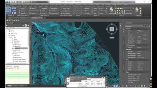
Hey the surveyor sent me a dwg and csv file of the survey. I followed the video but the dwg and surface are far apart. What could be the problem?
Hi Lebogang, check your coordinate projection system (you can use the world coordinate converter to chck). you might have to swap the x and the y on your csv file or make the one coordinate negative and the other one positive. that should solve your problem
@@c3dtutor349 Thank you. this is helpful
Great 👍👍
Nice one. Thanks alot. 😊
didnt show us how to setup exel (CSV)
studio.ruclips.net/user/videoCrX1oICyDbU/edit