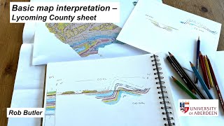
Analysing folds on a geological map

HTML-код
- Опубликовано: 7 фев 2025
- Part of The Shear Zone Channel. The video goes through the analysis of folds on a hypothetical (though realistic) geological map, starting by visualising topography and sketching a cross-section. This in turn informs identification of fold hinges on the map - tracing out hinge lines. It then goes on to construct fold axial traces. The map is available on associated The Shear Zone website.


This was so helpful for my geologic mapping class! I really didn't understand what to look for when telling apart topographic contours and fold patterns but this made it so much more clear!
Great - glad it's making sense for you. Folds on maps are fun...
Thanks for the great video, Rob! Will these maps and previous exercises be available on your website?
Thanks for asking - the map exercises are up there now.
Hi Rob, Could you activate subtitles? I m spanishspeaker😊
Will do - but I'll do it manually as commonly the voice-recognition tools generate silly things! But it won't be soon as I'm off in the field shortly.. Thanks for the suggestion!