Spotlight on Innovation with Bradley Meyers and Team

HTML-код
- Опубликовано: 4 окт 2024
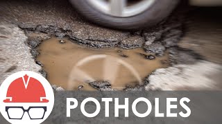
- The problem at hand was to quickly and efficiently take inventory of Region 4's road conditions, particularly potholes. The GIS Potholes Field Map & GeoHub Layer innovation allows known and new pothole information to be easily captured, stored, and shared in CDOT's GeoHub (online GIS system).