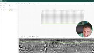
The latest version of Geolitix automatically understands if your project has GPS or not. So, when you import your data with parallel lines every 50 cm, Geolitix will understand that there is no GPS and you may need to define the pattern under positioning. If you are using a modern GPR which saves the original grid geometry, Geolitix will read that in and you won’t need to manually define the parameters.


Thanks so much.
That was great.
Sir, lets say the GPR scan were collected parallel line with 0.5m interval and without GPS coordinate, which pattern position should I use?
The latest version of Geolitix automatically understands if your project has GPS or not. So, when you import your data with parallel lines every 50 cm, Geolitix will understand that there is no GPS and you may need to define the pattern under positioning. If you are using a modern GPR which saves the original grid geometry, Geolitix will read that in and you won’t need to manually define the parameters.