
- Видео 17
- Просмотров 14 538
Geolitix
Канада
Добавлен 28 сен 2020
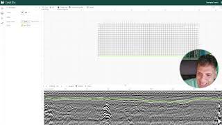
Geolitix is a cloud-based platform for the analysis of near-surface geophysical datasets which harnesses the power of clustered computing to enable rapid, accurate data delivery for projects of any size. Initially focussing on GPR datasets, Geolitix is a continually-evolving platform which allows new insights into the subsurface.
GPR users can drag-and-drop large datasets from any GPR instrument using any computer or tablet into a Geolitix workspace. Teams and stakeholders can collaborate in real time from acquisition through analysis and data sharing, well beyond what would be possible with simple images and PDF files. All Geolitix projects are securely stored in the cloud, eliminating the risk of data loss.
GPR users can drag-and-drop large datasets from any GPR instrument using any computer or tablet into a Geolitix workspace. Teams and stakeholders can collaborate in real time from acquisition through analysis and data sharing, well beyond what would be possible with simple images and PDF files. All Geolitix projects are securely stored in the cloud, eliminating the risk of data loss.
Видео

GPR Processing for Geological Mapping
Просмотров 1,1 тыс.Год назад
GPR Processing for Geological Mapping

GPR Processing for Rebar and Bridge Deck Assessment
Просмотров 462Год назад
GPR Processing for Rebar and Bridge Deck Assessment

GPR Processing for Utilities Mapping
Просмотров 1,1 тыс.Год назад
GPR Processing for Utilities Mapping

How to process IDS GPR data in Geolitix
Просмотров 1,5 тыс.Год назад
How to process IDS GPR data in Geolitix

Depth Grid | Geolitix How-to
Просмотров 3482 года назад
Geolitix makes creating surfaces from GPR data easy 👏 One example of when a depth grid is required is for a bathymetric survey. In this how-to video we demonstrate the process of creating a depth grid mapped to a lake bottom collected during a GPR bathymetric survey. For all our how-to support videos check out the playlist: Sign up for a free account today at www.geolitix.com

Flatten to Horizon | Geolitix How-to
Просмотров 2422 года назад
Learn how to flatten an irregular horizon in Geolitix. For example, in some situations (specifically, drone GPR and other air launched antennas), variations of the antenna height above the ground need to be accounted for. This is not a simple time zero correction along a first break. With our new function, you can use the automatic horizon picker to define the ground surface and then flatten th...

GPS Offset and Latency Correction | Geolitix How-to
Просмотров 3232 года назад
Learn how to correct GNSS latency and GPS offset in Geolitix. Regardless of how accurate your GNSS is, coupling it to a radar brings many possible sources of errors which are rarely mentioned. Aside from the physical offset between the GPS and the GPR, all GNSS receivers (including those at 10 Hz) have a variable latency (time delay), which will result in inaccurate survey outcomes if left unco...

Notch Filter | Geolitix How-to
Просмотров 2122 года назад
Learn how to use the notch filter in Geolitix. Book your free demo at www.geolitix.com
Gaining Data | Geolitix How-to
Просмотров 3232 года назад
Learn how to gain data in Geolitix. Book your free demo at www.geolitix.com
Background Subtraction | Geolitix How-to
Просмотров 2822 года назад
Learn how to use the background subtraction filter in Geolitix. Book your free demo at www.geolitix.com
Estimate Velocity | Geolitix How-to
Просмотров 2442 года назад
Learn how to use estimate project velocity in Geolitix. Book your free demo at www.geolitix.com
Geolitix 102 - Integrating GPS with GPR
Просмотров 8183 года назад
Geolitix 102 - Integrating GPS with GPR
Geolitix 101 - Introduction to GPR Processing
Просмотров 3,5 тыс.3 года назад
Geolitix 101 - Introduction to GPR Processing
Would like to see more videos of you in the future. Thank you!
Thanks very helpful hope to use it soon
Hi, can you share the data used on this webinar. Its better to follow your move in Realtime
Unfortunately, we can’t share the raw data used in this video since it comes from a user who gave us permission to use the files for the video. If you would like to learn more about Geolitix’s features and capabilities, please feel free to explore the rest of our RUclips videos or visit geolitix.com
Sir, lets say the GPR scan were collected parallel line with 0.5m interval and without GPS coordinate, which pattern position should I use?
The latest version of Geolitix automatically understands if your project has GPS or not. So, when you import your data with parallel lines every 50 cm, Geolitix will understand that there is no GPS and you may need to define the pattern under positioning. If you are using a modern GPR which saves the original grid geometry, Geolitix will read that in and you won’t need to manually define the parameters.
Thanks so much.
Thanks so much for video
Yes!
Hi ..when it is required to DC shift removal and will it be befor e time zero correction or after
DC Shift isn’t usually needed with modern GPR systems. It was more commonly used with analogue instruments. If it was needed, usually it would be performed after time zero correction.
So the green color in 3d model generated is based on line u traces it before?
Yes, and it can be exported in many formats, including Shapefiles, DXF and CSV files. Or, you can use those interpretations to create a depth surface, which itself can be exported as a 3D DXF surface, or a Surfer GRD file.
That was great.
Really Useful - thanks Jan! This processing flow also works pretty well for IDS Stream C data in Geolitix. The dewow is a key step!
The Geolitix platform is clearly very powerful! Thank you for demonstrating some of the new features
free soft ?
I have a few comments on lag and latency corrections. The first correction should always be a lag correction that is a distance based correction. The lag correction is based on the distance between the center of the GPS (or more correctly GNSS). The latency correction is a time based correction that corrects for the time difference between the GNSS receiver determining a location and the GPR saving that position with the GPR data. There really isn't an advantage of the GNSS receiver outputting positions faster than 1 Hz since the satellites are only sending data out at 1 Hz. Any output rate faster than 1 Hz is an extrapolation where the receiver might be from previous data. There is value in higher output rates if the GNSS system also includes a high quality inertial navigation system, but those quite often cost more than the GNSS receiver.