Using Google Earth Images in QGIS

Поделиться
HTML-код
  • Опубликовано: 18 мар 2023
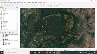
  • This video shows several ways to get Google Earth images into QGIS, with a focus on using base maps to create high-resolution images that can be easily georeferenced. Several base map options are discussed with examples of each method.
  • ХоббиХобби

Комментарии • 3

  • @stuarthedley5576
    @stuarthedley5576 Год назад +2

    Just starting out with QGIS as a digital non-native. This up-to-date guide to using GoogleEarth for basemaps is superior to the others because it's concise and clear and explains the alternatives. I also liked that it explicitly reassured on georeferencing. Others don't. Thanks, Jess.

  • @theideamechanic
    @theideamechanic 6 месяцев назад

    Just getting into GIS and new to using QGIS. Excellent video: clear instructions, great information. Thanks Map Guy! (ps hello from Fuquay-Varina, NC)

  • @revydmat
    @revydmat 9 месяцев назад +3

    Is there a way to select a historical map from Google Earth basemap in QGIS.