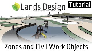
Lands Design Tutorial 02: Terrain Modeling Tools

HTML-код
- Опубликовано: 15 июл 2024
- This tutorial shows the main tools to create, edit, and work with terrains with Lands Design.
0:00 Introduction
0:51 Scan and import terrains from the web
6:02 Terrain from a DEM file
8:02 Create a new terrain
14:42 Pick boundary
18:11 Add contour
19:29 Add hole
21:48 Add cut and fill
24:22 Add path
29:35 Add division
31:11 List terrain information
Lands Design is a professional software product with BIM technology for designing gardens and green spaces in Rhino and AutoCAD
More information: www.landsdesign.com/
Download Lands Design: www.landsdesign.com/download/
Contact support: landsdesign@asuni.com  Наука
Наука


HI thanks
The Plugin seems to have useful features..
So i am researching in ways to improve imported Terrains for rather big Architectural Cityplans. this said, i try to import Terrains from China, which are Du to the bad online Datas in many cases not good enough. I am no Rhino user. But what i would like to know are two things..
is it possible to also manipulate the imported Meshmoddel in an easy way? In 3DS Max, i would just use a Brushtool, that moves the surface, using a selection falloff.
There seemed to be something compareable in Rhino too... SoftMove... But i cant get it to work
But more important. When i try to manipulate for example "Hills" that the Nasa Scann of the terrain accidentially created in China, because its Radar thought a highrise Building was a Hill.. I can use your Terrain and can get those.. hmm what was it called in Rhino.. Points.. i can manipulate one after the other..
But this is very inconvenient.. what i would like to do is to select a point or several points on your terrain and move them up and down, using some sort of Softselection (so caled in 3DS Max) comparable as it seems to be done using SoftMove.. does this work also on your Terrainobject.. just to be able to manipulate bigger arreas of the terrain in a faster way but to push single points?
That would be great...
Hi, You can modify the imported terrain, if when you import it, select the terrain, not mesh. This is an option in import terrain dialogue box. Once terrain is imported or generated by contour lines, you can select several point all at the same time and move them or indicate them an elevation. In Rhino, show control points helps you to do that. There is a nice option also, called add contour, and what it does is to create a new contour so that all points you desire, will be placed there. If you have more questions, please write us to landsdesign@asuni.com
I have few question, I commented on previous video too. How well can it deal with several excavation works in same place? one on top of another and another etc. Also we would often get roads in their proposed heights of their boundaries, its very important that the road and the landscape meets those boundaries without holes. Roads are not always the same width and often have odd turns (Construction site). How well this plugin can deal with those problems? Instead of just using typical central line and offsetting it in same width.
Also when you do the excavation work, is it possible to keep the land that was cut out?
Hi TheMartsy, the lands terrain stores all the operations you apply on it in the Terrain properties panel > Input Data tab. There you can change the order of these operations from the arrows below (next to the "Remove" button). The resolution of the terrain operation with the boundaries and its accuracy with the provided curve will depend on the terrain cell size. Take into account that terrains are meshes, so it might not be always possible to get sharp edges where a terrain cut or fill ends. Unfortunately, it is not possible to have paths with a variety of widths. It's a planned feature on our wish list though for future versions. Alternatively, you can use different curves for each segment of a path or turn on a terrain that has different widths, although it might be difficult to make each part connect nicely with another.
@@Martsycreatives0901 that's not possible, unless you work on a Grasshopper script for that. The terrain knows the volume of that land that was cut out though, and report it in terrain lists. But it's not visible as a 3D geometry. Using Grasshopper you could keep a copy of the original terrain and the one after an operation, and generate the 3D of the resulting geometry.
Hi, my terrain does not seem to properly be responding to curves or points: When making a hole exactly like in the video, it does make a hole. However, firstly, the subdivision is placed much lower than the curve itself! Secondly, when moving the curve up or down, or the control points to the side, the terrain does not follow!
More over, I can add points, and when moving them, the terrain does as well. However, for some reason, I cannot delete the grip!
Hi Signe, please send us the model to landsdesign@asuni.com so we can better understand the kind of error you are getting. Take into account that when you create holes (or do other operations) on terrains, the selected curve for the hole boundary is not linked to the terrain anymore, so the terrain doesn't react if you move, delete or edit the grip points of that curve. The terrain absorves the control points of that curve, so you can edit them if you activate the terrain control points. These grip points can't be deleted individually. You can delete the "Hole" operation, from the Lands Edit panel > Input data tab, selecting the Hole in the list, and clicking on the Remove button.
Where you had the path as a separate element. Can you bring that into revit as a separate topo surface?
Yes, there are 2 paths in Lands. Path in terrain and path tool which creates with a profile and is a separate element (a surface/ mesh). In the path in terrain case, you can do that by Rhino inside Revit plugin all terrains of Lands Design can open in Revit and be edited later.
When importing a DEM, is there a way to apply the imagery texture similar to the satellite selection option?
Rather than just producing a 'clay' terrain from DEM.
Hi Ryan, Yes you can assign a texture to the terrain object, from its "Material" tab. You will see a button to choose a texture, and you may need to scale it so it fits with the terrain mesh.
Not yet, but this is planned for a near future
When I'm importing the terrain mesh from the Earth elevation data I can't seem to find a way to get the texture mesh (The picture from the earth selection) to follow. Render mode is on but it's still showing. What am I doing wrong?
Hi Emma, make sure you are choosing the mesh and not the terrain option when you when running the laEarthScan command. Terrains are genterated with no texture, while meshes should get the photomap texture. If that is still not working for you, please send us the model to landsdesign@asuni.com with a screenshot of the area you are scanning, and we will take a closer look.
Hi, so I am relatively new to LandsDesign and I have been trying to import the scanned terrain onto my rhino after many attempts. I have read a lot of forums and watched a lot of videos but my problem don’t seem to be solved. I selected an area in which I wanted to import after going into the “Import Earth’s Elevation data” interface and clicked import. But the interface has stayed frozen for quite a while and so I thought it was just running and I left it to run. But after a couple of hours, it still stayed on the same interface. So I uninstalled Lands and reinstalled it but the problem doesn’t seemed to be solved at all. Please help out, thank you
Hi Grayson, it is possible that your internet connection makes the issue. To import elevation data, you need to have a good internet connection. Also, check the size of the project if is so large. In any case, if you are in 2D (especially in a view like wireframe) you won't see the terrain well. Finally, try to import another zone, and check the Lands Design edit panel to be in 3D, and let us know if the problem persists.
THX! there is one question, how to join two terrains together? like i have a 1:100 model which is more precise, how to put it in a 1:1000 larger scale model and combine them together?
Hi, are they meshes? You may place a mesh on top of the larger terrain and then make a boolean with boolean union command in Rhino.
Hi, you can put small one over another and make boolean for both objects.
Please send us the file you found the issue to: landsdesign@asuni.com
Thx! Can we modelling subsurface geology in Rhino? How do you think is it real?
If you have the point cloud or any other format that you can use for generating a terrain, you can create it with Lands Design. You can generate different layers on top of each other.
@@RhinoLands Then will we have as a result surfaces? And if we want to generate a solid btw two surfaces, is it possible? I saw a video where someone supposed to make a solid from 3d mesh, but he didn't) I was frustrated)
@@user-et2in4ib4k Hi, can you send us a picture of what you are trying to achieve to landsdesign@asuni.com?
Hello, thank you very much for your video, I have a question. When I export the terrain from the web, it doesn't show up with the slopes, it appears all flat. How do I change that?
HI, please send us the 3dm file of imported area to explore the issue. landsdesign@asuni.com
Will Lands Design be available for Rhino 8 (WIP/BETA)? Is there a WIP list I can join?
Yes Lands will be working on top of Rhino 8, too. Thanks for your interest. We'll answer you by email.
As for the add path command; what if there are a network of trails that split off and/or wrap back around? Is there a way to make these one path?
26:52 I'm trying to create a road but as I select the terrain the other commands don't come out as in the video. is it possible that the command doesn't work since it's a mesh?
Hi @danielea5773, Lands terrains are meshes, so that should not be a problem. Can you send us an email to landsdesign@asuni.com explaining in more detail the problems you are having? Please share any 3dm files or screenshots that can be helpful. Thanks!
Hi, how could I resolve the elevation data missing?
when I import terrain using 'import Earth Elevation Data', occur "elevation Data missing."
Hi Freud, it looks like the data for the requested area is missing or the download failed. Can you indicate us the location you are importing (aproximate long lat values). Or send a screenshot of the Earth Import window to landsdesign@asuni.com
Hi Freud, If you could tell us which area you are trying to import, that would help us. We just need you to pass us a file which contains the terrain importer settings.
You can find the file at: C:\Users\Public\Documents\Lands\Terrain Importer Settings\
And the file name is: EarthElevationImportData.json Please send it to: landsdesign@asuni.com
Hi, Path and Area are written as 0 in Terrain List. Can you tell me what the problem is? Please help me. Thank you.
Hi HJ P, please send the file to landsdesign@asuni.com and we will check why you are getting this error.
How small of an area can you import from the web?
There is no limit.
Hola, estoy diseñando una terraza y me surgieron algunas dudas, ¿podrían explicar la diferencia entre generar un terreno y una superficie, ventajas, desventajas, posibilidades y limitaciones de cada una, gracias!
Si necesitas hacer operaciones al suelo, como por ejemplo hacer una zona plana, un pendiente, etc. necesitas un terreno y aplicar herramientas de terreno. Si no, simplemente tienes un superficie donde quieres meter plantas y objetos, entonces tener un superficie es suficiente.
@@RhinoLands ¿se supone que debería tener un sólo terreno por archivo o puedo tener varios separados por superficies?
En algunos casos puedo hacerlo, pero cuándo hago un terreno a partir de curvas de nivel, no entiendo el comportamiento del programa, ya que al momento de intentar generar otro no hace nada...
@@diegomfontana puedes tener y generar varios terrenos. Fíjate si tienes las capa invisible, o bloqueada. De todas formas, si nos envias el archivo lo miramos e intentamos reproducir el error. Envianos al landsdesign@asuni.com
Hello, I cant seem to edit terrain in Rhino no matter how many times I import it. I have also tried to edit the mesh and nothing happens. Kindly advise
Hi Vanessa, could you send us the 3dm file to landsdesign@asuni.com? that way we can better figure out what's happening and help you.
at the moment of importing terrain, please be sure that you tick the terrain rather than mesh. If it imports terrain, you can do earthmobing operation. But it is not possible on the mesh in a straightforward way.
after I insterted the terrain on my contour lines, it just shows as brown block without any terrain to it...
also, this is basically ASMR...
Hi E W. Are you creating the terrain from the contour lines? then the result should be the terrain itself. If you select it you should be able to edit it from the Lands Edit Panel. Please write us to landsdesign@asuni.com to discuss this further, just in case you get something different.
Please make it possible to import the entire DEM without needing to select an area. The way the import DEM window works, it makes it impossibly to select corner to corner. For example, if my DEM is 1000x1000, it always a few rows in the bottom unselected (1000x995 for example).
Hi Primoz, thanks for the suggestion. If you double-click on the image, you will automatically select the whole area. In any case, we will try to improve this dialog so it's more clear to do the area selection.
@@RhinoLands Thanks for the tip, very helpful. Letting the user specify a fixed resolution (eg. 500x500) and a center point of the region would also be helpful. There are other ways of doing this, for example photoshop or QGIS, but since the DEM importer gives you the possibility of choosing a region in Rhino, it would be nice if there was more control.
@@pbrglez all right! we take note of your suggestions to improve this tool.
I have one problem, when I click on the import earth's elvevation data white window appears, but the map does not appear
Hi, If you have Windows 11, without any more info, we guess the issue comes from Windows 11 permissions.
We have seen similar issues with other users having Windows 11.
Please check if you have a “Lands” folder created in the following path:
C:\Users\Public\Documents
If not, then you might have restricted the permissions on that folder (we think Windows 11 has something to do with it). To solve it, can you try the following?
Right-click on the “Documents publics” folder and select Properties.
In the Security Tab press on the Modify… button. In the new dialog, press on “Add…”
Here, type your windows username, to add permissions only for that user. Use the verify name option to help you find the user exact name.
Once you have added your user to the list, enable for it the Total control checkbox. Press OK to apply the changes.
Hi, when I click import DEM, I do not have a file to import. Where do I get this tiff. File from?
This is a program function for those who want to convert their DEM file to a 3D terrain. If you need a DEM file for your project, you can look for it by searching in local/national geographic organizations' website.
hola, cómo se generaría un estanque o piscina?, hay alguna herramienta para representar agua?
Gracias
Hola, tienes que generar geometría (superficie de estanque) tanto por crear un hole en el terreno o por crear un poli superficie de Rhino. Para agua, creas un superficie plano, y le asignas material de agua, desde panel de material de Rhino.
@@RhinoLands Perfecto, es lo que venia haciendo, tal vez existía otra forma dentro de LandsDesign... Y en el caso de un Deck de madera ¿cuál sería la mejor opción para hacerlo?
@@diegomfontanaDECK: hacer un superficie, dar extrude para levantarlo y asignar material de madera. Luego, para obtener area, lo haces con zonify.
Whener I add a path it ends up with sharp angles, it's never curvy, even though the line I selected is a curve. What do I do?
Have you tried to increase the smoothness, by moving the corresponding slider to the right? This slider appears in the Lands Edit Panel when you select the path object. I'm assuming you mean a Path object, not a path as a terrain earthmoving.
@@RhinoLands Yes, the path object, as in the video. Thanks a lot!
@@comment514 Ok. Therefore, increase the smoothness, by moving the corresponding slider to the right. This slider appears in the Lands Edit Panel
UNABLE TO IMPORT ELEVATED EARTH DATA (TAB NOT OPENING) WHAT TO DO PLS GUIDE
this is an issue with older version of Lands Design and Windows 11. Update your Lands Design, install the last version form the web and the issue will be fixed.
Can you share us the practice files?
please write to landsdesign@asuni.com
Hello. Tell me did you get the practice file?
@@RhinoLands Hello, tell me what you need to specify in the letter to get a file for practice?
@@lexlex497 your email address. We just received it.
@@RhinoLands Thank you very much. We have already received your file and are undergoing training
Road function is not professional. It can not adjust road vertical curve precisily, it can not modelling road structure layers through defining the section of road.
For that issue, you can apply path tool, in hardscape objects of Lands Design toolbar. Watch the next tutorial about hardscape please.