Resection / Land Navigation Techniques

HTML-код
- Опубликовано: 1 окт 2024
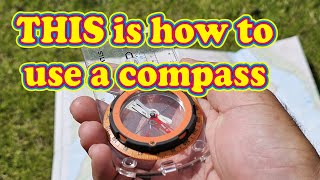
- How to determine your location when it’s unknown using natural or man made features you can identify on the map. Resection is a navigational tool that when used properly can aid in determining your exact location.
 Развлечения


This is so much more concise and clear than 99% of land nav tutorials. Thank you for producing this.
The full video of this was clear and concise training, just brilliant. Thanks for this reminder.
bro are you serious?
@@persaud881 stoker is right on!
Strokermatik makesssome of the best land nav vids, im not great at it but i understand your breakdowns better than any other channel thank you
Thought that island looked familiar then I saw the map. Solo Point is an awesome ruck and run location. Excellent video! You squeezed a topic many struggle with into an easy and comprehensible short video. Weep done!.
You have one of the best channels! Thanks for all you do.
Thanks!
As a former 2nd Lieutenant I can positively identify that I will still get lost and need First Sergeant to come get me.
When sighting with a lensatic compass, make sure the wire is vertical. This is also what the manual of your compass says. You're making your life hard by closing the cap in such a manner.
My thought exactly. Wonder why he lowers the sight window so far. It also shortens your sight radius which doesn’t help with accuracy.
Im lost in the woods cuz i suck at maths 😪
Hey 1SG when is your next land navigation course, and where?
Will have one scheduled for either August or September. Will be in Blairsville GA.
Not taught at school, true, but if taught this way it would be easily forgotten. If school trained people to actually get intuition about angles, trigonometry, Pythagoras'... This procedure wouldn't need to be published . So yes, study hard to get understanding of the basics!
Good stuff. Brother this is such an important lesson to learn for people
Ugh there is math involved 🤦♂️ I guess that's why it wasn't completely working for me.
Good video. Where can I get a grid map for my area?
Find, Buy, and Print Your Own Topo Maps
ruclips.net/video/P7WtkMvLHio/видео.html
You don’t even need the second bearing, you can see where that line intersects the shoreline, and that is where you are, it is more accurate to get a second bearing. That same principle applies to trails, power lines, and creeks. If you can identify what trail you are on, you only need one bearing.
This is exactly the kind of thing I want to learn this is awesome stuff! Thanks stokermatic!
Hey Stoke!
Great Video like always! I see this is a JBLM Map. Do you recommend any websites or companies that can produce topographical maps of an area of my choosing?
Find, Buy, and Print Your Own Topo Maps
ruclips.net/video/P7WtkMvLHio/видео.html
Terrific info Top!
thankyou so much! now azimuth makes sense to me!
Sensei
Yah compass hamare pass milati hai
damn that s cool
Thanks for the reminder. So converting from magnetic to grid is done by +/- the declination, right?
Based on where you are Floyd. This one lays it out
ruclips.net/video/OOFJW4qm2Qw/видео.html
@@STOKERMATIC , thank you. Watched it. Saved it. 1hundo percent.
use 3 azimuths, no intersection.. you messed up.
3 is better, but 2 works. X marks the spot.
This in Seattle?
Close, chambers Bay Area on JBLM