thanks for the video! but this saved jpeg you cannot run any segmentation models right as it is not 3-band 8 bit image? (as is a requirement for SAM segment anything model for usage in ArcGIS pro for example)
After entering an address on the search bar (left upper corner), and zooming in to "street level", the image looks like "crumpled paper". How do you solve that? Thank you!
Hey, how do I increase the size of the north arrow and scale when I save a picture as high resolution, when I increase the resolution, the size of the north arrow decreases.
Hi you can reduce the north arrow and scale --> Go to Map Option -> select -> Scale, now reduce the scale value from 200 to 40 or any number based on your requirement.


My brother, It's 2020 and really nice to see tutorial like this, reminds me of 2005s tutorial.
Thank you
thanks for the video! but this saved jpeg you cannot run any segmentation models right as it is not 3-band 8 bit image? (as is a requirement for SAM segment anything model for usage in ArcGIS pro for example)
That is correct
Only useful for relatively small areas. Capturing and merging large areas at full resolution is impractical.
Yes
For QGIS, I recommend captures in pieces, then merged.
After entering an address on the search bar (left upper corner), and zooming in to "street level", the image looks like "crumpled paper". How do you solve that? Thank you!
Please increase the image resolution, your problem will be solved.
very useful video. one small doubt, at around 0:38 , you use some shortcut to bring the tilt in the image to 0 and level it, what shortcut is that
Press "R" button to stabilize the image
@@GISMadras oh thank you so much
@@morganyu3391 Welcome
Hey, how do I increase the size of the north arrow and scale when I save a picture as high resolution, when I increase the resolution, the size of the north arrow decreases.
Hi you can reduce the north arrow and scale --> Go to Map Option -> select -> Scale, now reduce the scale value from 200 to 40 or any number based on your requirement.
dear GIS - is there any sound on this video?
No, Mr. Mr.Dominic Naughton
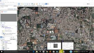
does this images already Georeferenced?
Jalaj Darpan, the image is not georeferenced.
Hello brother, do you know how to turn off the labels in Google Earth Pro ?
Sam, Below Layers --> Primary Database is seen, by clicking in the box you can turn off the labels.
Tanks
Thank you
THANK YOU SO MUCH
Thank you
thanks
thank you
no audio?
Yes
Thank you very much!
useless
Appreciate your comment. In your point of view it may be useless. Any way thanks for your comment.
@@GISMadras Thank you for the video. Humans are deuterostomes and some of them never advance beyond that.
dude, I watched the video, I download Google Earth Pro, I adjust the image and download with high quality, this is not useless to me
I agree - totally useless. I thought he will show how to download a High Res picture map of the entire city but... #IamWithStupid #WasteOfTime