a very informative video. thank you so much. i'm planning my first mission with the m 300 rtk with base station and can't wait to see the results. i know it will be a learning process and i am looking forward to that as well. have a good day.
@frontierprecisionunmanned9194 I learned a lot from my first mission. It wasn’t a complete success. We have however gone on to improve our mission planning because of the first flight. We are still learning of course and are looking forward to more success with this venture. I’m hopeful.
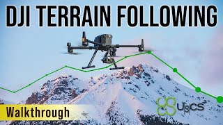
So with the terrain follow do you tend to use this more than UgCS? I'm wondering where you are in terms of a "best practice". While I like having a large screen and a mouse to plan missions, having everything on one controller sure is handy as well. The corridor and facade options on UgCS, course, are different. But just for flying a lawnmower pattern of an area this seems "good enough".
Thanks for your video. I am considering a M3E for roof inspections, essentially mapping at small scale. From your video, it looked like it was not possible to zoom in further on the park than what you did. Is there a zoom limitation in the DJI app? Can you turn on a Google Earth type aerial image in the app? What would happen in the planning app if you didnt have site internet access? Appreciate any feedback you or others may have.
Thas for the video, can you explain what happens, as this is multiple flights right? will it automatically come home, land, hotswap batteries (M350) then proceed with job?
i noticed in the terraine following selection it appears you have added local files? Any tips on that would be great, I've found with oursthere's some weird scaling happening to our DSMs and the surfaces get stretched way out throwing off the elevation data.
@@frontierprecisionunmanned9194 That's what i was afraid your answer was going to be. We've tried 4326, with ellipsoid Z coordinate, without z coordinate, we've exported as a direct copy of the Aster coordinate system and nothing appears to work, unfortunately. Appreciate the response though!
Shoot me an email jeremiah@frontierprecision.com, and remind me to make some DSM import videos. I got a ton on my plate, but Ill do what I can to help.


a very informative video. thank you so much. i'm planning my first mission with the m 300 rtk with base station and can't wait to see
the results. i know it will be a learning process and i am looking forward to that as well. have a good day.
How did that mission go?
@frontierprecisionunmanned9194 I learned a lot from my first mission. It wasn’t a complete success. We have however gone on to improve our mission planning because of the first flight. We are still learning of course and are looking forward to more success with this venture. I’m hopeful.
So with the terrain follow do you tend to use this more than UgCS? I'm wondering where you are in terms of a "best practice". While I like having a large screen and a mouse to plan missions, having everything on one controller sure is handy as well. The corridor and facade options on UgCS, course, are different. But just for flying a lawnmower pattern of an area this seems "good enough".
Thanks for your video. I am considering a M3E for roof inspections, essentially mapping at small scale.
From your video, it looked like it was not possible to zoom in further on the park than what you did. Is there a zoom limitation in the DJI app? Can you turn on a Google Earth type aerial image in the app? What would happen in the planning app if you didnt have site internet access?
Appreciate any feedback you or others may have.
Thas for the video, can you explain what happens, as this is multiple flights right? will it automatically come home, land, hotswap batteries (M350) then proceed with job?
Yes you can hotswap, or power down and power back on and resume the mission.
Thank you so much for the video. Do we have to get an RTK module to use the terrain following mode or it’s not necessary?
Front what I have experienced,it's best to have RTK as it is more accurate, but it still will fly without.
Thank for information
How to setting maximum attitude at front menu?
i noticed in the terraine following selection it appears you have added local files? Any tips on that would be great, I've found with oursthere's some weird scaling happening to our DSMs and the surfaces get stretched way out throwing off the elevation data.
Export your DSM's out in ESPG:4326
@@frontierprecisionunmanned9194 That's what i was afraid your answer was going to be. We've tried 4326, with ellipsoid Z coordinate, without z coordinate, we've exported as a direct copy of the Aster coordinate system and nothing appears to work, unfortunately. Appreciate the response though!
Shoot me an email jeremiah@frontierprecision.com, and remind me to make some DSM import videos. I got a ton on my plate, but Ill do what I can to help.
In linear mission there is no way to upload the DSM
How did you record the dji screen?
on the smart controller, pull down from the top, click the record button.
♥♥💘💘💖💖