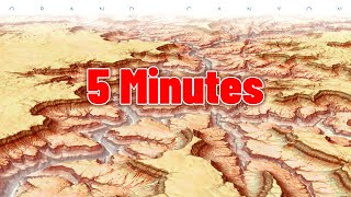
Hey John! Amazing video. Any suggestion on how to make a map similar to 2:08? It would be really cool to stack different layers on a study area like this. With 2 or more map frames.
@@orsonhyuri it's funny i've gotten a lot of questions about that illustration! i use camtasia to edit my videos. this was made by making three separate images and animating them in camtasia.
Great tutorial! Love the clear instructions for making a clean framed layout in ArcGIS Pro. Masking the basemap and adding a subtle graticule inside the oceans gives such a nice polished effect. And linking the map frames keeps everything neatly synchronized. More excellent mapping skills shared as always - thanks!
thank you Stevens family! you are always terribly supportive and thorough in your comments. if i knew your address and phone number i'd send you a Christmas card and send you insightful text messages!
I recall that previous video, and I tried it several times. I just couldn't reproduce the areas spilling over the neatlines. This video has inspired me to revisit the video and try again!
Love, love your maps, John! Your personality is as excellent! I have made the map sandwich, but how to separate (put a gap) between the masked and unmasked frame? I must have missed something in the video as usual lol.
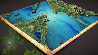
But John, how did you create the perspective view, with three separate layers, at 0.04??? Can ArcPro do that, or did you use some other software program?
Nice! The use of map duplicates and the scene views (?) of your demonstration actually got me thinking, is there a way to build a stacked layered axonometric/isometric diagram within ArcGIS Pro, or would that have to be accomplished by exporting with the Adobe plugin and rotating and vertically separating the layers manually in Illustrator? I am referring to the kind of exploded site analysis often used in urban planning, landarch, or architecture.
thanks! you can do this kind of thing in Pro. here's a video where you can get a sense of using different layers with different vertical offsets. ruclips.net/video/ehJhR3lgjNw/видео.htmlsi=iXwXWJkByxXqgzcg
@@JohnNelsonMaps Thank you! I must have missed this one and frankly, I'm so literal I probably wouldn't have made the connection between the bathymetry application and something like transit routes and urban greenspace. I will check it out!


here is a companion blog post with an introduction and stuff. www.esri.com/arcgis-blog/products/arcgis-pro/mapping/layout-sandwich/
Hey John! Amazing video. Any suggestion on how to make a map similar to 2:08? It would be really cool to stack different layers on a study area like this. With 2 or more map frames.
@@orsonhyuri it's funny i've gotten a lot of questions about that illustration! i use camtasia to edit my videos. this was made by making three separate images and animating them in camtasia.
Whoah! thanks for the swift response John, really appreciated. I will be sure to check that software out. Cheers. @@JohnNelsonMaps
Great video John, always love the endings where we get a brief look around your world.
Thanks Chris!
Great tutorial! Love the clear instructions for making a clean framed layout in ArcGIS Pro. Masking the basemap and adding a subtle graticule inside the oceans gives such a nice polished effect. And linking the map frames keeps everything neatly synchronized. More excellent mapping skills shared as always - thanks!
thank you Stevens family! you are always terribly supportive and thorough in your comments. if i knew your address and phone number i'd send you a Christmas card and send you insightful text messages!
Astounding! It makes so much sense and is so useful.
Glad you think so! I hope you give it a go.
so simple, so effective. i’ll be trying to use this in my work!
fantastic! i'd love to see what you make!
Thanks for the video, John! You're shed/office is way cool.
Thanks!
I recall that previous video, and I tried it several times. I just couldn't reproduce the areas spilling over the neatlines. This video has inspired me to revisit the video and try again!
You can do it!
This is fantastic love your channel
Thanks!
I'm new to your videos. Thank you very much. Great ideas, great explanations... and great ends:
@@osorious thank you! And welcome!
Brilliant, this was exactly what I needed
sweet!
I'm a novice cartography lover. That was great! And,, awesome office.
thanks! and welcome to cartography!
Love, love your maps, John! Your personality is as excellent! I have made the map sandwich, but how to separate (put a gap) between the masked and unmasked frame? I must have missed something in the video as usual lol.
thanks! hmm i'm not sure i understand your question.
Hi there! I would like to ask, if I want to render this effect in pro , should I make another 3d model in the 3d model? Something like a nested feel.
It's a topographical presentation of a Chinese tomb raiding theme, under the sea, tombs, bronze trees, ancient Chinese civilizations and such
sounds cool @@YUZHOUMAOMAOJIAO
i think instead you should use this method: ruclips.net/video/Eecq5D5Y7_E/видео.htmlsi=pBfrXt-UwYs--hI1
Could you please mention the projection of the grids? Thank you in advance 😊
this is a graticule feature that you can activate for any map view in a layout. they are lines of latitude and longitude.
John these short are great! Do you happen to have one creating a custom GDB diagram with floating layers in 3D like you jumped to in this video?
Hmm, no I don’t! But that would be cool.
Is it possible to create this effect and mask out specific states/countries as well?
yes, absolutely
Wow 😍😍😍
thanks!
Nice fade out
thanks!
But John, how did you create the perspective view, with three separate layers, at 0.04??? Can ArcPro do that, or did you use some other software program?
I just did that in the editor (Camtasia) I use for making videos. I exported three separate images from Pro, then animated them in Camtasia
Nice! The use of map duplicates and the scene views (?) of your demonstration actually got me thinking, is there a way to build a stacked layered axonometric/isometric diagram within ArcGIS Pro, or would that have to be accomplished by exporting with the Adobe plugin and rotating and vertically separating the layers manually in Illustrator? I am referring to the kind of exploded site analysis often used in urban planning, landarch, or architecture.
thanks! you can do this kind of thing in Pro. here's a video where you can get a sense of using different layers with different vertical offsets. ruclips.net/video/ehJhR3lgjNw/видео.htmlsi=iXwXWJkByxXqgzcg
@@JohnNelsonMaps Thank you! I must have missed this one and frankly, I'm so literal I probably wouldn't have made the connection between the bathymetry application and something like transit routes and urban greenspace. I will check it out!
@@bluenosesailor cool, good luck! here's a similar one: ruclips.net/video/Eecq5D5Y7_E/видео.htmlsi=wGaa0N8tqlgdQLzS
Cool.
thank you!
Tasty...
snack time!
the gis hut
my work-home next to home-home.