How To Be More Accurate With Chart Plotting Tools

HTML-код
- Опубликовано: 4 июл 2024
- Plotting on a nautical chart demands accuracy if you want to achieve the best results. Whether for a Coast Guard exam or for everyday navigation, being more accurate on a chart pays off. This video shares three tips on how to be more accurate when plotting.
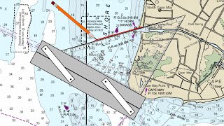
0:10 Tip #1: Don't rely on the compass rose.
3:48 Tip #2: Use the dividers correctly.
6:29 Tip #3: Use the most visible portion of the plotting tools.
8:05 Chart Plotting Course Advertisement ($125, take 50% off with code RUclips).
For more on chart plotting, particularly for plotting on USCG license exams, check out my course and use the code PRANAV for 50% off.
practical-navigator-training....
Here are some links for my favorite plotting tools mentioned in this video:
amzn.to/2ob2pxK Extra divider leads
amzn.to/2ocNQtz My favorite Weems and Plath dividers
amzn.to/2ofW8AE One handed dividers from Weems and Plath
amzn.to/2p0HRs7 Rolling parallel plotter
amzn.to/2ocPoUp Triangles
amzn.to/2ob8gD6 Parallel Ruler
Music: "The Valley" by Jahzzar, Royalty Free Audio.
www.practicalnavigator.org/


I never knew about the sandpaper trick until today.
Also, I agree that a few pin pricks in the map is a fair price to pay for an accurate measure. I come from aviation, where it's mandatory to replace maps every year: I always did my routes in pen. I did my daily math and notes in soft pencil of course, but my primary track line and my 10° lay lines and any hazards on my route were marked in pen because I'm always going to fly the same routes, so why not: after a year of drawing and erasing pencil lines in exactly the same place every week (small airline, same runs, same altitude, every week) the other pilots maps were barely readable while mine could have been used another year easy! Man did this bother some of the captains though! I can't imagine doing different for sailing since I want to permanently keep a souvenir of my journeys; I do understand it would of course be different for tugs, fishing boats, etc, that wander around more, so depending on the circumstances one has to use some judgement, but there's no need to be a religious zeolite about it! My mom's Bible is marked up with notes all over, and that's how I treat my charts: if I notice a tall tower or a shallow reef I circle it, in pen: just because I noticed it today does not mean I'll notice it when I'm tired some day.
Another excellent video. Maybe I am a geek, but I get excited every time one of your videos pops up in my notifications.
Thanks for the kind words!
One note, using the compass rose you can either use the compass setting or the true-north setting. When using the meridian they will have their course for true north and may forget to correct for variation for a magnetic heading. I use my aviation plotter for both nautical and aviation since it's so easy to use it on latitude and longitude. I like your presentation very much.
0:10 Tip #1: Don't rely on the compass rose.
3:48 Tip #2: Use the dividers correctly.
6:29 Tip #3: Use the most visible portion of the plotting tools.
8:05 Chart Plotting Course Advertisement ($125, take 50% off with code RUclips).
Excellent tips, thanks for sharing.
If you save the center of the compass rose as a way point you can use that to quickly find your position by doing a goto and then reading the reciprocall distances and bearing through the rose, its what we did in the ealy days of Gps before plotters
Or simple you can use a Portland plotter to set the course and make declination adjustment as well.
Super helpful! Thank you! I’m just starting out teaching myself basic navigation and these tips help a lot.
Great tips, really enjoy your videos.
Great information on technique.
Thank you for this video (from Denmark :) )
Use sharp skinny lead and spin your pencil and draw lightly and erase nicely …a clean plot is a happy plot 😂…and know your ‘station peculiarities’
Dude kinda sounds like Jim from The Office.
Great tips Chris, let me share some of the techniques I learned over 30 years ago in Operations Specialist Class A School in Dam Neck, VA. These are techniques I still use on my vessel and at the REC. Before I get into actual technique, let me just paint a picture of my chart table. Chart (taped down) notepad for writing down and remembering (I'm getting older...) a magnifying glass for the same reason, a calculator, two pair of dividers, one compass set exactly as you recommend ( Dividers = no lead, Compass = marking device ), parallels, one triangle (I only use the triangle for distance off or time abeam questions), a machinist's straight edge (28"), a C-THRU protractor (best $2 you'll ever spend for a tool: www.amazon.com/Westcott-Protractor-Measuring-Tool-255/dp/B000YQIE5I/ref=sr_1_8?dchild=1&keywords=C-Thru+protractor&qid=1618154494&sr=8-8 I use the protractor for the occasional relative bearing question that pops up from time to time...now this is where I get a little picky, I have a .2mm, .3mm and a .5mm mechanical pencil (I find I use the .3 mm most for laying out course lines).
So when I get a bearing or course to plot, I write it down along with the reciprocal...buoy "8" 270/090 then I take one of my dividers and open it to the size of the compass rose ( I try, if possible, to use the rose as close to the center of the chart or the largest one...whichever is more convenient). I try to use the same rose throughout the entire chart-plot if I can get away with it, sometimes that is inconvenient, but it has served me well over the years and I have never failed a chart-plot at the REC yet...
PUT YOUR DIVIDERS ON THE GIVEN BEARING AND THE RECIPROCAL...never in the center of the rose and the course. Now I bring my parallels to my dividers on the rose and transfer to the chart. if I need a longer reach than the parallels can give, instead of drawing the line and moving my parallels I just bring my straightedge up to my parallels and continue the line out as long as I need it to be.The reason I do this is twofold, first I find it is a bit more accurate and accuracy counts on the chart-plots (especially when given those pesky "and a half degrees" bearings. Also, it keeps the center of the rose from getting worn out, I like to use the cross in the center of the rose to accurately determine bearings using a method similar to your vertex method...I use the thin black line (never the edge) of my parallels through the cross to get an accurate reading of my bearing.
Thank you for the tips, this is a great write up!
How do you plot on a harbor chart? The scales have me off, is there a conversation I have to do?
Some harbor charts have latitude and longitude scales using degrees, minutes, and seconds instead of degrees, minutes, and tenths of minutes. You could set up a conversion scale when plotting, but there are 60 seconds in one minute, and 60 minutes in one degree. Hope that helps!
@@NavigationTraining thank you so much, still having a hard time with it. Thanks so much for all that you do your videos are amazing. Anyway could you please make a video on chart corrections. Having a hard time with this for my harbor chart.
Regarding reading Courses and Bearings, are you a fan of the Breton style plotter?
ruclips.net/video/55Zt2rhg_R0/видео.html