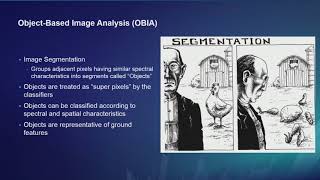
“I don’t understand on which raster you are exactly running the classification. You calculated indexes, then exported all the rasters. So finally, did you combine all the exported rasters first before classifying them? If not, please help me understand. Then, I have another question. After segmentation, does the image itself appear or only the preview can be seen? I have been struggling to display the final result of segmentation, not just the preview.
Bonjour Merci J'espère que nos vidéos sont instructives pour vous Merci de partager les vidéos avec vos amis Si vous avez des questions sur les vidéos, n'hésitez pas à les poser et nous y répondrons
I had occuring issue with the satellite image that export from usgs to arcgis pro. Its always blurry and appears in low quality. Also the image cant classify perfectly
@@rsgis6997 Thank you so much!! Stay blessed. Hope to see more tutorials are coming. These are great learning materials. It would be nice if you could make a series of TerrSet tutorials also. Best wishes, greetings from Bangladesh.


Your explanation of step by step is awsome keep posting on arc gis pro thanks
Hello
Thank you for your kind comment
Glad it was helpful!
Thank you so much!
Glad it helped!
wow. gem of knowledge. ty
Very good
Thanks
very useful
Glad you think so!
great video ,Thanks a lot
Glad you liked it!
“I don’t understand on which raster you are exactly running the classification. You calculated indexes, then exported all the rasters. So finally, did you combine all the exported rasters first before classifying them? If not, please help me understand. Then, I have another question. After segmentation, does the image itself appear or only the preview can be seen? I have been struggling to display the final result of segmentation, not just the preview.
Nous sommes beaucoup de francophones à vous suivre.
Bonjour
Merci
J'espère que nos vidéos sont instructives pour vous
Merci de partager les vidéos avec vos amis
Si vous avez des questions sur les vidéos, n'hésitez pas à les poser et nous y répondrons
I had occuring issue with the satellite image that export from usgs to arcgis pro. Its always blurry and appears in low quality. Also the image cant classify perfectly
These images are displayed based on their accuracy
If you need high accuracy, use Google Earth or Google Earth images that are inside ArcGIS Pro
What is the first song?
To make the video attractive
@@rsgis6997 i understand. That song is nice. Can you tell me the title? Thanks. Btw, i follow your tutorials. You are doing great 👍
Hello
Thank you for your kind support
Yes, I will definitely send you the title of the song@@iffatara8846
ruclips.net/video/2p6GHc0FlyE/видео.htmlsi=iIbINwRIdzDd2wjK@@iffatara8846
@@rsgis6997 Thank you so much!! Stay blessed. Hope to see more tutorials are coming. These are great learning materials. It would be nice if you could make a series of TerrSet tutorials also.
Best wishes, greetings from Bangladesh.
This music in the background is so disturbing, I had to stop watching after a couple of minutes
🌹
In the video, you said you will attach the link to the image file in the description, but I can't find it
t.me/RemoteSensingandGIS
If you can log in to Telegram, we have uploaded it inside the Telegram channel
If you do not have Telegram, let me know and I will send you the file
@@rsgis6997 Hi, I could not find the file in the Telegram