U stil trust nasa even after the moon landings were easily debunked even bye a 12 Ty grader. Why keep believing there lies wake up man is from the hole 🕳 sun sits In the black hole horizon out of darkness comes light but men comprehend it not! What ur teaching is a religion pseudoscience! God created this realm we live n the physical the non physical is what we can’t see u and I live in a duality system electromagnet system
You get inside the head of your audience / students and show a deep understanding of how to glue what they already understand from the physical world , and apply it to celestial navigation , thats a rear gift that has been honed for many years of tried and true teaching.. We are privileged to have passionate folks like yourself...
I was a deep sea navigator for eleven years tramping all around the world we only had a magnetic compass a sextant and a chronometer Starting in the 1950s The current growth round the world single handed race revived my interest in celestial navigation which I had completely forgotten. your explanation is superb and very clear I am thoroughly enjoying re learning even though at 86y I only sail in local Uk estuarys
Hi Ken, I got so much pleasure out of your note - especially knowing that you are still sailing at 86. I guess I can look forward to another 15 plus years of enjoying sailing if I can stay as active as you! Congratulations! "God doesn't count the days spent sailing." Will
Hey captain Lesh. Thanks so much for taking time to re-introduce CN to me. I studied the subject 40-years ago as a hobby, and had forgotten much of the basics. You set me straight. I never made that crossing from Long Beach, CA to Oahu in my 20-foot Cal as planned (that would've been a rough ride in that little tub, no doubt). But now I'm interested again. I've had an old Davis Mark IV plastic sextant since I was a young man. I recently acquired a Celestaire Astra sextant and having great fun practicing with an artificial horizon. Who knows, I just may make that crossing one day. Very enjoyable and elegant science. Thanks for your help and inspiration.
Thank you for this very good video. I thought I already had a decent understanding of celestial navigation from a course I took several years ago, but your video has made the underlying principles much clearer. Thanks again.
To Mr Will Lesh, Thank-you for the video, "Celestial Navigation made easy. Well done and I enjoyed. You look good with the white beard, in fact I'm growing one also. Going to glue the deck on the T65 tomorrow with the help of my daughter in Virginia, near Virginia Tech college where she lives. Thanks again! Joseph Michael
It's such a nice feeling when the fog in my brain suddenly clears up. Finally I understand the reasoning behind the reduction tables. Thank you so much! You are a great teacher.
This is amazing. I have been cracking my head around this subject, doing a online course and not understanding half of it. Just went throw part one and everything just makes a lot more sense. I cannot find the words to appreciate the effort and the amazing work and the invaluable help and knowledge that this video brings for someone preparing and RYA Ocean Yachtmaster.
I Just want to say thank you Sir, at this moment I am doing the Ocean skipper degree, and you've helped me a lot, because of you I finaly understand celestial navegation, again thank you Sir.
I was pleased to find that Google Maps accepts latitude and longitude and comes up with a location. However, when I asked to calculate the travel time from Everson, Washington, by walking, Google said it was not able to do this - and the same for car, bus, and bicycle which I found disappointing! That looks like a beautiful island off the coast of Brazil. Google Maps placed your location in the middle of the channel between the mainland and the island. Happy Sailing, Will
This made me get a 1967 vintage DDR Freiberger sextant. I also got a Nautical Almanac and managed to program my SwissMicros DM15 to help with these calculations. Works very well. Oh yeah a WWII bubble sextant too. 😅 There’s also a theodolite here… deep 🐇 hole this!
Will, I would like to thank you on explaining so patiently what every other instructional publication or video has tried to do. As a longhaul airline pilot I rely on GPS and Inertial navigation totally, but as a sailor I could use a sextant but never understood way the information the was derived. Problem is sailing in the British Isles the sun is never out for long. Thanks again for taking the time to produce this. Rgds Stu
This is the best simplified version of teaching celestial navigation on RUclips. Best thing being that , he does not uses the jargon. Wonderful work sir.
The only easy parts to celestial navigation are latitude by Polaris and noon longitude (never done by me). The rest is easy to screw up (extraction, calculation, and plotting errors). Former RC-135 navigator. Thank for sharing.
this is the easy version? 2 and three quarter hours for one part? Second part better be 3 seconds long. What's the difficult version? Maritime academy 4 year program?
1:48:44 Something comes to mind as an easy mental thing to think about it. You have two elevation angles, 30deg and 31deg. Just like angular sizes get smaller as you get further from an object, elevation angles get smaller as you get further from an object's GP.
I hope you still read this. I took your course awhile ago. I always had a question. Since today you have programs like AutoCad that could blow up a map in software. Using spherical trig to calculate an exact intersection point. I was blown off course going to Hawaii from NewPort Beach. No GPS in 1985. It worked using my computer software. We had a large sail boat. Anyway I love your lectures. Fraser
I was a deep sea navigator for eleven years tramping all around the world we only had a magnetic compass a sextant and a chronometer Starting in the 1950s The current growth round the world single handed race revived my interest in celestial navigation which I had completely forgotten. your explanation is superb and very clear I am thoroughly enjoying re learning even though at 86y I only sail in local Uk estuarys
I always remind myself that celestial navigation tells you where you are on an ocean, it does not tell you what side of the table you are sitting on. I also remind myself: Latitude tells you how far north and south you are, Longitude tells you how far east and west you are, Altitude tells you how high you are and Attitude tells you if you're getting dinner tonight.
Very useful information. However, at times, you neglect to reference relative tables used for calculations against the sextant readings. As a beginner, the flow and conclusions are pretty scattered when you neglect to introduce these very intrinsic and critical elements as part of overall formulas. Thanks for your enthusiasm and willingness to share, I do know how difficult it is to share concepts in a meaningful and logical way to the layman, so I cannot entirely fault you for your overall approach.
Dear Captain Lesh. For 25 years I have held a British Yachtmaster Offshore license (150 n.m from shore) with which I work in the yachting industry. At the time I acquired that license I also took the theory exam for the British Yachtmaster Ocean license. Just recently I delivered a yacht from New York to the BVI's which gave me the opportunity to take a shot at the final oral exam after an ocean passage, and at last get my full Ocean license. But you know, 25 years is 25 years, and I found that the astro nav was almost a complete re learn - and my work demands were piled on top of my atro study. But then I found your You Tube Lectures.......thank you so much for being willing to share your knowledge and take the time to make the videos. Your teaching approach/method is fantastic. I now have passed my Yachtmaster Ocean final exam, and my work horizons and literal horizon are now extended. Many thanks, Patrick Truscott of zigzagsailing.com (originally from Cornwall, UK. Now living and working in Turkey).
Your explanation of the CN concept is fantastic, you have managed to present this subject in the clearest and simplest possible manner. After this video I really understand what's behind the different steps and what exact purpose each step serves. I finally got it. Thank you so much!
Thank you for creating such an informative video on celestial navigation! I've always been fascinated by this traditional method of navigating at sea, and your explanations and demonstrations were clear and easy to follow. Your passion for the topic really shone through and made the video even more enjoyable to watch. I can't wait to try out some of these techniques on my next boating trip. Thanks again for sharing your expertise!
RUclips has a lot of sailing videos that are made by people who buy a sailboat, fill it up with the latest GPS equipment and take off to points unknown. I don't think they have a concept of anything powered by electricity breaking down. After making a series of successful journeys where nothing goes wrong they get a false sense of security and think that the electronic equipment will function perfectly forever. What happens if a lightning strike or a massive wave knocks out their electrical system? This means that their radio may not work as well to call for help. If the radio works and they call for help how can they tell the person on the other end where they are located. No one should ever take off in a boat without knowing conventional navigation and practicing it often enough to have complete confidence in plotting their location. david
Faraday bag with back up gps, chartplotter and radio. But having said that, here I am watching this video with my Davis sextant and conversions charts!!
Think you're going to use "conventional navigation" to "plot your position" when there are huge waves and lightning strikes to contend with? Or that you can "call for help" in those conditions because the lightning is going to "spare" your radios with their tall metallic antennas but "take out" their GPS with its low-profile plastic-enclosed receiver? Are there lots of "lightning strikes" at sea? I mean beyond the continental shelves where most of you coast-hugger "navigators" run into "huge waves" because you want to stay close to "help"? News flash. The COAST GUARD wants "positions" in cardinal directions and nautical miles "from" or "off" major "landmarks" or coastal "features". GPS makes that possible. "Conventional navigation" and "latitude" and "longitude" are worthless for rescue AIRCRAFT. Not to mention "conventional navigation" do DICK for "avoiding" those conditions in the first place. The ONLY reason the USCG goes out to "rescue" anybody in "trouble" in severe weather off the "coast" in U.S. "territorial waters" is so other vessels and crews don't have to risk their "safety" trying to "navigate" around private "pleasure craft" that are "in trouble" in coastal "shipping lanes" because they try to "conventionally navigate" into the closest "port in a storm" as commercial oceangoing vessels with full and redundant and "storm-resistant" modern navigation aids go about their "business". If some clown calls in with "latitude and longitude" it means he or she doesn't have current "charts", doesn't really know where they actually "are" and are probably reporting a "last known position" because they "conventionally navigate" via "dead reckoning" and assume because they can "connect the dots" and figure out their "position" plus or minus MILES "offshore" the handful of hours per day they spend "at sea" in "international waters" they're real "sailors" and skilled "navigators" without all that supposedly "fragile" and "unreliable" and "waste of money" SOLID-STATE ELECTRONIC GEAR THAT HAS "SAVED" MORE LIVES IN A HANDFUL OF DECADES IN THE HANDS OF AMATEUR "SAILORS" WHO KNOW "NAVIGATION" IS A PERISHABLE SKILL, FULL-TIME JOB AND A "PROCESS" THAT LIKE "PAINTING" ABOARD REAL SAILING SHIPS NEVER BEGINS OR ENDS BUT SIMPLY "IS" THAN "CONVENTIONAL NAVIGATION" IN THE HANDS OF WANNABE "MASTERS AND COMMANDERS" WILL EVER "LOSE" BECAUSE SO FEW "CONVENTIONAL NAVIGATORS" MANAGE TO "SURVIVE" AT SEA WITHOUT GETTING IN "TROUBLE" THAT SEEMS "LIFE-THREATENING" AT THE TIME ONLY BECAUSE IN AN "EMERGENCY" THEY FIND OUT ITS POSSIBLE TO KNOW THEIR EXAXT "POSITION" BUT STILL BE "LOST". THEY "SURVIVE" BECAUSE SOMEBODY ASSISTS THEM SONYHEY DON'T END UP "SHIPWRECKED" AND A "HAZARD TO NAVIGATION". THEIR "OCEANGOING" VESSEL USUALLY ENDS UP "LOST" BECAUSE IT GETS "ACCIDENTALLY" RAN DOWN BY A REAL "SAILING SHIP" HEADING IN TO "ASSIST" AS THE COAST GUARD "HEADS PUT" WITH ALL "HANDS" RESCUED OR ITS "TAKEN IN TOW" BY A "SALVAGE VESSEL" THAT "ACCIDENTALLY" TOWS IT INTO PIECES OF "FRACTURED" FIBERGLASS AND RECORDS ITS TRUE FINAL POSITION IN CASE THE INSURANCE COMPANY WANTS TO MAKE SURE ITS ACTUALLY "LOST" OR ITS "ADRIFT" OUTSIDE "SHIPPING LANES" IN THE 99% OF THE "SEVEN SEAS" ONLY "PLEASURE CRAFT" SAIL IN AND FIGHT THE WORST OF CURRENTS, WEATHER ETC IN BECAUSE THEY'RE ALONG THE "SHORTEST DISTANCE BETWEEN TWO POINTS" AND THEREFORE ARE HIGHLY APPEALING TO TIGHTASS "CAPTAINS" THAT BUY "SAILBOATS" AND THINK THEY'RE "SAVING MONEY" AND "SAVING WEIGHT" AND "SAVING FUEL" BY GOING "OLD SCHOOL" WITH THEIR "YACHTS" AND THEIR "RETIREMENT" PLANS TO "SAIL AROUND THE WORLD". ITS LIKE THEY NEVER HEARD THE OLD JOKE ABOUT THE TWO HAPPIESTS DAYS OF A "BOAT OWNER'S" LIFE. THE DAY THEY BOUGHT THE BOAT AND THE DAY THEY SELL THE BOAT. OF COURSE THATS A "FRESHWATER" JOKE AND WANNABE "SAILORS" DON'T "GET IT" BECAUSE SO FEW "SALTWATER" BOATS ARE SOLD "PRIVATELY" BY THE ACTUAL "OWNER" RATHER THAN BY A "BROKER" OR "AGENT" WHO 99 TIMES OUT OF 100 WOULDN'TOWN A "SAILBOAT" IF THE DAMNED THING WERE "FREE" OR HE/SHE WOULD "OWN" SEVERAL AFTER A FEW YEARS IN THE "USED BOAT BUSINESS".
I agree completely. However unless you are mid Pacific, and aiming for Hawaii, you rarely are going to "need" it. Let's take a more realistic scenario. 200 miles from California you are headed for Hawaii, and a lightning strike takes out all electronics on the boat. Added bonus, it also melted your only compass. My first step, heave to, until the storm stops. First light, point toward rising sun. 2 days later I run into California coast, where I follow until I see a marina I recognize, and buy a new GPS. Next scenario, I'm in Florida sailing to Bahamas,.... follow setting sun, this time I magnetize my sail repair needle for a makeshift compass. Also 15 miles from the coast my cell phone picks up a signal and suddenly tells me where I'm at.
I just wanted to say thank you so much for making such a (seemingly) in-depth video about celestial navigation. I've had only the most basic understanding of navigation before this, so your time and effort to explain everything and methodically build up on that knowledge is masterful in my opinion. I think all of these negative comments simply don't understand your goal which, to me, seems to be to present such a daunting field of knowledge so that everyone can keep up and understand. So once more, thank you for your time and effort
Question regarding the 3rd diagram.....how do your plot the angle of the suns GP on the chart? Thanks for the video also! Very helpful so far with my ocean Theory.
The Sight Reduction tables give you the Z value which is the solution for the direction to the sun based on the ground point of the sun in Latitude and Longitude which you have given the tables and based on the Lat and Long of the AP. The only part to resolve is if you were sighting to the east (morning sun sight) in which case Z = direction to sun measured from North around to East like a compass, or if Z is the mirror image of the first situation as in sighting to the West in which case Z is being measured from North around to the West so the direction to the sun = 360 degrees minus Z to match our standard way of measuring compass angles from North around through East. The tables solve these two problems as though they were the same problem, which essentially they are. The mirror image of these two problems in the Southern hemisphere are solved at the same time resulting in the equations: shooting East in Southern Hemisphere, direction to sun = 180 - Z. Or shooting towards the West, Direction to the sun = 180 + Z. Z is the value taken from the Sight Reduction Tables. If the tables gave separate solutions for each of these 4 situations, it would be simpler and Z would not have to be manipulated, but the tables would be 4 times as long resulting in 4 times as many volumes of tables! If you want to use the rules given at the top and bottom of the sight reduction pages for figuring out which of these equations to apply for getting the direction to the sun from the Z value, then you must always measure the LHA to the West, and not just take the difference between the AP Longitude and the GHA (Longitudinal position of the sun). I usually know if I have taken a sun sight in the morning or afternoon (ie. shooting to the East or to the West) so I find it easier to simply take the difference in the AP longitude and the GHA position and then correct the Z value based on which of the two triangles is appropriate if I am in the Northern Hemisphere. Some people may prefer to always measure the LHA to the West in which case the formula in the tables will adjust Z correctly for the direction to the sun. In a star or planet sight where you don't always know if you shot to the East or to the West it is easy enough to compare the AP Long and the GHA of star or planet to see if the body you shot was to the East or to the West at time of taking the shot.
I first heard about celestial navigation right at a historical fort reenactment type thing at the engineers camp right before I was going to go back to school to start my undergrad degree in engineering…I became fascinated by the concept. This connects so well to all my previous math experience and ties the real world and the simple math concepts together.
Great explication. Please also learn the importance of thinking of your audience. Make your subject visible for the audience. I can only see about 1/2 of what’s been drawn. Use visible markers and size. This is the first lesson for public speaking.
Yes, definitely a point well made. I really did this pretty spontaneously and just for fun. I never expected almost 240,000 viewings. I might have gotten better markers if I had known how popular the video would turn out to be! It may still be the best explanation available despite the markers being a little weak!
Yup! It's the Brits fault that people think that Celestial Navigation is difficult 'cos really anyone can come up from the lower deck and take over the ship 'cos all it's dead easy stuff really! Any thickie can do it! :o)
Hi Will, Tks for response. Great you took the initiative to record his story that otherwise would have probably been lost. I recently read Sir Francis Chichester autobiography and this kind of reminds me of his story. It’s a fascinating read if you ever get your hands on it. These guys seen hard times that molded them into great men. We will never see their likes again that’s for sure. Thanks for sharing.
Chichester is definitely one of my all time heroes. I have read many of his Gypsy Moth books. I will look for his autobiography to see if I have read it yet. Amazing personality!
Part 2 is just finished and available on RUclips now. Sorry it took so long. I was waiting to see if anybody wanted Part 2, and I got a lot of requests, so now it is done.
What is your view on these Starfinders: ruclips.net/video/v7t-iQckrtg/видео.html That video makes everything a bit confusing(though not unbearable), but here is what i compressed it to: (please do tell me if i got something wrong.) tools: sextant, compass, clock (GMT) 1)get your latitude (sun, north star). 2)shoot several stars (asc., dec., GMT time) 3)use appropriate plate and grid template and rotate the grid until the shot stars end up in their measured positions. 4)read LocalHourAngle from the orientaion of the grid. 5) subtract LHA from the time of the shot and voila, you know your longitude. If your clock is not dialed to GMT, subtract the longitude of the location where your clocks noon is solar noon.
Hi John, Thanks for your great comment. It is a fun subject. Part 2 is launched and ready on RUclips. Just search for Celestial Navigation Made Easy and part 2 should be right there. You may need to refresh your screen for part 2 to appear, but I would not expect so. Enjoy! Will
@@TippeCanoeT50 Dear Bill, thank you, I will check it out course 2 over the next few days. I got a brief introduction to celestial navigation while in the USCG. I was a cook but one of the officers was giving some informal lessons while we were deployed off the coast of Africa in the summer of 1974. Later, as a civilian, I was part of a crew of 3 on a 41' Morgan out islander that in 1980 sailed from Norway to Baffin Bay. I wasn't the chief navigator on that trip, my job cooking and handling the boat keeping track of dead reckoning and helping with the sextant readings. We mostly relied on Sun shots and doing our best to keep good track of our DR. Seas were too rough most of the trip for stars. It was a great experience, I saw some heavy seas while in the Guard but that was a 378' cutter - being in a 41' you really get upclose and personal with some hellish seas. We came within 2 miles of Cape Farewell with gale force winds knocking us about 1,000 miles off course. We dealt with gale force 7to 9 with bursts of 10 for4-5 days then beat into a force 5-7 NW wind for 4 days. My younger brother has just bought a Shannon 43' and he wants to do a cross Atlantic in the next couple years. So I figured it would be good to catch up. I like the way you are explaining and breaking down the concepts. I'm almost there, your advice about drawing the diagrams is key to understanding. Thanks again for your time and effort putting this course together.
I offer a sample of an ancient text mistaken as having some esoteric mystery school pedigree...To which I disagree because the adjudicators were not navigators....I think the author is bragging about his knowledge and ability familiarity with celestial navigation. Paying poetic homage to the golden area/triangle/mean in sextant construction and employment including warning of risk to the eye, purple filter. Even alluding to the need of records charts etc..Finishing with a boast of the warmth of knowing ones position and course. So I ask a NAVIGATOR... "He who desires in pomp of sacred dress, The Sun's resplendent body to express, p. 11 Should first a veil assume of purple bright. Like fair white beams combined with fiery light; On his right shoulder next, a mule's broad hide, Widely diversified with spotted pride, Should hang an image of the pole divine, And doedal stars whose orbs eternal shine; A golden splendid zone then, oe'r his vest He next should throw, and bind it round his breast, In mighty token how with golden light, The rising sun from earth's last bounds, and night Sudden emerges and with matchless force, Darts through old Ocean's billows in his course, A boundless splendour hence enshrined in dew, Plays on his whirlpools, glorious to the view, While his circumfluent waters spread abroad, Full in the presence of the radiant god; But Ocean's circle, like a zone of light, The sun's wide bosom girds and charms the wand'ring sight.
I am 62yo, have some but not a lot of sailing experience but nothing that would require celestial navigation. I'm even STEM-minded (an MS in CompSici). I thought I didn't want to be bothered with celestial navigation, bur now I think it is a great backup to GPS.
This is exactly how I write technical documentation for complex banking and pharma processes. General to specific. It's always frustrating to see a lecturer pile loads of data on the heads of new students without first explaining to them what, exactly, they are doing or trying to understand. Hats off to you. "How are you with differential calculus?" lmao. Good one.
Will - I live near 40 N 90 W so I was waiting for you to say 90 W goes near the center of the USA or say 25 N 90 W is about the center of the Gulf of Mexico. L O L
The fish tank in the background is a nice touch. 2.4 hours of talking seems like a long time to explain three simple diagrams. 1.5 hours in and still haven't got to the 3rd diagram yet...
My dad was in the Army Air Corps and the USAF. He taught celestial navigation and Morse code keying to newbies and was till able to key faster than I could type at 70. He was the Deputy Commander of Maintenance at Anderson AFB in Guam when the first B52 missions to Vietnam took off to support that conflict in 1965. I was on a space available flight from El Paso with three B52 crews who flew the first mission to Vietnam. They lost three aircraft and aircrews according to my father, on the return flight from Vietnam because their knowledge of celestial navigation failed them. These old skills have tangible value and shouldn’t be discarded or disregarded.
Ho ho ho....... Just remember that there is a 7 hour ( part two ) video continuing what you learned in this one .. ruclips.net/video/yu5R5mrrGB0/видео.html
Long ago was curious about how people navigated using sextant back in the days, trough some reading and computer simulation i was able to find where i was roughly
Thanks you so much, I really enjoyed this video. You explain very well. I'm just a person interested in the subject, Ive discovered it just recently, and find it fascinating.
It's interesting that all the videos by young whippersnappers on this topic just bang out the numbers on the screen and expect you to follow along, but lack this detailed "how it works" critical information for complete understanding. It's a parallel to the education system, where Kids are being taught by teachers with their own "instant gratification" syndrome, so theres no depth to learning and understanding. This is well worth a watch for anyone serious about this stuff, and anyone crossing an ocean should be as this could be life and death.
The formula for the distance for the Assumed Position isn't that complicated, and can be done with a compass and straight edge. en.wikipedia.org/wiki/Great-circle_distance i.stack.imgur.com/GPRBV.png


Uh oh, looks like I had better get busy and film Part 2! Thanks for all the positive comments, I am delighted that the explanation has been helpful!
i am tempted, but 7.5 hours sounds daunting at best...
Get some help my man earth is not a globe and nasa knows it u look stupid
U stil trust nasa even after the moon landings were easily debunked even bye a 12 Ty grader. Why keep believing there lies wake up man is from the hole 🕳 sun sits In the black hole horizon out of darkness comes light but men comprehend it not! What ur teaching is a religion pseudoscience! God created this realm we live n the physical the non physical is what we can’t see u and I live in a duality system electromagnet system
Plz stop teaching lies
Unfortunately, flat earthers don't watch these videos, because they claim CN can only be done if the earth is flat....
You get inside the head of your audience / students and show a deep understanding of how to glue what they already understand from the physical world , and apply it to celestial navigation , thats a rear gift that has been honed for many years of tried and true teaching.. We are privileged to have passionate folks like yourself...
Here is the link to Part 2 of Celestial Navigation Made Easy! ruclips.net/video/yu5R5mrrGB0/видео.html
9:00 The basics: longitude, latitude, geometry. (36:46,56:00)
1:11:44 Equipment: sextants and tables.
1:41:00 Putting it all together.
You're a hero.
I was a deep sea navigator for eleven years tramping all around the world we only had a magnetic compass a sextant and a chronometer
Starting in the 1950s
The current growth round the world single handed race revived my interest in celestial navigation which I had completely forgotten. your explanation is superb and very clear I am thoroughly enjoying re learning even though at 86y I only sail in local Uk estuarys
Hi Ken, I got so much pleasure out of your note - especially knowing that you are still sailing at 86. I guess I can look forward to another 15 plus years of enjoying sailing if I can stay as active as you! Congratulations! "God doesn't count the days spent sailing."
Will
I wish i could do that
This guy’s just great. Im a novice and this instructor is exactly what I need to understand the concepts of navigation.
Hey captain Lesh. Thanks so much for taking time to re-introduce CN to me. I studied the subject 40-years ago as a hobby, and had forgotten much of the basics. You set me straight. I never made that crossing from Long Beach, CA to Oahu in my 20-foot Cal as planned (that would've been a rough ride in that little tub, no doubt). But now I'm interested again. I've had an old Davis Mark IV plastic sextant since I was a young man. I recently acquired a Celestaire Astra sextant and having great fun practicing with an artificial horizon. Who knows, I just may make that crossing one day. Very enjoyable and elegant science. Thanks for your help and inspiration.
Thank you very much for the great effort extended to educate people , very well explained ! God bless you 🙏😇👍🤗
Brilliant explanation. Thank-you for taking the time to help us!
Thank you for this very good video. I thought I already had a decent understanding of celestial navigation from a course I took several years ago, but your video has made the underlying principles much clearer. Thanks again.
Great simplified and informative presentation! It had definitely made it easy to understand. Thanks for taking the time to share your knowledge!
Should of been taught this from first grade, why we were not pissies me OFF
I've been studying cel nav for ages and this has made it so simple and clear. Looking forward to your next video
To Mr Will Lesh, Thank-you for the video, "Celestial Navigation made easy. Well done and I enjoyed. You look good with the white beard, in fact I'm growing one also. Going to glue the deck on the T65 tomorrow with the help of my daughter in Virginia, near Virginia Tech college where she lives. Thanks again! Joseph Michael
Simple? The first part is 2 hr 40 min, the second part 7 hr 38 min! But, he talks so slow this could be could be watched ar 1.25x or even 1.5x speed.
It is simple. He just rambles a bit.
great strategy of teaching , thanks
The mind of an ocean sailor - 'we're 2400 miles away; we'll be there pretty soon'
Explain this then flat earthers.
I may need to do a new version for that group.
Haha
You cannot explain things to people who do not want to listen.
I love the episode under the dome on Netflix. Were they debunked their own theory. 🤪worth watching.
you hurt my feelings
It's such a nice feeling when the fog in my brain suddenly clears up. Finally I understand the reasoning behind the reduction tables. Thank you so much! You are a great teacher.
Same Feeling
Thanks Will enjoyed the presentation and diffidently interested in part 2! Nice job.
Lawdy, this was like those 1 credit hour labs that lasted 3-4hr weekly +wkend follow-ups ... very good, thx.
Thank you for a great Video, Best i have ever seen on "Celestial Navigation".
Will, in the second diagram with your second ground point for the sun why did you use 5400 nautical miles instead of 4200 nautical miles
multiplying while talking seems to engage different gears in the brain - I usually know my multiplication tables through the 12 times tables!
brilliant :) many thanks - wow - I finally understand every naval novel I read - provides great perspective when reading Hornblower
This is amazing. I have been cracking my head around this subject, doing a online course and not understanding half of it.
Just went throw part one and everything just makes a lot more sense.
I cannot find the words to appreciate the effort and the amazing work and the invaluable help and knowledge that this video brings for someone preparing and RYA Ocean Yachtmaster.
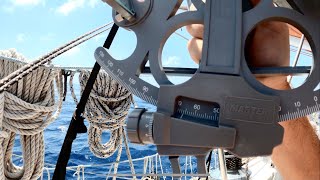
I'm trying to master the astrolabe never understood how a Sexton works with a curved horizon
Perfect declared! Thank you so much am have a grat time 👍🏽😎🌎🌞
I’m so 😊😅😅
I Just want to say thank you Sir, at this moment I am doing the Ocean skipper degree, and you've helped me a lot, because of you I finaly understand celestial navegation, again thank you Sir.
The best explanation. Thanks from 23°46'48.0"S 45°22'14.3"W
I was pleased to find that Google Maps accepts latitude and longitude and comes up with a location. However, when I asked to calculate the travel time from Everson, Washington, by walking, Google said it was not able to do this - and the same for car, bus, and bicycle which I found disappointing! That looks like a beautiful island off the coast of Brazil. Google Maps placed your location in the middle of the channel between the mainland and the island. Happy Sailing,
Will
Thank you. Very informative. I am looking forward to Part 2.
Take a shot for everytime he says "understand", LOL, great video. Thank you
English is not even my native language, but the video you made is so clear that I am understanding better now than lectures I had in my own language!
Thanks for such a clear and slow paced explanation. You have answered many questions that I had when I tried to learn celestial navigation by myself.
Thank you from Switzerland!
The clearest tuition I have found. Thank you.
This made me get a 1967 vintage DDR Freiberger sextant. I also got a Nautical Almanac and managed to program my SwissMicros DM15 to help with these calculations. Works very well.
Oh yeah a WWII bubble sextant too. 😅 There’s also a theodolite here… deep 🐇 hole this!
Thanks a lot. Great way to explain it, Finally I got it. Looking foreward to episode two.
Will, I would like to thank you on explaining so patiently what every other instructional publication or video has tried to do. As a longhaul airline pilot I rely on GPS and Inertial navigation totally, but as a sailor I could use a sextant but never understood way the information the was derived. Problem is sailing in the British Isles the sun is never out for long. Thanks again for taking the time to produce this. Rgds Stu
Thank you so much Sir, for taking so much time to hold that wonderful lesson to us. It was worth every minute and now I'll start with lesson 2. :-)
This is the best simplified version of teaching celestial navigation on RUclips. Best thing being that , he does not uses the jargon. Wonderful work sir.
wow thank you so much for the work you invested in this video...all the videos in my mother language i didnt get it...but this one is epic...thank you
The only easy parts to celestial navigation are latitude by Polaris and noon longitude (never done by me). The rest is easy to screw up (extraction, calculation, and plotting errors). Former RC-135 navigator. Thank for sharing.
I like to reserve "declination" for discussion about the variance between true and magnetic north. I understand your use. Thanks for the explanation
Congratulations on your teaching. Easy understanding.
A 2-hour video titled "Celestial Navigation Made Easy"? 🤔 FANTASTIC!
It’s actually 2 hours and 40 mins lol
this is the easy version? 2 and three quarter hours for one part? Second part better be 3 seconds long.
What's the difficult version? Maritime academy 4 year program?
1:48:44 Something comes to mind as an easy mental thing to think about it. You have two elevation angles, 30deg and 31deg. Just like angular sizes get smaller as you get further from an object, elevation angles get smaller as you get further from an object's GP.
I hope you still read this. I took your course awhile ago. I always had a question. Since today you have programs like AutoCad that could blow up a map in software. Using spherical trig to calculate an exact intersection point.
I was blown off course going to Hawaii from NewPort Beach. No GPS in 1985. It worked using my computer software. We had a large sail boat.
Anyway I love your lectures.
Fraser
I was a deep sea navigator for eleven years tramping all around the world we only had a magnetic compass a sextant and a chronometer
Starting in the 1950s
The current growth round the world single handed race revived my interest in celestial navigation which I had completely forgotten. your explanation is superb and very clear I am thoroughly enjoying re learning even though at 86y I only sail in local Uk estuarys
9:25 "15 degrees per hour"
thanks, bob!
Very informative, learned a lot. Where is part 2?
This should be a flat earth debunking video. You did it without even knowing it
Great video!!! Thanks for sharing your knowledge, much appreciated :-):-):-)
I always remind myself that celestial navigation tells you where you are on an ocean, it does not tell you what side of the table you are sitting on.
I also remind myself:
Latitude tells you how far north and south you are,
Longitude tells you how far east and west you are,
Altitude tells you how high you are and
Attitude tells you if you're getting dinner tonight.
Very useful information. However, at times, you neglect to reference relative tables used for calculations against the sextant readings. As a beginner, the flow and conclusions are pretty scattered when you neglect to introduce these very intrinsic and critical elements as part of overall formulas. Thanks for your enthusiasm and willingness to share, I do know how difficult it is to share concepts in a meaningful and logical way to the layman, so I cannot entirely fault you for your overall approach.
2hr 30+. ‘Made easy’?!!! 2 1/2 hours plus. Outta here.
Subscribed and liked. You are doing the Lord’s work 👍
Dear Captain Lesh. For 25 years I have held a British Yachtmaster Offshore license (150 n.m from shore) with which I work in the yachting industry. At the time I acquired that license I also took the theory exam for the British Yachtmaster Ocean license. Just recently I delivered a yacht from New York to the BVI's which gave me the opportunity to take a shot at the final oral exam after an ocean passage, and at last get my full Ocean license. But you know, 25 years is 25 years, and I found that the astro nav was almost a complete re learn - and my work demands were piled on top of my atro study.
But then I found your You Tube Lectures.......thank you so much for being willing to share your knowledge and take the time to make the videos. Your teaching approach/method is fantastic. I now have passed my Yachtmaster Ocean final exam, and my work horizons and literal horizon are now extended.
Many thanks, Patrick Truscott of zigzagsailing.com (originally from Cornwall, UK. Now living and working in Turkey).
"How good are you with differential calculus?"
Me: ☠️
CORRECTION: radius instead diameter 58:45 and 55:14
Your explanation of the CN concept is fantastic, you have managed to present this subject in the clearest and simplest possible manner. After this video I really understand what's behind the different steps and what exact purpose each step serves. I finally got it. Thank you so much!
Far and away the best video on celestial navigation. Thank you very much for sharing it.
Thank you for creating such an informative video on celestial navigation! I've always been fascinated by this traditional method of navigating at sea, and your explanations and demonstrations were clear and easy to follow. Your passion for the topic really shone through and made the video even more enjoyable to watch. I can't wait to try out some of these techniques on my next boating trip. Thanks again for sharing your expertise!
Thank you for taking the time to do this. Much appreciated.
RUclips has a lot of sailing videos that are made by people who buy a sailboat, fill it up with the latest GPS equipment and take off to points unknown. I don't think they have a concept of anything powered by electricity breaking down. After making a series of successful journeys where nothing goes wrong they get a false sense of security and think that the electronic equipment will function perfectly forever. What happens if a lightning strike or a massive wave knocks out their electrical system? This means that their radio may not work as well to call for help. If the radio works and they call for help how can they tell the person on the other end where they are located. No one should ever take off in a boat without knowing conventional navigation and practicing it often enough to have complete confidence in plotting their location.
david
Faraday bag with back up gps, chartplotter and radio. But having said that, here I am watching this video with my Davis sextant and conversions charts!!
Fully agree
Think you're going to use "conventional navigation" to "plot your position" when there are huge waves and lightning strikes to contend with? Or that you can "call for help" in those conditions because the lightning is going to "spare" your radios with their tall metallic antennas but "take out" their GPS with its low-profile plastic-enclosed receiver? Are there lots of "lightning strikes" at sea? I mean beyond the continental shelves where most of you coast-hugger "navigators" run into "huge waves" because you want to stay close to "help"? News flash. The COAST GUARD wants "positions" in cardinal directions and nautical miles "from" or "off" major "landmarks" or coastal "features". GPS makes that possible. "Conventional navigation" and "latitude" and "longitude" are worthless for rescue AIRCRAFT. Not to mention "conventional navigation" do DICK for "avoiding" those conditions in the first place. The ONLY reason the USCG goes out to "rescue" anybody in "trouble" in severe weather off the "coast" in U.S. "territorial waters" is so other vessels and crews don't have to risk their "safety" trying to "navigate" around private "pleasure craft" that are "in trouble" in coastal "shipping lanes" because they try to "conventionally navigate" into the closest "port in a storm" as commercial oceangoing vessels with full and redundant and "storm-resistant" modern navigation aids go about their "business". If some clown calls in with "latitude and longitude" it means he or she doesn't have current "charts", doesn't really know where they actually "are" and are probably reporting a "last known position" because they "conventionally navigate" via "dead reckoning" and assume because they can "connect the dots" and figure out their "position" plus or minus MILES "offshore" the handful of hours per day they spend "at sea" in "international waters" they're real "sailors" and skilled "navigators" without all that supposedly "fragile" and "unreliable" and "waste of money" SOLID-STATE ELECTRONIC GEAR THAT HAS "SAVED" MORE LIVES IN A HANDFUL OF DECADES IN THE HANDS OF AMATEUR "SAILORS" WHO KNOW "NAVIGATION" IS A PERISHABLE SKILL, FULL-TIME JOB AND A "PROCESS" THAT LIKE "PAINTING" ABOARD REAL SAILING SHIPS NEVER BEGINS OR ENDS BUT SIMPLY "IS" THAN "CONVENTIONAL NAVIGATION" IN THE HANDS OF WANNABE "MASTERS AND COMMANDERS" WILL EVER "LOSE" BECAUSE SO FEW "CONVENTIONAL NAVIGATORS" MANAGE TO "SURVIVE" AT SEA WITHOUT GETTING IN "TROUBLE" THAT SEEMS "LIFE-THREATENING" AT THE TIME ONLY BECAUSE IN AN "EMERGENCY" THEY FIND OUT ITS POSSIBLE TO KNOW THEIR EXAXT "POSITION" BUT STILL BE "LOST". THEY "SURVIVE" BECAUSE SOMEBODY ASSISTS THEM SONYHEY DON'T END UP "SHIPWRECKED" AND A "HAZARD TO NAVIGATION". THEIR "OCEANGOING" VESSEL USUALLY ENDS UP "LOST" BECAUSE IT GETS "ACCIDENTALLY" RAN DOWN BY A REAL "SAILING SHIP" HEADING IN TO "ASSIST" AS THE COAST GUARD "HEADS PUT" WITH ALL "HANDS" RESCUED OR ITS "TAKEN IN TOW" BY A "SALVAGE VESSEL" THAT "ACCIDENTALLY" TOWS IT INTO PIECES OF "FRACTURED" FIBERGLASS AND RECORDS ITS TRUE FINAL POSITION IN CASE THE INSURANCE COMPANY WANTS TO MAKE SURE ITS ACTUALLY "LOST" OR ITS "ADRIFT" OUTSIDE "SHIPPING LANES" IN THE 99% OF THE "SEVEN SEAS" ONLY "PLEASURE CRAFT" SAIL IN AND FIGHT THE WORST OF CURRENTS, WEATHER ETC IN BECAUSE THEY'RE ALONG THE "SHORTEST DISTANCE BETWEEN TWO POINTS" AND THEREFORE ARE HIGHLY APPEALING TO TIGHTASS "CAPTAINS" THAT BUY "SAILBOATS" AND THINK THEY'RE "SAVING MONEY" AND "SAVING WEIGHT" AND "SAVING FUEL" BY GOING "OLD SCHOOL" WITH THEIR "YACHTS" AND THEIR "RETIREMENT" PLANS TO "SAIL AROUND THE WORLD". ITS LIKE THEY NEVER HEARD THE OLD JOKE ABOUT THE TWO HAPPIESTS DAYS OF A "BOAT OWNER'S" LIFE. THE DAY THEY BOUGHT THE BOAT AND THE DAY THEY SELL THE BOAT.
OF COURSE THATS A "FRESHWATER" JOKE AND WANNABE "SAILORS" DON'T "GET IT" BECAUSE SO FEW "SALTWATER" BOATS ARE SOLD "PRIVATELY" BY THE ACTUAL "OWNER" RATHER THAN BY A "BROKER" OR "AGENT" WHO 99 TIMES OUT OF 100 WOULDN'TOWN A "SAILBOAT" IF THE DAMNED THING WERE "FREE" OR HE/SHE WOULD "OWN" SEVERAL AFTER A FEW YEARS IN THE "USED BOAT BUSINESS".
I agree completely. However unless you are mid Pacific, and aiming for Hawaii, you rarely are going to "need" it.
Let's take a more realistic scenario.
200 miles from California you are headed for Hawaii, and a lightning strike takes out all electronics on the boat. Added bonus, it also melted your only compass.
My first step, heave to, until the storm stops. First light, point toward rising sun. 2 days later I run into California coast, where I follow until I see a marina I recognize, and buy a new GPS.
Next scenario, I'm in Florida sailing to Bahamas,.... follow setting sun, this time I magnetize my sail repair needle for a makeshift compass. Also 15 miles from the coast my cell phone picks up a signal and suddenly tells me where I'm at.
I just wanted to say thank you so much for making such a (seemingly) in-depth video about celestial navigation. I've had only the most basic understanding of navigation before this, so your time and effort to explain everything and methodically build up on that knowledge is masterful in my opinion. I think all of these negative comments simply don't understand your goal which, to me, seems to be to present such a daunting field of knowledge so that everyone can keep up and understand. So once more, thank you for your time and effort
That was demystifying something I always thought was inscrutable.You are indeed a Celestial Lecturer Sir!
Amazing video. You're a fantastic teacher
Sir, you are a great teacher, and I have an advanced degree in learning !
Question regarding the 3rd diagram.....how do your plot the angle of the suns GP on the chart? Thanks for the video also! Very helpful so far with my ocean Theory.
The Sight Reduction tables give you the Z value which is the solution for the direction to the sun based on the ground point of the sun in Latitude and Longitude which you have given the tables and based on the Lat and Long of the AP. The only part to resolve is if you were sighting to the east (morning sun sight) in which case Z = direction to sun measured from North around to East like a compass, or if Z is the mirror image of the first situation as in sighting to the West in which case Z is being measured from North around to the West so the direction to the sun = 360 degrees minus Z to match our standard way of measuring compass angles from North around through East. The tables solve these two problems as though they were the same problem, which essentially they are. The mirror image of these two problems in the Southern hemisphere are solved at the same time resulting in the equations: shooting East in Southern Hemisphere, direction to sun = 180 - Z. Or shooting towards the West, Direction to the sun = 180 + Z. Z is the value taken from the Sight Reduction Tables. If the tables gave separate solutions for each of these 4 situations, it would be simpler and Z would not have to be manipulated, but the tables would be 4 times as long resulting in 4 times as many volumes of tables! If you want to use the rules given at the top and bottom of the sight reduction pages for figuring out which of these equations to apply for getting the direction to the sun from the Z value, then you must always measure the LHA to the West, and not just take the difference between the AP Longitude and the GHA (Longitudinal position of the sun). I usually know if I have taken a sun sight in the morning or afternoon (ie. shooting to the East or to the West) so I find it easier to simply take the difference in the AP longitude and the GHA position and then correct the Z value based on which of the two triangles is appropriate if I am in the Northern Hemisphere. Some people may prefer to always measure the LHA to the West in which case the formula in the tables will adjust Z correctly for the direction to the sun. In a star or planet sight where you don't always know if you shot to the East or to the West it is easy enough to compare the AP Long and the GHA of star or planet to see if the body you shot was to the East or to the West at time of taking the shot.
Looked this up for I have been listening to podcasts and audio books on explorers. What a great find, very interesting and you are very entertaining.
THANK YOU SO MUCH FOR THESE VIDEOS. YOU ARE MY TUTOR
I first heard about celestial navigation right at a historical fort reenactment type thing at the engineers camp right before I was going to go back to school to start my undergrad degree in engineering…I became fascinated by the concept. This connects so well to all my previous math experience and ties the real world and the simple math concepts together.
“There is nothing as practical as a well understood theory “
Thank you for the video and the wonderful knowledge
Great explication.
Please also learn the importance of thinking of your audience. Make your subject visible for the audience. I can only see about 1/2 of what’s been drawn. Use visible markers and size. This is the first lesson for public speaking.
Yes, definitely a point well made. I really did this pretty spontaneously and just for fun. I never expected almost 240,000 viewings. I might have gotten better markers if I had known how popular the video would turn out to be! It may still be the best explanation available despite the markers being a little weak!
Yup! It's the Brits fault that people think that Celestial Navigation is difficult 'cos really anyone can come up from the lower deck and take over the ship 'cos all it's dead easy stuff really! Any thickie can do it! :o)
Pure history at its best!
Thank you very much
Great lecture! Thank you!
Hi Will, Tks for response. Great you took the initiative to record his story that otherwise would have probably been lost. I recently read Sir Francis Chichester autobiography and this kind of reminds me of his story. It’s a fascinating read if you ever get your hands on it. These guys seen hard times that molded them into great men. We will never see their likes again that’s for sure. Thanks for sharing.
Chichester is definitely one of my all time heroes. I have read many of his Gypsy Moth books. I will look for his autobiography to see if I have read it yet. Amazing personality!
Where can I find lesson no 2 please?
Part 2 is just finished and available on RUclips now. Sorry it took so long. I was waiting to see if anybody wanted Part 2, and I got a lot of requests, so now it is done.
A true master and teacher. I have watched this 3 times with joy. Thank you
Thank you for the video sir
Parabéns Capitão, pelo excelente vídeo. Obrigado por ajudar meus estudos.
Thank you for this video sir! This is a fantastic video
THANK YOU SIR
What is your view on these Starfinders:
ruclips.net/video/v7t-iQckrtg/видео.html
That video makes everything a bit confusing(though not unbearable), but here is what i compressed it to:
(please do tell me if i got something wrong.)
tools: sextant, compass, clock (GMT)
1)get your latitude (sun, north star).
2)shoot several stars (asc., dec., GMT time)
3)use appropriate plate and grid template and rotate the grid until the shot stars end up in their measured positions.
4)read LocalHourAngle from the orientaion of the grid.
5) subtract LHA from the time of the shot and voila, you know your longitude.
If your clock is not dialed to GMT, subtract the longitude of the location where your clocks noon is solar noon.
Nicely done Captain. Thank you for breaking it down so effectively. Hope you find the time to make the second part.
Hi John, Thanks for your great comment. It is a fun subject. Part 2 is launched and ready on RUclips. Just search for Celestial Navigation Made Easy and part 2 should be right there. You may need to refresh your screen for part 2 to appear, but I would not expect so. Enjoy! Will
@@TippeCanoeT50 Dear Bill, thank you, I will check it out course 2 over the next few days. I got a brief introduction to celestial navigation while in the USCG. I was a cook but one of the officers was giving some informal lessons while we were deployed off the coast of Africa in the summer of 1974. Later, as a civilian, I was part of a crew of 3 on a 41' Morgan out islander that in 1980 sailed from Norway to Baffin Bay. I wasn't the chief navigator on that trip, my job cooking and handling the boat keeping track of dead reckoning and helping with the sextant readings. We mostly relied on Sun shots and doing our best to keep good track of our DR. Seas were too rough most of the trip for stars. It was a great experience, I saw some heavy seas while in the Guard but that was a 378' cutter - being in a 41' you really get upclose and personal with some hellish seas. We came within 2 miles of Cape Farewell with gale force winds knocking us about 1,000 miles off course. We dealt with gale force 7to 9 with bursts of 10 for4-5 days then beat into a force 5-7 NW wind for 4 days.
My younger brother has just bought a Shannon 43' and he wants to do a cross Atlantic in the next couple years. So I figured it would be good to catch up. I like the way you are explaining and breaking down the concepts. I'm almost there, your advice about drawing the diagrams is key to understanding. Thanks again for your time and effort putting this course together.
I offer a sample of an ancient text mistaken as having some esoteric mystery school pedigree...To which I disagree because the adjudicators were not navigators....I think the author is bragging about his knowledge and ability familiarity with celestial navigation. Paying poetic homage to the golden area/triangle/mean in sextant construction and employment including warning of risk to the eye, purple filter.
Even alluding to the need of records charts etc..Finishing with a boast of the warmth of knowing ones position and course. So I ask a NAVIGATOR...
"He who desires in pomp of sacred dress,
The Sun's resplendent body to express, p. 11
Should first a veil assume of purple bright.
Like fair white beams combined with fiery light;
On his right shoulder next, a mule's broad hide,
Widely diversified with spotted pride,
Should hang an image of the pole divine,
And doedal stars whose orbs eternal shine;
A golden splendid zone then, oe'r his vest
He next should throw, and bind it round his breast,
In mighty token how with golden light,
The rising sun from earth's last bounds, and night
Sudden emerges and with matchless force,
Darts through old Ocean's billows in his course,
A boundless splendour hence enshrined in dew,
Plays on his whirlpools, glorious to the view,
While his circumfluent waters spread abroad,
Full in the presence of the radiant god;
But Ocean's circle, like a zone of light,
The sun's wide bosom girds and charms the wand'ring sight.
I am 62yo, have some but not a lot of sailing experience but nothing that would require celestial navigation. I'm even STEM-minded (an MS in CompSici). I thought I didn't want to be bothered with celestial navigation, bur now I think it is a great backup to GPS.
This is exactly how I write technical documentation for complex banking and pharma processes. General to specific. It's always frustrating to see a lecturer pile loads of data on the heads of new students without first explaining to them what, exactly, they are doing or trying to understand. Hats off to you. "How are you with differential calculus?" lmao. Good one.
Will - I live near 40 N 90 W so I was waiting for you to say 90 W goes near the center of the USA or say 25 N 90 W is about the center of the Gulf of Mexico. L O L
The fish tank in the background is a nice touch. 2.4 hours of talking seems like a long time to explain three simple diagrams. 1.5 hours in and still haven't got to the 3rd diagram yet...
55:17 should be "a circle with a RADIUS of 2400 Nm", not diameter.
My dad was in the Army Air Corps and the USAF. He taught celestial navigation and Morse code keying to newbies and was till able to key faster than I could type at 70. He was the Deputy Commander of Maintenance at Anderson AFB in Guam when the first B52 missions to Vietnam took off to support that conflict in 1965.
I was on a space available flight from El Paso with three B52 crews who flew the first mission to Vietnam. They lost three aircraft and aircrews according to my father, on the return flight from Vietnam because their knowledge of celestial navigation failed them.
These old skills have tangible value and shouldn’t be discarded or disregarded.
1 error - 2400 Nautical miles is the radius, not diameter. - at 55:16. Otherwise a great explanation.
Ho ho ho....... Just remember that there is a 7 hour ( part two ) video continuing what you learned in this one ..
ruclips.net/video/yu5R5mrrGB0/видео.html
Enjoyable to watch, thanks!
Long ago was curious about how people navigated using sextant back in the days, trough some reading and computer simulation i was able to find where i was roughly
Thanks you so much, I really enjoyed this video. You explain very well. I'm just a person interested in the subject, Ive discovered it just recently, and find it fascinating.
I wish you were my geography teacher, when I was a kid,I hated geography very much. You made the whole thing look like a fruitcake....
It's interesting that all the videos by young whippersnappers on this topic just bang out the numbers on the screen and expect you to follow along, but lack this detailed "how it works" critical information for complete understanding. It's a parallel to the education system, where Kids are being taught by teachers with their own "instant gratification" syndrome, so theres no depth to learning and understanding. This is well worth a watch for anyone serious about this stuff, and anyone crossing an ocean should be as this could be life and death.
The formula for the distance for the Assumed Position isn't that complicated, and can be done with a compass and straight edge.
en.wikipedia.org/wiki/Great-circle_distance
i.stack.imgur.com/GPRBV.png