Creating 3D models from maps using OS map and contour lines.

HTML-код
- Опубликовано: 16 июл 2024
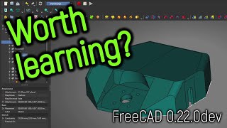
- In the video below I show how you can take a 2D map and create a 3D model using FreeCAD. This is a manual process in mapping the contour lines from an OS map into FreeCAD. The model can then be printed using a 3D printer, or viewed online as a static image or through a 3D viewer.
I used this to help teach map and navigation skills to Cub Scouts. This helped them to visualise the contours so that they could understand how steep a hill is by looking at a map. This could also be a useful technique if you would like to visualise a hill before your walk or to create 3D models of places you have visited.
The example map used in the video is an Ordnance Survey Map, known as OS Maps. Ordnance Survey are the national mapping country for Great Britain and the standard for walking maps. You can use alternative maps (including Google Maps). OS Maps provide a free "standard" level map which is available through a free account. They also provide a premium account which provides additional maps, if you wanted more detail.
The maps are available online from osmaps.com/
The map is first imported to FreeCAD using the Images Workbench. If you include the map scale on the map then you can set the scale using the scale tool. In my case I set a scale of 1mm to 1 meter. This makes it easier to determine the correct value when using the pad.
I then created a body for each layer and created a sketch mapping out one of the contour lines using the b-spline tool. This is achieved by clicking onto the contour line at regular intervals, zooming in and scrolling around the FreeCAD model as required.
The resulting sketch could then be extruded into a 3D object using the pad tool.
This was repeated with a new body, sketch and pad for each contour layer. I cleaned up the edges by cutting away any excess using tools in the FreeCAD part workbench.
Once it's complete then it can be exported as an STL file which can viewed through a 3D viewer or imported to your slicer software for 3D printing. Depending upon the size of your model and the bed size of your 3D printer you may have to scale the model in the slicer so that it can be 3D printed.
For one of the models I printed it on white PLA and then using a sharpie I added some of the map symbols to help show how the map and the 3D model related to each other. This is of the local area of Redditch so the Cubs could also associate it with the places they know.
Chapters:
00:00 Introduction to 3D maps
01:26 Different maps from ordnance survey OS Maps
03:36 Importing a 2D image into FreeCAD
05:18 Using an image scale in FreeCAD
06:48 Tracing a contour from a map image in FreeCAD
12:06 Adjusting a FreeCAD Sketch B-spline
14:29 Creating a pad to extrude a layer in FreeCAD
17:10 Creating multiple bodies in FreeCAD
29:13 Show / hide bodies in FreeCAD
32:09 Moving a layer below the plane in FreeCAD
36:01 Combining bodies into a compound object
37:25 Boolean cut in FreeCAD draft workbench
40:50 Export from FreeCAD to 3D print
41:16 Scaling a 3D model in Cura before print
41:27 Finished 3D models
For more details see: www.penguintutor.com/news/3d-d...  Наука
Наука


Please explain again how you set the size of the polyline segment?
The size of the segment is determined by where you click the mouse. You can choose large or small segments as you prefer.
And how make or remoove roads on this landskape?
If a road is upper or below the groud level?
The roads only exist in the imported image. There is no way of removing them from the maps I used.