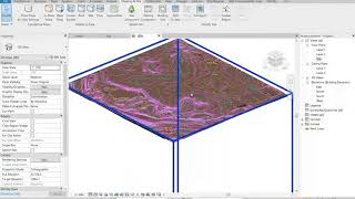
most of the time, it ends up creating rubbish topography that breaks the rules of topography---no topo line should ever cross one another no matter how steep they are. So, how do I solve that?
I think it's all about how accurate your CAD file. Check the coordinates of your file points, also make sure to select only the correct layers before creating the toposurface. Best of luck
@@dr.-ingsalemabdalla7080 I used both - elevation pts from developers, and geolocation from sketchup, with adjusted elevations based from the original points then saved as dwg.


Still works to this day, thanks!
merci frére ton tuto etait tres utile et tres claire pour moi. bro from Algéria
Thank you so much for this video. I really appreciate it.
Really great video! Helped me a lot. Thank you!
Great video! Very helpful.
you saved me like year 😊🤩
Why does every Revit tutorial on RUclips seem like the person is doing everything for the first time?
Nice video! Really easy to follow! :)
Dear Doctor, could you please put the topography data DWG file so we can download it for our trial use.
I have to check if I still have it.
Where did you find the cad file with these points' data?Can you tell me the site?
He's most probbably acquired it from a professional surveyor
Hey! Is there a way to edit the topography once it is imported in Revit?
Yes, many possibilities.
@@dr.-ingsalemabdalla7080 How would you do it? :-)
@@Dondideeda let me know what do you want to edit.
@@dr.-ingsalemabdalla7080 A flat surface into a hilly landscape! :-)
@@Dondideeda Place point and specify the required elevation value.
and if the autocad lines don't show any elevation?
That means it won't work because Revit needs the elevations for each contour to build the surface.
what to do if the linked Autocad file does not show in revit?
I believe if you follow the steps it'll show.
Sorry for late reply. But, it should show as I demonstrate, or you may send me your file and I will try to help you.
most of the time, it ends up creating rubbish topography that breaks the rules of topography---no topo line should ever cross one another no matter how steep they are.
So, how do I solve that?
I think it's all about how accurate your CAD file. Check the coordinates of your file points, also make sure to select only the correct layers before creating the toposurface.
Best of luck
@@dr.-ingsalemabdalla7080 I used both - elevation pts from developers, and geolocation from sketchup, with adjusted elevations based from the original points then saved as dwg.
@@drvlive2023 it's hard to tell, unless I view the Autocad file. Also, Revit depends on x,y,z coordinates to establish the toposurface.
@@dr.-ingsalemabdalla7080 Yeah, had already cost me a lot of time. I'll always put the last sentence in my mind. Thank you so much!
Thanks a lot
Thank you.
Helpful Dr.
Thanks, but you should buy a faster PC :-)