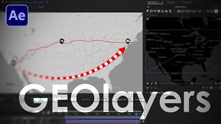
Here's how to create some stylized topography animations in Adobe After Effects using real world elevation data (heightmaps). And remember kids, freedom isn't free. Join my Patreon now to go beast-mode mapmaker. You'll get the project files to this tutorial as well... www.patreon.com/boonelovesvideo
Hey, I'm just stuck at something. How do you change the labels location of geo layers labels for countries and cities? You can move it by anchor point but it does not moves the origin of the label. I could not find a tutorial of on google about this. So please help me out! Thanks for creating amazing content.
Not sure if I understand the question, but you can manually place labels with the label button to the left of the label templates dropdown menu. It gives you a crosshair which you can use to manually place the label on the map.
Oh this looks brilliant - I want to try this for a coastal region and maybe use a different colour for the sea. I suspect my efforts won't look as slick as yours!! Thank you
An idea that comes to mind is to use each precomp and not sure yet which could be the best workflow but, to use Layer/auto-trace, and then use Element 3D so then you can have those shapes into a very customizable 3D objects, so then you can go crazy with textures and more, and also maybe use freqreact (I need to use more this plugin), and go even more crazy and make those shapes react to some rhythm. Greetings.
Oh that's great, i checked the other tutorial for the Master Properties and is very useful, i didn't know about that, also this tutorial is really good!!!... Greetings.
So I’ve bench watched about 10 of your videos now! I’m super glad I found you. I’m doing this type of work myself, but no where near as skilled as you, so you’re a big inspiration from now on! I do have a question for you. Historical maps, they don’t exist in GeoLayers. So how would you go about making these? I’m thinking if you need to show something like the Roman Empire, Ottoman Empire or perhaps an not so famous empire, so there are no images to get online. How would you go about this? Interesting to hear your workflow for this! Again, great work 👏
Thanks for the kind words! This tutorial shows how to find old country and empire borders. It's quite technical, so be ready. ruclips.net/video/N2IQs94rx_Q/видео.html If this doesn't work, you can always pin another existing map and use it to simply trace over with the Pen tool in AE.
@@BooneLovesVideo Thanks a lot! I will definitely check that repo out! I currently does this in AI. Pen to draw a region, it's time consuming, so having some empires ready to go in Geo would make it so much faster! :)


Here's how to create some stylized topography animations in Adobe After Effects using real world elevation data (heightmaps). And remember kids, freedom isn't free. Join my Patreon now to go beast-mode mapmaker. You'll get the project files to this tutorial as well... www.patreon.com/boonelovesvideo
Map Monday is my favorite day of the week.
Woohoo! Thanks. 😎
I put in my diary to-do list to watch your Monday maps episode...task done😊
Awesome! Haha, thanks for watching.
Great setup! Also exposure elevation on b&w map can be used for creating luma transition like "ink effects"
Duuuuuuudee thanks for sharing! I'm going to give this a try. 🙏
Hey, I'm just stuck at something. How do you change the labels location of geo layers labels for countries and cities? You can move it by anchor point but it does not moves the origin of the label. I could not find a tutorial of on google about this. So please help me out! Thanks for creating amazing content.
Not sure if I understand the question, but you can manually place labels with the label button to the left of the label templates dropdown menu. It gives you a crosshair which you can use to manually place the label on the map.
@@BooneLovesVideo if it allows me to place the label manually then my problem will be solved. Thanks for answering. Gonna check it out in the morning.
Oh this looks brilliant - I want to try this for a coastal region and maybe use a different colour for the sea. I suspect my efforts won't look as slick as yours!! Thank you
Thanks, Ian! Give it a try and let me know how it goes. 😎
An idea that comes to mind is to use each precomp and not sure yet which could be the best workflow but, to use Layer/auto-trace, and then use Element 3D so then you can have those shapes into a very customizable 3D objects, so then you can go crazy with textures and more, and also maybe use freqreact (I need to use more this plugin), and go even more crazy and make those shapes react to some rhythm. Greetings.
Whoa, yeah that sounds like an incredibly cool workflow. :) I've yet to use Element 3D with GEOlayers. Seems like a powerful combination.
Oh that's great, i checked the other tutorial for the Master Properties and is very useful, i didn't know about that, also this tutorial is really good!!!... Greetings.
Glad to hear that! Master properties are indeed crazy useful.
So I’ve bench watched about 10 of your videos now! I’m super glad I found you. I’m doing this type of work myself, but no where near as skilled as you, so you’re a big inspiration from now on!
I do have a question for you. Historical maps, they don’t exist in GeoLayers. So how would you go about making these? I’m thinking if you need to show something like the Roman Empire, Ottoman Empire or perhaps an not so famous empire, so there are no images to get online. How would you go about this? Interesting to hear your workflow for this!
Again, great work 👏
Thanks for the kind words! This tutorial shows how to find old country and empire borders. It's quite technical, so be ready. ruclips.net/video/N2IQs94rx_Q/видео.html
If this doesn't work, you can always pin another existing map and use it to simply trace over with the Pen tool in AE.
@@BooneLovesVideo Thanks a lot! I will definitely check that repo out! I currently does this in AI. Pen to draw a region, it's time consuming, so having some empires ready to go in Geo would make it so much faster! :)
Love ur videos❤️❤️
Hey thanks for watching. 🙌
is there a way to search for places with coordinates?
Yes indeed, with the GEOlayers 3 plugin. bit.ly/3Clko5I
@@BooneLovesVideo Thank you for the answer. I have one more question, how do I stylize the geolayers map in a way that it looks like a height map?
@@BooneLovesVideo Nevermind, figured I need maptiler subscription.
- fantastic job - many thx!! :^D