Это видео недоступно.
Сожалеем об этом.
World’s FIRST Map of Ancient AFRICA Will Shock You

HTML-код
- Опубликовано: 16 авг 2024
- The only thing more Bizarre than a Massive network of Lakes, Rivers and even a DENSE FOREST the size of Texas in the middle of the Sahara Desert - Along with numerous cities, settlements and even Castles blanketing virtually the entire region of the Sahara…Is the realization that these Lost 600 year-old maps literally annotate these geological features Several thousand years prior to their modern Scientific discovery. How could they have possibly known of the existence of the Green Sahara 5,000 years before us?
I'm Jimmy Corsetti, and my channel is called Bright Insight.
Follow and Support me on these other platforms where I can more freely speak my mind and share Truth!
brightinsight....
www.subscribes...
/ brightinsight
Instagram: / bright_insight
Twitter: / brightinsight6
Rumble: rumble.com/c/B...
Odysee: odysee.com/@Br...
TikTok: vm.tiktok.com/...
Or, Tip me on Venmo! @bright_insight
Must see Podcast I had with Danica Patrick! • Jimmy Corsetti | Are W...
Check out my podcast with Joe Rogan for FREE on Spotify: open.spotify.c...


*WHAT ARE YOUR THOUGHTS ON THESE MAPS??*
Follow and Support me! www.patreon.com/BrightInsight
brightinsight.locals.com/support
Twitter: twitter.com/BrightInsight6
Instagram: instagram.com/bright_insight/
Rumble: rumble.com/c/BrightInsight
Subscriber Star: www.subscribestar.com/bright-insight
Or, Tip me on Venmo! @bright_insight
Hi Jimmy i just noticed, isnt Anatarctica also shown on the map at 3:52 from Fernando Bertelli from 1565 ??
*SCIENCE is not FACT*
*SCIENCE is a HYPOTHESIS* - It is tested & should never stop being tested with the *Tools, Tech, Knowledge & Perspective* of what we know *TODAY* -These tests should provide a repeated outcome & this outcome is then determined to be *SCIENCE FACT* that’s until our *TOOLS, TECH, KNOWLEDGE and/or PERSPECTIVE CHANGES*
- Thank you Jimmy for constantly asking questions, then checking & rechecking the *SCIENCE*
Where you been Jimmy. Long time no see.
we need more videos
I'm surprised by the hair, and I like it.
One thing I'm kinda surprised of is that the pyramids are not displayed on the map. You'd think that something that big and unique would definitely be on a map from this time.
i stumbled over your comment and am baffled now that you tell me this. absolutely correct. where are they? i went and asked google and chatgpt and apparently they never have been depicted in anything older than 19th century maps. this is an amazing detail that you're pointing out. maybe they're so old that they didn't have this knowledge back when creating these ancient maps. perhaps they were covered in lush green when the Sahara was still thriving or buried in sand after it's violent destruction and therefore not discovered yet. similar findings of cities and other pyramids have been done by using Lidar nowadays. anyway Egyptology is a scars topic on the internet. it's hard to find information about who did the first expeditions and their data that they collected on the pyramids of Giza.
That's a good point. Maybe they were just used to them because they were so big and flashy and well known. Therefore everyone just knew where they were and there was no need to depict them. Just a thought. Not a fact.
they must not have been there
Or Göbekli Tepe for that matter.
Great wall isn't on the Asian map...
Everytime Jimmy upload I'm just happy that he hasn't been disappeared
"disappear"
Word! I really appreciate his work. ❤
@@CajmereThoughtsyes because googling is extremely difficult…
It is a concern these days for sure.
@@cp37373you having a bad day mate?
This doesn't surprise me because I study old maps and there are many maps that show Africa with no Sahara desert. I think the past is more of a mystery than we know. The more you look at old maps and take them at face value, you can see that the world was a very different place than it is now.
Yeah except we do know that it was different. There a simple video called “When the Sahara Was Green” that’ll explain a bit.
@@noelvalenzarroWe know it was different at some point, it’s the when up for question. These maps are old but not thousands of years old which is when mainstream say the Sahara was last green.
Since you mentioned Mansa Musa, I’ll throw this in. He took over the throne after his predecessor Mohammed Qu took a fleet to sail west to explore the Atlantic. Qu never returned, yet the 15th century Spaniards met some distinctly black tribes in the Caribbean 170 years later. Possible connection?
What’s MORE important is how whites were neanderthal in caucus mountains caves in these times. Blacks building pyramids and beginning mathematics. When the sahara was an ocean. An ocean for a million + years sir. Races were separate no debate. Suntanning is death for some. No debate.
They met them in Mainland America. Mexico i think
Dang I gotta do some research
@@RainettaJones Ayiti....later called Hispanola. Or as we know today as Haiti and the Dominican Republic.
A similar situation exists in Papau New Guinea. In a region full of orientals and thousands of islands full of Micronesian/oriental looking peoples, why is New Guinea full of distinctively black looking natives?
I believe that a great deal of human history is either being hidden or simply undiscovered. We as a species still have a great deal to learn about ourselves.
Hidden because modern day society was built on a pseudoscience called white superiority... meaning any history that doesn't project that message is intentionally hidden... and if its not hidden scientists will attempt to white wash it or give the credit the ancient aliens... anything to not give the progenitor of the human race their deserved credit.
The Vatican has a huuuuuge library that only a few people are allowed to visit and with special restrictions. But I'm sure a church that created kings who controlled most of Europe's recent history as well as still possessing a large amount of the world's wealth even today wouldn't be hiding anything beneficial for all of humanity.
Hidden...
yeah I'm 100% sure theres a lot of archeological stuff below the sahara desert. Like mind blowing number of ancient city, egyptian style
It is hidden, because some people's jobs literally depend on defending a collection of tales about history. If it is put under question, their reputation and published materials become obsolete.
Ive always believed that under the Sahara sand dunes there is so much we have yet to discover.
Never minding a fable caught in time about a shiek(or king??) Having made a deal with jinn over a bottle of perfect sand to make glass for his kingdom and someone stealing it only to not understand the bottles instructions and being frightened by a bottle spewing endlessly causing the Sahara to grow and bury everything in sand.
I have wondered what might be under them.
Actually, I now remember that villages are known to be under them, in some places. As I recall, some were in use until fairly recently, like about 100 years ago. There are even records involving them, like birth certificates and tax forms, and so on! I saw the tops of some of their tallest buildings in a RUclips video, in footage taken when they were temporarily uncovered by the wind!
@@lucykelly7152 what video?
I remember reading that the sahara was created because back in the day the best way to live was just to have a giant flock of goats and live on their yogurt and they eat all of the grasscausing it to lose its moisture causing dessertification. The periodic desertification of the sahara may have also caused humans to leave africa.
Well if Northern Africa really did suffer from a massive rush of ocean water then the desert is literally a product of that. All the sand was left over used to belong at the bottom of the Mediterranean and all former society was buried under possibly dozens or hundreds of feet of sand.
Can you imagine the knowledge lost in the fire of the library of Alexandria? The maps, the books....
I wonder this often. What priceless wisdom and accounting was destroyed throughout it’s decline? From the sieges, fires, theft and censorship certainly much was tragically lost
The reason this has been kept out of the mainstream is to remove any inference of West African influence in ancient Egypt. Making the Sahara desert seem like an impenetrable barrier, adds Credence to the notion that ancient Egyptians had no relation to west
Africa
No! It’s because it was all in America
Or any other part of Africa for that matter. Bunch of liars and thieves.
I was just commenting this…seems like slavery destroyed a lot of traditional oral knowledge
@@ChiquitaSpeaksThat was the goal
it's so much deeper than taht... that is so minor
The reason I love your videos is because they don't claim to have all the answers. Their main purpose is just to make people think outside the box and explore possibilities other than the narrow POV that just gets hammered into people's heads by mainstream history lessons. Thank you for doing what you do.
Yes he doesn't speculate but leaves that to us.
@@Sparky6stringbut it's not like he's just saying gibberish or just giving his own opinions he literally give information he's found compacted with loads of spot on proven evidence
@@Sparky6stringit makes me upset people don't react to his videos but react to these lame for 10 year old kids science channels
@@BESTMOAD We only have power over ourselves. Acceptance is the path to inner peace. I used to think like that but now I'm just grateful for the gifts God gave me that allows me to discern the worthwhile from the rest. God bless
@PaulKinley54remember they tell you the richest man ever was mansa Musa. Yet somehow all of Africa was primitive and poor also. Makes no sense. Especially when you realise they went and had been seeking for them. Somehow the lies of these people who we now know we're very racist is still being held up as facts and truths. Africa was raped, pillaged and lots of Kingdoms called Great by Europe like Mali and Benin were destroyed. Who knows where else they destroyed to justify their "primitive" narrative
It would be cool if we could arrange an expedition to the eye of the Sahara with scientific equipment that could be crowdfunded by fans of the channel or something.
No. Needs to be funded and run by scientists or its just a flat earth field trip. There is something to it but regular idiots like you and I shouldn't give our two cents. Just support where we can, shut up and let scientists and humans like this guy in the video do what we never will. That would only hurt the reason for going. RUclips sucks truly.
An expedition with that kind of equipment, the logistics, the professionnal team... would cost hundreds of thousands of dollars if not more!
Mauretania doesnt like🤷
I hear the local rulers are currently rather hostile
@@caphesta441 Also! Mountains of paperwork to get through, with zero assurance that in the end the local authorities will give you the green light! This kind of expedition is too expensive and difficult for average people to launch!
I found an interesting clue while watching a History Channel Documentary on the Sahara. It stated that every 20 thousand years the Sahara goes from wet to dry, based on the earths wobble. "The Sahara Desert's Scorching Heat, How the Desert was Made (S2, E4) at 26:50. Sorry for the lack of a link. Love the channel man! Keep up the good work!
Yes, this is due to the Precession of the Equinoxes. Look it up!
I love how passionate Jimmy is about this subject matter. It makes the video's that much more enjoyable to watch.
In 2010 I travelled to Marroco and we made a tour on camels through the Sahara. The Beduins gave the camels and us water from a whole in the ground. When I asked them about what kind of pit this was, answered that there was a whole river system underground the Sahara and as they passed this knowledge down, they know, where they can find water in the desert and that is why they have until today caravans that they bring from Marroco to Mali.
Maybe this could be an old burried river system, thanks for your fine research on this topic
The roads are most likely based on the old river systems so they follow those routes.
There’s a mythical? river in India (in Rajastan, I think) that shows up on the satellite image as a shadow. I heard that it is an underground ancient river? Can’t explain well, but you get what I mean?
@@juliegoodwin1i know what ya mean hunny bunny
@@yetiisoutthere8708 Synchronicity ☯️🌱
@@juliegoodwin1 the saraswati river.
I always thought it was strange that the Egyptian Empire would have founded their empire in a desolate wasteland with nothing but a major waterway/river in the Nile.
Nobody claims that Egypt was a barren wasteland 5000 years ago...
That’s a gross misunderstanding of African history. We see evidence of people in Northern Africa from 8,000 years ago, and that when the desertification began, we see those people moved east into Egypt where they could remain because of the river. It’s not that someone moved from a lush land and decided to stay in the desert, but they left a land quickly becoming a desert and found and land that was holding strong against the desertification.
Well it makes sense if major trade came from the center of Africa to the Mediterranean, it’s a choke point for taxation thru their river ???
The nile dude... So much fertility... Its like a dream to expend population, same shiet as Tigris and Eufrates...
All you have to do is conquer river Banks and you rock and roll, no need roads... A boat and you good easy
I am a terraformer working in Egypt on a project to turn the Sahara green. I work as a consultant with landowners who have thousands of sq acres of desert land, and I show them how to terraform it to become grasslands and forests. Based on historical accounts and geological features, we discovered that the southern section of Egypt use to be a huge grassland with huge lakes just 500 years ago. I myself saw mummified cows lined up along a road in the middle of the desert in what was once a grassland during the Roman times. What had happened is that the Nubians (one of the oldest Christian nations ) were taking care of cows in that area and their stewardship was keeping the grasslands alive. But then, after the Arab invasion, the Bedouin tribes attacked the Nubians constantly for hundreds of years, destroying farms and taking people as slaves. This constant assault pushed the Nubians closer to the Nile regions where it was safer. When the Nubians were pushed out of the Lake Toshka area, the cows died off and the grasslands started to die off too. Now, the area is devoid of a single blade of grass (except around the New Lake Toshka shore, fed by over flow from the Nile floods, due to government engineering) . The temperature is almost unbearably hot outside of the Toshka Lake Basin, and there are small sand dunes everywhere. But we are working hard to turn it back into a grassland. Humans created the desert. So we should be the ones to fix it
BS 😂😂Lol
@@kimconrad1365Do you have a counter arguments? Or just self righteous condescending ridicule? You must think you're so "open minded" right?
Dear Jimmy,
Not sure if you will ever see this comment, however I just wanted to thank you for sparking my interest in the ancient history again since the school. I’ve been watching your videos for a few years now and nothing about the ancient Egypt has been more inspiring and fascinating than your presentation and commentary on this channel.
The reason I’m writing this comment now (which probably is the first one I’ll leave under one of your vids) is that thanks to your content I actually decided to visit the Egypt by myself, and it was one of the best experiences ever for me!
Being on the Giza plateau was a dream come true, and felt like seeing something straight out of a movie.
I also decided to go inside the great piramid (even though our tour guide strongly advised against it as there was apparently „nothing interesting to see there”). I was amazed to see the precision and oddness of the whole structure with my own eyes.
However the weirdest part happened just before the great gallery, as the FRICKIN LIGHTS WENT OFF, so everyone had to rely on their phone flashlights in the pitch dark pyramid shafts. How crazy is that??? And what are the odds of this happening precisely when I was there? (Unless this is a common occurrence, but the tour guide was quite surprised to hear about it.
Anyways, I just wanted to thank you for inspiring me to get into the ancient world, and visit the actual pyramids. I’ve experienced something out of this world which will stay with me for ever and it’s all thanks to you 🙏🏻
What a nice comment. History is a lot more fun when you are listening to someone with passion and an open mind.
❤
Last month I re-read the Alchemist, and a detail stuck out to me that my brain had perhaps filtered out every previous read... It mentions clearly that sea-shells can be found in the Sahara, and something to the effect that old wise men know the Sahara was teeming with life and large parts covered in water, yet people have forgotten. Odd to read that in a 'fictional' book published in the late 80s.
I have pictures of me holding the coral and other fossils I found in the desert of North Africa. Picked it up right off the top of the ground! It's everywhere out there. Proof is everywhere, just gotta go see for ourselves
i thought it was common sense that it had been former seas there because of the geology just that it was million years ago and not "recently"
@@demonsluger500 years ago doesn't count as "million years ago" tho..
@@demonslugerthey say everything was millions of years ago. It’s speculation
I believe this was common sense to people outside of the western world.
Modern history should start a complete rewrite, we can't expand our knowledge without discussion
Imagine the history under the Sahara. And the history under the water from civilisations lost due to past sea level rises
no need to imagine, they see with LiDAR technology now
Jimmy I'm so excited for you man, I just watched a clip of you on history channel explaining all this, Ive been following you for probably 6 or seven years now and I'm just really psyched you're getting the recognition you deserve for your research. Keep at it man
I might add some theory: It is interesting that most of the maps appeared after 1453 - the fall of Constantinople. Few years back I visited Florence again for a conference and visited an old Palazzo. There was a tapestry depicting 1453..where the leaders of Florence had invited the leading scientists of Constantinople to find a safe haven in Florence after the raid of the Turks. You could clearly see the scientists in a caravan coming towards Florence carrying wagons of books and rolls of paper. As Southern Germany and Northern Italy had tight business, cultural and scientific exchange (both former part of the Holy Roman Empire of German Nations) , it is no surprise that the map makers of Southern Germany got information about the knowledge of Constantinople. It is no surprise that after 1453 suddenly the Renaissance started in Florence as ancient knowledge from (East)Rome reappeared in Europe again. But how did Constantinople got this knowledge? This has to do with two factors: first that Egypt had been part of the Roman empire from 30 Before Christ till 641. This means that definitely scholars from Constantinople exchanged knowledge and script rolls within the empire. Second in 644 one of the biggest catastrophes of Human history occured when Caliph Umar ibn al-Chattab as the new emperor of Egypt had all scripts and rolls and books of the library of Alexandria burn. It is said that he concluded that the new Quran would hold all knowledge God needed man to know. And thus all books which were not the quran would hold evil knowledge or unnecessary knowledge. The library papers were burned for more than 6 months...In this time important maps and scripts where smuggled to Constantinople. And as we know from Bright Insight's other video about Atlantis, ancient knowledge going back even 10,000 years bc was stored in the libraries of Egypt....This is my theory why Southern German maps from the 15th century hold old egyptian knowledge :)
Well thought theory. Thank you.
Cool theory, although one would need to add that the story of the burning of books on ordrance by Umar Ibn Al Khattab is not concrete history, rather a topic of disputes. But the Byzantenes most certainly took books to Constantinople before Alexandria was conquered by the Muslims. One should also add that Andalus also contributed immensely to progress and renaissance in Europe.
Absolutely! WHY would the Barbarians and Roman (subsecuently the Bizantines) be fighting over Northen Africa if it wad just barren land? Look at the written descriptions of each of these peoples.
@@MP-tj5xvjub Jin
You could take what im about to say as racism but instead look at it as worship. Wherever Jews went in history, there went the success and money. If a particular people are smarter than everyone else then success follows. You can trace it all the way to the black sea becoming salty to spain kicking them out to the netherlands in 1492. Just follow the money/world powers. It’s all fairly logical.
Maps are always changing. I am in my 70's and remember the Sahara being much smaller than today. We were taught back then that it was growing larger and it has so they say. We were taught it was about 1/3 smaller than now but no one talks about it. And I even lived in Libya back then at a US air base just outside Tripoli. Each generation seems to be taught something diffrent. I think you are on to something. Keep up the great work sugar.
Yep. Governments constantly change what schools teach based on what they want to make people believe. History, Religion and Geography, everything is changed and hidden over time. Humanity has lost so much knowledge of itself its ridiculous.
You say taught I say indoctrinated
Adorable.
Do you anything about Islam even though its practised by 2 Billion Globally?
What about Hinduism? Or Taosim?
Do you know the History of China and how we got Paper from them by the Muslim traveling to them? Did you know Muslims invented Algebra, Algorithms, Social Sciences, Free healthcare and Hygiene?
This isn't a dig at you but bro, Western Secular Indoctrination Camps called school is not a place to learn real knowledge
Wonderful to hear your input!
I think about the fact that the North Pole has been disappeared off the maps right now a lot... in the next 100 years maybe people wont be told about it at all!
This is absolutely fascinating! Thank you so much for sharing this.
Jimmy!! Stoked to see you on The Unexplained! So glad that you’re getting the spotlight and credit for your Richat theories.
14:20 I'm a native from Portugal and I think I can explain this "cyclops" appearences.
We were the first people to successfully cross from Europe to India by sea and during those times the caravels would sink near these land-water straights ('Cabo Bojador', 'Cabo Negro', 'Cabo da Boa Esperança' and the most relevant one is the 'Adamastor Giant' that I'm going to talk about here). In our history textbooks it says something along the lines of "sailors tought 'Adamastor' was ONE of the one-eyed giant that lived on ONE of the cape's that would sink the caravels in our explorations around 1500~, now scholars believed it was the shallow waters and rocks that would carve the bowels of the ships", all that can be verified if you read "Os Lusiadas" which was written arround 1570 (coincides with the maps date) by the first successful sailor to pass all of the cape's "Vasco da Gama".
So most likely this depection was a warning for sailors to not go near land in that straight has one of the giants would sink you.
I feel you are on the right track, Jimmy. I have always felt that amazing things will be discovered under the Sahara (or any) desert. These maps, for my money, are showing copies of ancient knowledge pre-deluge. Very good work. I would be curious to hear how/where you found these maps if they are so unknown. Your detective work is impressive as always.
I have actually seen several of these before. They’re all findable online. After Graham Hancock’s Ancient Apocalypse, I googled ancient maps and would review them before falling asleep. I fully believe our ancient ancestors knew more than archaeology gives them credit for. They knew more and did more than we have been told. I believe these old maps used even older source maps from the ancients for their content and that’s where the 10,000+ year old content shows up on the maps.
I mean, considering it was just a few years ago that there was a case in Poland of re-discovering a lost part of a Polish medieval poem... In some german digital library, i kid you not. It was just digitally being displayed there for all to see and NO ONE realised it. And it was a poem literally everyone is learning about in school over here, and a lost part of it... In a DIGITAL GERMAN LIBRARY.
I say, it's not so weird or suspicious where he found them, but it is indeed important, as all these amazing sources are just sitting somewhere and often waiting.
@monkeywang9972 hi, I have also looked at old maps of pangea before it became separated into other contenants and found that if this was true then atlantis was part of North America, gotta admit the native americans were very gifted spiritual people (I'm native american) until Columbus brought Europeans here and settled in north America. Doesn't it make you wonder why they tried to exterminate us? Wiped out our memories when they took our ancestors children and forced them into residential schools where they brainwashed them, raped, beat religion into them😢 now most natives today think they are white with white God beliefs because the settlers have also been hiding our history since day one and making us believe we are white like them! atlantis is part of our history and it's been hidden for far too long. To this day they (govt) still stealing children and putting them in white foster homes where they continue to brain wash them, t and sterilizing native women to prevent them from carrying life for future generations. We are still here..
There's a difference between something being unknown and something simply never being brought up in the mainstream education system. They don't need to hide ANYTHING they simply need to keep your attention on other things. As he said in the videos, many of the maps are made by known ancient cartographers. So they're apparently not "Unknown" in the cartographer hobby-ist/academic world. But if the academic world unanimously are either paid to ignore these specific few maps of theirs or willingly mock them and ignore them for whatever narrow minded reasons, then who else can we rely on to bring these up in schools? Nobody.
@@Faine212 So it's deliberate, hiding or distracting.
They are starting to find large aquifers under the Sahara now, so it's all probably still there, just underground.
Seeing as some of the maps of Africa don’t even show the pyramids, I’m guessing they simply guessed what the internal of the continent was.
Desertification happens _VERY_ fast. There was a cool TedTalk (in the early days of Ted) about the process of reversing desertification using and dictating the feeding patterns of heard animals such as sheep. The researchers show how quickly a desert can expand through some time-lapsed images. If resources are misused and not managed properly farms, forests and entire cities can vanish in a matter of a decade or two.
Great share! 👍
It goes both ways. Desert can also be turned green again with proper land management.
The Sahara desert is larger than the whole of America. Reversing desertification would take quite awhile rather natural or not. It's truly huge
Yeah, that's a lot of desert to tackle! They've talked about building breaks and walls to stop the spread of deserts, at the very least. Once those sand dunes form and start swallowing the land it becomes quite a challenge to contain. Their are minor features such as fencing and tall grass used along the coastline to stop the sand from moving as much. It's pretty effective, but on a desert scale, who knows!?
Not human driving the climate. Sun and Cosmos did.
@@patriciaoudart1508 To a great extent, yes. But we have accelerated certain processes, without a doubt. From the plastic island in the ocean, to nuclear meltdowns, warhead testing, agricultural pesticides, algal blooms cause by chemical spikes from farm run off, eviscerating forest ecosystems to plant monoculture crops, chopping down and paving over forests and plains causing disruptions of natural water cycles, and the list goes on. I don't fault you for towing the line with that rhetoric, as long as you aren't knowingly being ignorant. That's just the narrative of corporations that don't want to change because it will gouge there bottom lines.
Start researching the things I talked about here and perhaps your mind will be swayed. ✌️
Jimmy I noticed some evidence you didnt point out on the maps. On two of the maps with a city enclosed by water near Mauritania there seems be the same 4 streams that go straight into the ocean from the structure. The structure on one of the maps also seems to be in ruins, but the fact that this structure corrolates with the richat structure being filled with water and also depicting it as a possible civilization with similar documentation on many maps is very interesting.
It's odd how the Sahara being millions of years old somehow took hold so recently. In the '70's there were TV shows in the US talking about how the Sahara was a massive rain forest, much like South America and within the last 10,000 it turned to desert. But then 'someone' did a really good job changing the narrative and drove the millions of years mantra into the main stream.
timeline lines up pretty well with the formation of the great lakes in canada / US. As millions of tons of ice melted in the end of the ice age, water levels rose and changed up climate patterns is my guess. As North America wakes from its slumber, a great portion of Africa goes to sleep.
Solid investigation from Bright Sight Billiam. J.k. Always enjoy learning more about latent history.
You never disappoint Jimmy , glad to have another mind blowing upload . Be safe
Because ancient paper was very brittle with a short shelf life it was common for ancient manuscripts and maps to be copied by hand, often in monasteries. When we are looking at an old map it’s quite likely it is based on an ancient original. There’s no telling how old the original might be. No doubt, there may be more detailed versions in the Vatican Library or The Cairo Geniza. So much of what we know as history has been “lost”, or more precisely, curated to create a narrative.
Glad you brought out a Portuguese 🇵🇹 map. So many of these videos seem to ignore Portuguese maps which has always been somewhat confusing to me, considering the Portuguese were pioneers in the art of map making and global exploration.
Henry The Navigator's School of Navigation in Sagres, whether mythical or not, definitely produced maps and trained expert navigators. Those maps and untold number of ship's logs were stored in Lisbon for 400 years. And almost all of that knowledge was destroyed, lost forever, in the Great Lisbon Earthquake of 1755.
Christopher Columbus and his brother, a map maker, lived in Lisbon. They must have seen top secret maps. The Portuguese were ultra secretive about the knowledge they possesed.
Perhaps there just aren't enough old Portuguese maps left to study due to extreme secrecy and the Great Earthquake.
Then there's the Order of Chirst, which nobody talks about. Henry The Navigator was a Grand Master, and many of the early explorers like Vasco da Gama, Bartomeu Dias and Magellan were members of the Order, which financed many of the early voyages.
What are the chances that the Order of Christ, descendants of the Knights Templar, have copies of these maps and logs hidden away somewhere in the land at the ends of the Earth, where no one will ever think to look?
Might be too difficult a subject to research, as Portugal 🇵🇹 is the land were secrets go to disappear forever.
Even the largest waves on Earth, just off the coast of western Europe at Nazaré, were completely unkown to the outside world, even to the Portuguese, until the 21st century.
It would be cool to see a video speculating about the knowledge lost in Lisbon on November 1st, 1755.
I remember looking at afrika in school at age 14 and see it now 45 years later the dessert is moving south..
*JIMMY* - I didn’t realize how much I needed a *BRIGHT INSIGHT video* today!! Thank you my friend 👍🏼
It reminds me of Tulare lake in California that disappeared 100 years ago and now it's back. It only took 100 years of people damming rivers and messing with it to dry it up. We missed you Jimmy!! The Sahara is probably so full of stuff to find, it's crazy!
Even today people are being forced to leave their towns due to the desert taking over. Its easy to imagine what only 500 years of desertification can do to a region
my thoughts : find all the known points on the old maps and stretch/bend/rotate them onto a modern one. Give each old map a color and stack multiple.
Hearing this reminds me of visiting Wupatki national monument.
The dwellings were active around the 1100’s
In the high desert of AZ.
Today, it’s not a hospitable place, but when you see the scale of this place, there was no way that there wasn’t a solid water source for a community that size to thrive:
Cool video, new subscriber.
It's obvious on the old maps that those cities in the NOW Sahara "is located at the side of the rivers" and I bet when those rivers dried up, the civilizations living near it has evacuated and searched for other rivers to settle down. I'm always amazed by the ancient documents. Jimmy you did a great job! 👍
I know map makers back then used older source maps to make their maps, so they all have a green Sahara on their maps because the older source maps used were from when the Sahara was green.
It's no secret that Africa used to be covered in Savannah grasslands, and also no secret that maps were copied from earlier versions and subject to inaccuracies
I believe that, to solve the puzzle of what happened to the ancient forests and hydrographic network of Northern Africa, one may have to go back to Immanuel Velikovsky.
Velikovsky postulates that a series of cosmic catastrophes took place in historical times, 34 and 36 centuries ago (that is, during the Bronze Age). The fact that these happen relatively close to our age also explain the almost total amnesia mankind has suffered since then: firstly, because human civilizations were almost entirely wiped out; secondly, because it is an ancient trauma that we cannot come to term with. In my view, Velikovsky’s great merit lies in his interdisciplinary research method: looking at archaeological and geological evidence, as well as the evidence of historical texts. He points to the numerous genealogical inconsistencies and holes in our histories, exactly as if mankind’s memory was wiped out several times in the past, and each time we had to try to piece it all back together, but with fewer and fewer pieces of the puzzle after each cataclysm.
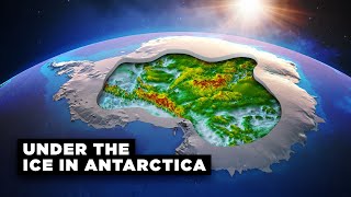
It's hard to comprehend the forces that could cause a continent-size area covered with lush forests, rivers, and lakes (like what you describe Africa used to be) turning into a gigantic desert in just a few thousand years, unless one considers the possibility that earth’s axis and its astronomical directions may have abruptly changed due to cataclysmic astronomical events. Such events could have caused pole shifts and massive geological displacement of earth’s crust, indescribable destruction on the surface, including massive electrical discharged, gigantic fires, flooding, typhoons, etc. After such cataclysm, as Velikovsky describes, the North and South poles may have moved to where the tropic used to be, and what used to be the tropical belt would now be frozen and baren land. Just look at a familiar example: we know that if the Gulf Stream current was somewhat interrupted or deviated, Western Europe would be like Northern Canada and Scandinavia would be under permafrost, imagine a scenario where, not only one major current, but earth’s entire geography is totally rearranged: New poles, new equator, new seas and continents, new atmosphere, new solar system configuration and new orbital trajectory (new sun?)! With such upheaval and geological changes, the desertification of North Africa becomes quite plausible, just as the ice-free Antarctica depicted in the Piri Reis map suddenly makes sense.
If what Velikovsky proposes is true, such massive disruptions would have occurred at least twice in the last 36 centuries, but perhaps many more times, if we consider smaller events. But what if we go back 120, 240, 360 or more centuries, how many such astronomical upheavals has the earth survived? The official geological records of the last 100 million years looks like a roller coaster ride with huge swings at regular intervals and abrupt extinction events. Of course, it’s difficult to take what ‘scientists’ say at face value due to the Global Warming cult and other immutable dogma. The point is, our planet’s ancient history appears to have been extremely tumultuous, up to our historical time.
It may be very difficult to solve the North African historical puzzle, without adopting a method akin to Velikovsky’s interdisciplinary research approach: finding and studying what ancient legends/myths and written texts say, conducting multisensory satellite observations of specific areas, once an point of interest is spotted, doing excavation of the sites, etc. For example, I would try to find these hydrological basins and locate the coastal areas that are adjacent; these must have significant traces of human development, if what the ancient maps show has any validity. We know we haven’t uncovered much of Egypt’s ancient secrets, imagine what lies beneath the 9 million km2 of the Sahara (an area 12% larger than the continental US)? One can hope that it would be possible to do this type of research with some African nations, if not now, perhaps in the near future.
Excellent comments although unfortunately if we are heading into yet another earth moving catastrophe we are going to be set back once again to start again.
Pole shifts could account for such a catastrophe . The disruption of all current flows , air & water , globally , along with the raising & lowering of land masses .That would account for cities buried under mud , under water , in lakes & oceans . Add to that , the foolishness of destroying the Library of Alexandria twice , by Muslims , & Constantinople once , by Turks , mankind tends to get very large holes our history . Pole flips , an incline to 90 degrees , then back to current , would do the same damage , but the land masses would be relatively the same , just highly barren for a long time period , from the ocean salt of 1000 ft. tidal waves . There is evidence for this , every 12K , & 6K years . 2040 to 2050 is the next one . Academia would have us believe no flood happened , & that everything important happened in the last 5K years . No . There were global civilizations , long before that .
It's called 'artistic license'. They made maps of Africa depicting what they _thought_ was there, and what people would _believe_ was there, because that is what sold maps. It wasn't like anyone who commissioned, inspected, or displayed the map was going to have _factual grounds_ to dispute what was represented by them! And, it's not like they, or anyone else, was going on fact finding expeditions to prove or disprove what was being claimed...
And the people commissioning and buying these works of _art_ were fully aware of these conditions at the time!!! It's only in the modern age, with our modern mapping conveniences, that some people think that these must have been facts recorded for posterity!
Archaeology and our lost knowledge has become one of my favorite things in existence in the past few years due to exceptional people like Jimmy,Hancock and others...I thank you so much and wish that one day we will get more answers!!
According to Wikipedia Lake Giga-Chad was still in Mega-Chad form 3.000 BC, when the first pyramids were build. So the Egyptians did have trade routes through the whole Sahara and surely have visited the Richat Structure while it still had some water. Lake Kilo-Chad was still pretty huge lake during the roman times, so it is no wonder how the cartographers got this information.
Yep it would have been a hot tourist destination, for sure. Everybody that was anybody would have known about it
😂😂😂😂 Giga Chad lake would be a super famous tourist atraction today
Assuming the pyramids date?
@@ONEILL0099 Yes, the evidence points that old kingdom pyramids are mostly build when the humid period in Sahara was at its very end, and Egypt was the dominant power thanks to river Nile. Around 4.800 years ago.
@@ONEILL0099they must not have seen that 7000 year old carving of the pyramids
Rivers and lakes are disappearing right now in the Caribbean and north America but nobody is talking about it. Whilst there are springs bursting up in the desert in the middle east
The Sahara has received relatively little archaeological attention. These maps would make a great starting point. Can we locate some of those lost settlements using LIDAR?
2:54 On these maps you can see that the Sahara wasn't always a dessert.
I think there's strong evidence for a green Sahara.
Jimmy is a better scholar/teacher than 99% of the official scholars/teachers.
Ummm, whuh?!?!
@@Meine.Postma Since no one has ever solved the whole enigma of our ancient past, i agree.
They are all the same, it is all about money. I doubt any of these people are in any way interested in knowing actual truths.
I say that, as someone who has managed (after 30 years) to do just that, which none have done before.
We tried for a year to rouse the interest of academics as well as Alt Researchers and the new Generation of RUclips "researchers" and all just keep ignoring us.
It is pathetic. Donna, Hancock, and so many more are all not worth their salt.
NONE of them.
It is extremely difficult for our research group to believe everyone has missed all we now know.
Facts are, there were people here who used Technology thousands of years ago and it was and is kept in massive underground facilities.
From experience, we will assume that not one person will have any questions, if this whole comment is not deleted by this "Truth seeker".
this is why everyone should seek a rogue scholarship. Nothing the sheeple have been taught is truthful.
@@entertainmentranger4140So where can I see your research?
Most scholars use sociological theories without digging site to build their narratives. So the story of Joshua and the arrival of jewish people to the promised land as per the Bible is discarded because it "does not make sense" as per some leftist sociological theories. Most scolars refuse to embrace evidence from digging sites because doing so would mean their published material would be rendered obsolete.
Just imagine if we still had the Library of Alexandria. I bet we would have been able to bridge so much of what is dismissed by modern science as mistakes or just too primitive. I can't begin to fathom the history and knowledge that was lost to that fire.
There’s so many videos saying that library didn’t hold anything important
@@geni412but is that just a false flag to make us stray from our real past! Just like these maps, not vastly viewed, kind of hidden from the mainstream. We just have to rely on what we’re taught, or what science considers right.
@geni412 in Tibet they found a library or monastery that holds 84000 books of knowledge going back 10K years. Closed off.
That black and white map from 1507 looks like it could have been Tolkien's inspiration for Middle Earth the way North and South America are depicted.
How did the mapmakers know the names of all those lost cities?
The reason they don't share this in schools these days makes your research and sharing of this content even more valuable. Keep going man!
The size of the Sahara and the volumetric expanse of sand could literally be hiding just about anything. I know the Sahara isn't all sand and that the dunes aren't stationary, but even so, it is pervasive enough to possibly conceal crucial details to North Africa's past.
Considering what we've already found preserved in hot, dry climates, or buried under sand (the Dead Sea Scrolls, Nag Hammadi library, Gobekli Tepe), the possibilities of what lies under the Sahara boggles my mind! I hope I get to know in my lifetime.
So is the ocean
@randomxaos There's at least attempts at exploring and mapping the oceans.
The sand? ...not so much.
I understand that the "authorities" do not want the "crucial" details of North Africa's past to be revealed. I suspect the area was intentionally scorched, flooded, destroyed, and/or buried.
@@MagicianPhysician I've had this same intuition for awhile now. Its just too barren looking from outer space.
Can you imagine being a civilization along these rivers and seeing everything you knew being turned to dust and sand a dead land
I have the first map. The scramble nations tore down the castles and cities, so they could perpetrate their lies about Africa and Africans.
As you see they completely ignore your comment. I wonder why...
I think something that is often overlooked is the Alexandria Library fire. It could be that the source maps for these cartographers were lost in the fire. If that’s possible, we’re talking about only one thousand years between Alexandria’s fire and your maps featured here. It is conceivable that the information on those source maps was passed down through oral traditions during that 1,000 years. Great video 😄
Really wasn't a ancient that fire was it?
@@MrSassduk The fire itsself not, but the conents of this huge library was.
@@yanis539 This reminds me, we excavated all these artifacts from tombs and the Pyramids and put them in the British museum. If Russia nukes London, they'll all be gone. So I asked AI about it, it told me not to worry.
In the event of a nuclear strike or any catastrophic event, the safety and preservation of ancient relics and antiques depend on various factors, including the specific circumstances and mitigation measures in place. While it's true that some ancient relics and antiques are stored in the pyramids of Egypt, it's essential to note that not all artifacts can be accommodated or appropriately preserved there.
Many valuable artifacts are located in museums worldwide, including the Museum of London. Museums often have stringent security and conservation measures in place to protect their collections. These measures include advanced security systems, climate control, fire suppression systems, and trained staff to ensure the safety and preservation of the artifacts.
Furthermore, the pyramids of Egypt, while historically significant, may not offer the same level of protection and conservation capabilities as modern museums. They were created as tombs and may not have the necessary infrastructure to safeguard artifacts against various potential risks.
In the event of a nuclear strike or any major disaster, safeguarding artifacts becomes a priority concern for museums and cultural heritage organizations. They create emergency response plans, employ specialized experts, and implement strategies to minimize damage and ensure the protection of valuable objects. This can involve relocating artifacts to secure off-site facilities or taking other necessary actions depending on the circumstances.
Overall, while the pyramids have played a significant role in preserving ancient relics for centuries, museums like the Museum of London and others use advanced techniques and technology to ensure the safety and preservation of artifacts under various circumstances, including potential nuclear strikes.
The Pyramids were NOT built for tombs....keep digging! God Bless you! 🙏
Imagine the knowledge of the ancient world destroyed. Makes one wonder what information was lost.
Lake Mega Chad was likely filled during the deluge then fed by the glaciation the same event caused, and eventually dried out when its resources were depleted. It was massive in area, but probably not very deep. A large surface shallow basin can evaporate fairly quickly without inflow. We've seen this in our time as well.
No, it wasn't very deep. One of the clips he shows that talks about lake mega chad says that the depth was 36ft (11m) at most.
Mega Chad, the grandfather of the Giga Chad😁
@@kke 😂 😂 😂 I came here to make a similar comment
What is most fascinating about these maps is that there is a general consistancy to them of the features you speak of, therefore based on the perponderence of the evidence these features likely existed. Taking into account that these maps were done by different people in different places at different times only adds to their general credibility.
There is also a map showing Atlantis on the west coast of Africa. There is also a place in the Sahara on the west coast of Africa with circles and mountains as described about Atlantis.
I spoke too soon he covered it.
My main question is how did so many bodies of water dry up? To exist for thousands of years. Only to be gone in a few hundred. 💭 🤔
It got very hot, some would say as hot as a desert...
We killed the Aral Sea in about 50 years.
SUVs, they must have had SUVs 10000 years ago. That is the secret they are trying to keep :)
I could be wrong, but...
Pole shift.
When the pole shifts, some land will raise, some land will lower.
Land at the equater is further from the earths core than land at the poles.
There are loads of examples of this all over the planet.
Maybe God is real... But that can't be right?
When GOD said he would keep man out of EDEN, He wasn't kidding.
Turned the whole thing to desert
Glad to see you are back to posting regularly. I know the research takes time but keep blessing us with these thought provoking videos.
Makes you wonder how much knowledge of the world we’ve lost and rediscovered centuries later
It seems to me that this adds to the evidence that the people around several thousand years ago knew a good deal more than we realise, not only about geography but also about the natural energies of the earth, which they tapped using specially designed structures such as stone circles. (And arguably the pyramids.) It is a great pity that many of the ancient writings collected in the great libraries of the past were destroyed by rulers who regarded them as "pagan" or anti Christian.
Sure would be nice to know what was in the library of Alexandria.
Those "energies" are known as slavery. Once you master the energies, you can do pretty much anything.
Yes but those people were black. Meaning we can't give these people credit because it will go against all the prejudice we project towards the creators of the human race.
@LLlap - The slaves built the structures. We know this. But what they are saying is that the structures themselves were designed and built to harness the energies of the planet itself.
@@LLlap Jokes on you if you think that is dead, lots of people worldwide work day to day just to eat an unfulfilling meal and sleep along tens of others because that's the peak of what they afford, basically how slaves lived like long long ago...Nothing really changed, we just call it different names and called it day.
I.could.only imagine what's underneath all thet sand in the Sahara 🤔
"More sand"
-King Tut, probably
Refer to seismic surveys done all across Africa by oil exploration companies.
😮😮
Yeah man Dr. Ben Jochanan had been talking about these river systems across Africa since the 80s. Many people migrated east to pre dynastic Egypt and some fled West and South. These maps are reproductions of Extremely ancient knowledge that's been passed down over several millennia. Fascinating! And since you @brightinsight arent afraid to approach Africa and all of its truths and possibilities, you will be by far ahead of the game, when it can no longer be ignored.
Necho II who ruled in the 26th Dynasty (610-595 BC) from the city of Sais in Egypt, with the Phoenicians circumnavigated Africa in three years starting from the Red Sea and coming back through the Strait of Gilbralter returning to Egypt according to Herodotus the "Father of History".
The city of Sais is where the Rossetta Stone originated from and also is where the 10,000-year-old records of Atlantis were according to Solon the great Athenian law giver. This could have been where the ancient maps were kept.
Edgar Cayce the Sleeping Prophet also stated that the Sahara was once lush and that the Nile emptied into the Atlantic from East to West in his readings before 1950.
Great to see you back Jimmy! As always, thought provoking stuff!!
All this proves is the fact that Cartographers of old, copied one another down through the ages, and others just filled in the spaces often with imagination. It’s also well known that 9 to 10,000 years ago the Sahara was tropical.
I haven’t had one notification/update/or video from this channel in forever. Glad I remembered to check in. Def some shadow banning going on. Love your work, Jimmy. My name is also, Jimmy!
The man, the myth, the legend, had come back when we needed him most.
Glad he hasn't been hauled off to some remote forced labor camp by the feds for speaking facts.
Good to see a video out of you, Jimmy! Thanks for all that went into making this video available to us! Take care and keep on going!
who started coming into the lands with fire blowing weapons? That's the million dollar question
Can't wait for the interview with Ben! Eyes open, no fear! ~S0
Ya , Ben Davidson (S.O.) would have some excellent relevant data about this subject . The time-line matches perfectly , 12K & 6K cycle times . Eyes open , nothing to fear . You should talk to him , Jimmy . Excellent post , & I hope they don't erase my comment . I agree with your findings .
I used to hate History when I was studying school. But the way Jimmy breaks down and explains stuff.....It makes a point that any subject can be interesting if you teach them interestingly..... Thanks Jimmy
can have something with that you arent teached propaganda and bullshit here.
Don't take any of this as fact... I hope you realize this is less a history lesson and more along the lines of a conspiracy theory.
With that said I do believe there's hidden/lost human history we haven't discovered.
@muscleman125, do you even know what a "conspiracy theory" is? Sharing vintage maps of the Sahara is far from it....
@@BrightInsightconspiracy theory (n)-any fact that hasn't been approved by the mainstream media yet.
@@BrightInsightit's easier to fool someone than convince em they've been fooled
Jimmy, on it as usual. It's crazy that there aren't majorly funded expeditions looking into this.
Yes, Mauritania, where the Ricat Structure is located, is politically unstable. Just not a great place to visit right now.
@@sedleyparkinson1506 probably upheld by cia or something to make sure people keep out
Only thing that would come out of that is the information being hidden great example Egypt! 🤦🏽
A kidar scan of the Sahara needs to be done to stir the pot
Who would fund it? The folks with the money are more interested in controlling other humans than actually doing something positive for humanity with their money. Bill Gates is a shining example of this.
I think the change happened around 600 and that the maps were of that time, The richest African king took so much gold to Mecca it became devalued!
If the Sahara was lush & green as recent as 500 years ago, that might throw a big wrench into your Atlantis theory. Not to mention how abysmal our current dating methods are.
That being said, I think it's more likely that people were copying maps handed down through the ages. How long would it take a 16th century cartographer to map a single contingent?
It's a very interesting topic worthy of way more attention than it gets.
Did you notice on many of the maps, it wasn't showing the Richat structure...only round lakes. Even if the maps from 500yrs ago were copied from earlier ones, the structure maybe was there but still under water, (remaining from the flood). It was also written Atlantis was lush and green as shown on the Sahara maps.
I wonder what happened to turn the Sahara area into the vast desert it is today also maybe those towns/cities are still there buried under all that sand.
Like you say" the experts" could have got a great many things/calculations wrong.
Watching this video and considering the time-frames suggested, I can't help but connect this to Suspicious0bservers' theory of 6,000 and 12,000 year disaster cycles. It just lines up so nicely with scientists' theories of green Sahara which are corroborated by these maps.
I absolutely agree. As it was before so it shall be again soon.
@@16830mw Not soon enough.
I 100% think there was an industrial civilization in our past and I think these maps are mostly made from older maps a'la Piri Reis. Also, many early cartographers made relative landmark maps, which does help explain much of the Sahara Settlements on these maps. They were depicting sub-urban areas located north of timbuktu. Now, if we want to find the really old settlements, follow the oases and dig.
Seeing those cities in the Sahara makes me think of that freakishly well preserved mummy of a child in a bag in the middle of the Sahara desert that was really old, heavily implying that people used to actually cross the desert with entire families in the past, when now it’s difficult to even reach the place the mummy was found with a small research team with modern technology.
that map on your shirt is a particular shock. But yes, the study of maps may be the best education on the planet, literally. History has been re-written by the victors so many times that history (like a lot of science like physics too) is highly suspect if not entirely discredited.
I watch every video Jimmy posts. Wish he would post more often but I greatly appreciate the depth he goes into the topics on his videos and understand that it must take a ton of research and time to make the videos he creates. Keep up the great work!
Yes, and kudos to his production staff, whomever they may be.
I'm amazed Jimmy was able to find all those old maps. Every time I try to search online for ancient maps of the world, the results are SO filtered that I hardly see anything I wasn't already taught in school in the mid-90s.
Censorship
I did find some old maps on Wikipedia
We all thought the internet would be this incredible place where the knowledge of humanity was stored for anyone to access. I remember being taught things like this as a kid, what we weren't taught was that the elite still have a firm grasp of information and even though it may exist, you cannot find it unless you know "exactly" where to look or have the technical know-how to get around.
@@BlakeusAurelius Yep, same for me. And back then, it was near-impossible to imagine information being censored.
@@Ne0Freedom Did you have to search for specific things? That's usually the only way I can ever find stuff like that.
I was just wondering what Jimmy has been up to. Great to see you back!
I was taught that the Sahara only became a desert around 100,000 years ago caused by the beginning of a glaciation period
1: Tropical Sahara makes sense in a young Earth lense.
2: Lake Chad dried up in our lifetime. I remember reading about it as a child.
3: Joshua's long day could explain the catastrophic flooding and the destruction of Atlantis.
I love old maps, even in your own neighbourhood you can learn how it grew from a few cottages into a City.
Yeah I love maps too, pretty much every day I look at a map, ordnance survey maps are a like books with a different story every time
Seeing all these maps it's baffling how mainstream historians refuse to acknowledge the idea of a lost ancient civilisations whose maps were used to draw maps in the 15th and 16th century. Excellent stuff, Jimmy, I love this video! I can't wait to see you talk to the Forbidden Frontier guys to possibly go in even more depth.
Ancient lost civilizations with advanced technology would go against the narrative that Europeans are the “most advanced” hence why it’s always rejected
They don't "refuse" they get paid to lie. 🎉
They have certainly admitted that the Sahara is undoubtedly home to many lost cities and other archeological sites. They just don't really think about the consequences of that, I think.
It's not unlikely that less than 5000 years ago there were still some areas drying out and hence inhabited perhaps as recently as 2000-3000 years ago. But like the civilizations of the Amazon, which they also denied existed for a long time, as soon as nature took over the sites would have been completely lost very quickly.
@@AlbatrossRevenue they don’t WANT to because then it would go against the whole “Africans never invented anything so we were justified in putting them in slavery” narrative. Notice how most of history downplays any accomplishments by black-skinned people
@@heerosanosyuy1173 paid to lie? Why though?
The answer to why it dried up is easy. The glaciers in the Atlas mountains completely melted and no more water flowed down the mountain. If the last glacial flow was around 5k years ago it makes perfect sense. It took 6K years to melt. The Holocene started 11k years ago. The numbers add up.
There are some old paintings as well that show castles with cityys and both white and black working together all dressed in silk big hats things were much dif than what were taught
Jimmy is one of " these" people who has a job to introduce us to the real world and the real hidden history slowly, step by step. So much interesting stufd is coming out lately...As far as I'm concerned, it's an organized world action
15min video feels like 5mins with all the information you share with us. Amazing work Jimmy, thank you 🙏
Glad you are now on Rumble, uncensored. Loved your rant on your first livestream there! If you get cancelled here we will know where to find you!