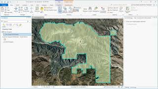
Navigate maps and scenes in ArcGIS Pro

HTML-код
- Опубликовано: 25 апр 2023
- See how to navigate maps and scenes in ArcGIS Pro. You'll learn how to navigate a 2D map and a 3D scene using the explore tool, the on-screen navigator, and with the keyboard. Follow the scripted tutorial for the current version of ArcGIS Pro in the ArcGIS Pro documentation: (pro.arcgis.com/en/pro-app/lat... )
____________________________________
Follow us on Social Media!
Twitter: / esri
Facebook: / esrigis
LinkedIn: / esri
Instagram: / esrigram
TikTok: / esri_maps
The Science of Where: www.esri.com  Кино
Кино


Thank you for watching! If you have questions about our products or services, make sure to visit community.esri.com/. Is there a general topic you'd like us to cover in a future video? Let us know in the comments below!
ruclips.net/video/zpwpqBizRDw/видео.html
The Flash couldn't follow along with this tutorial without having to pause
Hi Riley, these videos are meant as overviews for our written tutorials. I highly recommend checking out the link in the video description and following along with our step-by-step written tutorial. Hope this helps!
great
hello thank for interesting video tutorial
Hey - just a question: how frequently is the satellite data/images updated? For example: I'm a journalist. And if there is a wildfire and would like to show it in a map - would the image of the affected area be present or it's an image taken some time back?
Hi, the satellite image is usually updated once a week
ruclips.net/video/zpwpqBizRDw/видео.html