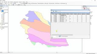
Download Soil data and Prepare Soil Type Map in ArcGIS

HTML-код
- Опубликовано: 20 окт 2024
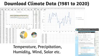
- Hello and welcome everyone to GIS and RS Solution channel. Today we're here with a brand-new tutorial regarding how to download world soil data in several format like ESRI shapefile, ERDAS, IDRISI and other as well. Following this video, you will be able to prepare soil type map of any location of the world. I hope you will enjoy this video. We have tried our best to make it as easy as we can. So, Let’s have a cup of tea and stay with us till the end.
Soil type download link: www.fao.org/geo...
Hope you enjoyed todays video. If you do so, please consider subscribing this channel and give a like and share with your fellows. You can also write in the comment section which type of GIS and remote sensing tutorial you needed. I will try to prepare and upload as per your requirements. Bye today and meet you in the next video. Stay safe and stay cool. Thank you for being with us.
related tags: soil type, soil classification, download soil data, how to download soil type data, how to download soil classification data, how to prepare soil map in arcgis, soil classification map in arcgis, soil classification map, soil type map in arcgis, soil classification in arcgis, soil map in Bangladesh


This channel needs more recognition.
Try to make geological and tectonic maps of the world and Bangladesh including downloading the data also. Bangladeshi geography students like me are thankful to you.
Thanks for your suggestions. I will try to keep your words. Please keep in touch.
it will b of great help if u can explain these soil types or provide link elaborating the properties of these soils. so we can decide which is better for water retention etc
thank u for giving brief explanation!!
could you do another video on the land suitability analysis for surface irrigation with the parameters slope, soil and land use land cover!!
Excellent presentation. thank you.
Please make a tutorial video of preparing land capability Classification map using GIS
Thank you. Please keep in touch.
It's so help full thank you
it is not opening
Hello, When trying to clip a specific study area from the region, It shows the error message " one or more drop items were invalid and will not be added to the control". The same goes for mask, what is the problem, please?
Please upload a video regarding preparation of Soil textural map if we have individual layer of sand, silt and clay content
I have a plan to make a tutorial on it. Please keep in touch.
Thanks for the valuable information
You are welcome.
Thank for valueable video. But we can't download shapefile for this site please provide any solution for us.
Hi, do you have any video showing how to make a CN map from this DSMW soil map and a land-use map?
I tried to open the soil type shape file using QGIS but it shows no CRS attached to the layer. Any recommendation?
hi sorry could you please give the link of KMZ file of google earth . because there is not actually on the website they removed it from website, Thankyou
the link you have provided is leading toward different topic, it does not shows the soil map as u mentioned
Attribute table is not in sequence
What should we do?
very good
Mashable allah
Can i get the latest data for 2020 or 2019 for my project please can you tell me???
Which methodology we do used sir?
firstly, thanks for the information. i am just wondering how can I get the date of certain area? am i just adding my specific shape file? how?
data*
I can't access the website. When I click the Digital Soil Map of the World it shows " the page is not working" .
Please give me the shapefile and the image pdf .
I urgently need this data for my College project.
Please send me 🙏🙏🙏
How can i cut my study area by shape file? I know it's possible from raster image by shape file masking... But its a vector file ... How could I extract then?
When i import the shape file in to arc map it is saying that unknown spatial reference ? But that is not in your Video ? Can you please explain me that how to fix it?
First you have to set the coordinate system of your location like Geographic coordinate system or Projected Coordinate system (WGS 1984 or any other).
@@GISRSSolution thanks
@@chiranthadissanayake1326 could you please send me the shapefile of soil map beacause FAO server doesn't response with me and I need it ? Thank you. mail: mona.metawee95@gmail.com
@@monametawee6669 just sent please check
sir can you just tell me where can I get world's wetland shapefile data ??
How to convert it to A b c d TYPE FOR CURVE NUMBER CALCULATION?
Hey kindly direct me on how to get the DSMW location excel sheet .I will really appreciate.
I can not clip specific study area from the region, It shows error message " one or more drop items were invalid and will not be added to the control". Could you please suggest me a solution?
You can watch this video about how to extract specific study area. Hope it will be helpful.
ruclips.net/video/JMGvmDeW1-0/видео.html
How to choose the fid for a country not given in order? Bangladesh it was in order but for some other country its random.
sort the column of country ascending, it will be arranged alphabetically
thank you, but I cant reach the website, if possible please send the shapefile
I am also unable to download
indrajitgeo51@gmail.com
Hi..
Can you suggest how to get shape file for hydrological soil group classification (HSG-A, HSG-B, HSG-C,HSGD)
Thankyou
nope. all the best.
Can you give a soil classification map in philippines because it is a requirement in our course. Its hard for me to get cause i dont have a laptop to do all the things. Please
You can tell me that resolution for Bangladesh region..
What if we want to know the type of soil frm a particular location?
In this case you can extract the location based on area specific shapefile. Thank you.
hello, hope you will this message, did you get information for the certain area you want?Cause I also need to get data of my certain area
@@mervekeles5809 you can get your desired area by clipping. thanks
THANKS
please
can i have a video about
How to download esa cci soil moisture data
How to calculate surface runoff usng Arcgis / QGIS?
you have to use Arcgis extension GeoHMS
Hello, i'm cant reach to browse the site, can u please send me the shapefile
try another browser.
Sir please tell me cell size or resolution of this soil data
How to convert vector into raster of soil type?
Using conversion tool of arcgis
Could you please send the wold soil shapefile in our country is not available the site, I means send me DSMW file
Which country you need soil sample?
@@GISRSSolution, sorry for the late reply, I need the Afghanistan soil shape file.
download the dsmw file and then clip it according to your use using clip tool
@@akanksharana6145 thank you
how to download AHP data for Pakistan
Could you please provide the link to the software? Anyone?
Which software you are asking for?
Arcgis
@@malapamei13 please check my videos. You will get a tutorial on it with software download link.
@@GISRSSolutionThank you for your time. The thing is I'm having difficulty with the download. Let me just try again.
@@malapamei13 Okay. If it is not working, let me know. I'll share the link again then.
The background music is annoying.....
P
propaganda_
#sixlline :