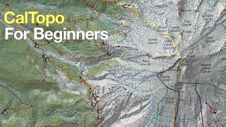
CALTOPO TUTORIAL // Backcountry Mapping Made Easy

HTML-код
- Опубликовано: 31 июл 2024
- Caltopo Tutorial - Backcountry Mapping Made Easy
Caltopo is a free mapping tool that helps you create great high quality topographic maps. With Caltopo you can create routes and waypoints for your next backpacking or backcountry hiking adventure.
In this video tutorial, I will show you the basics of the interface, how to create markers (points), plan a route and print high quality topographic maps using some of the common base map and overlay features. We will also analyze a route using the elevation profile tool and terrain statistics.
Facebook: / outsidechronicles
Instagram: / outsidechronicles
Website: outsidechronicles.com  Хобби
Хобби


![J.P., NLE Choppa - Bad Bitty (Remix) [Official Music Video]](http://i.ytimg.com/vi/rBDa6BCvw10/mqdefault.jpg)


Good information. Thanks for sharing. 🙂👍
Thank you, stay tuned for another Caltopo video on importing/exporting routes and points to GPS devices and apps. Thanks for watching!
instaBlaster...
Amazing video! You have a very effective way of explaining things without adding additional confusing info. Appreciate the effort that went into this video!
I appreciate the kinds words. Thanks for watching. Be sure to check out my Avenza Maps video to see how you can use Caltopo maps offline.
Excellent tutorial. It shows you put a lot effort into this to help all the rest of us. Thank you!
Thank for the kind words. I love maps and Caltopo! Thanks for watching.
Finally, I found an in depth explanation that I can understand. Thanks good sir.
My pleasure, glad it helped you. Caltopo is my go to mapping tool. They now have the TF Outdoors map layer, be sure too check it out on the right side drop down.
dude great tutorial. cal topo is such an important tool for backcountry exploration. this is what we used when we mapped out the wild west trail. thanks for sharing!
Thanks for watching. I can't believe it is free! I also have a video on Importing/Exporting into devices using Caltopo and a Land Navigation series.
Excellent video and clarification. I'm much more confident in utilizing this tool now.
Glad it was helpful! Thanks for watching!
Great tutorial!
Great job describing this tool.
Glad it was helpful!
Great presentation. Concise and clear...good job!
Thank you!
Hidden Gem. Thank you!
My pleasure, thanks for the comment
Thank you so much for this, Sir! Very helpful!
Glad it was helpful, see you outside!
Great video. I can’t wait to start making my own maps.
You can do it!
This was an AWESOME instructional video. Thanks so much.
Glad it was helpful, see you outside!
Seriously, this video will undoubtedly save people from many a fun hike turned scary. It may even save lives. It simplifies an program that some would find confusing or intimidating. So many people just give up mapping and hope for the best or think they'll be able to remember the route. Thanks again!
Great tutorial on using CALTOPO maps.
Thank you so much!
Thank you!! You covered about anything hikers would want to know
My pleasure, be sure to check out my Avenza Maps videos that can integrate with Caltopo Geospatial PDFs for offline maps.
Amazing! So helpful
My pleasure, glad it was helpful. See you outside!
Edit: I spoke too soon! If I click on the route, it brings up a different menu then the one you showed. It does give an option to extend. However, when I click on it, every street and trail on the map turns bright yellow, and my route disappears!
!Excellent tutorial! Very clear and concise. I was trying to find out how to extend the route. I searched through the calitopo material, and watched two other tutorials, without success. 14:47 You nailed it, and it's so simple I feel a little silly! But then, there are so many options on these apps, It can be overwhelming. Sometimes you can't see the forest for the trees! Great job and I'm definitely a subscriber!
The snapping with routes can sometimes be tricky. I flip flop back and forth with Caltopo and GaiaGPS. Caltopo is more flexible, but GaiaGPS has better snapping. Happy to answer any questions.
Fantastic tutorial, very helpful!
Thanks for the comment and watching!
Nicely done. Thanks.
Thank you! Thanks for watching!
Excellent video... great information and very well presented.
Thank you, hopefully you learned something and take advantage of the great free tool. Thanks for watching!
Great video !
Thank you very much ..
My pleasure, thanks for watching! See you outside!
EXCELLENT video!
Daryl Fleischer Thank you! And thanks for watching!
great video thanks so much for doing this
Thanks! I appreciate the comments and thank you for watching!
Excellent tutorial, thanks.
Thanks for the comment and watching! Be sure to check out my Land Navigation series. Land Navigation ruclips.net/p/PL0JzmvrJfyEQ7mLgesV8Ue6wU-iWwsIqJ
@@OutsideChronicles Absolutely, thanks.
Really enjoyed this and coincidentally I’m using it for Adirondack back country bushwhacking :) and a 46er familiar with your Wright Peak example. Great content!
Glad I could provide some assistance. Bushwhacking in the Adirondacks is no joke. We did one in winter since we had some extra time. Planning to do the Shepherd's tooth to Iroquois this summer. Ever hear of Erik Schlimmer?
Outside Chronicles Nice, that hike should be a blast! Yes, I’m familiar with some of Erik’s writings and the Trans ADK Route is on my hiking bucket list.
@@phillipg7315 Cool, he is a good guy and has done his share of bushwhacking in ADK. Happy Adventures!
Excellent
Thank you so much 😀
Great!
Glad you enjoyed it!
Thank you!
You are welcome, thanks for watching!
Nice vid. Shout out to the 46 peaks!
Thank you, are you a 46er or aspiring? I’m 12326W.
If I make a mistake, can I reverse my line? I can't figure out where to do that??
Thanks for the detailed tutorial on how to use CalTopo. When I took a Land Navigation class at REI, the instructor used CalTopo. But he never taught us how to create Maps. This tutorial fills that void. Quick question, does CalTopo give you the option to save maps in GPX format?
Yes, Caltopo you can import and export to GPX or KML. Have a look at this video: ruclips.net/video/KR89wsIluV8/видео.html Thanks for watching!
I just listened to you and you are a great teacher. I’m 74 years old (or young) and I want to get in deeper to Caltopo.
I do deer food plots and do Church Mens Group “All about deer" talks here in PA as a hobby. I do mapping to teach the best I can during my talks. I don’t want to kill deer - I want to grow them and take Grandfather/Father/Son teams on hunts. I want to up the odds of success for these “family” teams.
Will you be my pen-pal on Caltopo help! Many of the terms are new to me. I have 36 years in the computer software business but none in mapping and that
hurts me sometimes.
I am happy to help. My background is in IT, but also have a degree in Environmental Science where I learned a good deal of mapping. Feel free to reach out to me. My email is mike@outsidechronicles.com
@@OutsideChronicles I have sent an e-mail. This will be great!
Thanks for your useful posts. Question, I just found these apps. Does your tutorial work with trial version?
Yes, all of my videos are using free versions of the app. I would suggest looking at my Avenza Maps videos, it’s a great combo with CalTopo
Does CALTOPO have designated trails (trail-maps)? If so, I'm having a problem finding them. Can you direct me where to find them ? and thanks a ton for your tutorial !!! I must have missed that where you covered pre-existing trails
It depends on the area. Some of the more popular areas are mapped via OpenStreetMaps. The best map for this for hiking is the TF Outdoors basemap. They recently added this basemap. It has many of the trail in the Adirondacks and some of the local ones in WNY. The local parks are kind of hit and miss. The larger state parks and national parks are mapped fairly well.
This was awesome... great tutorial. I've been trying to find a details backcountry map service for my phone, instead of using Gaia, Avenza, or All Trails. I take it that once the maps are downloaded, it should be easy enough to pull up on my phone and use the GPS locator to see my location?
My mistake. This is just a map maker, not a GPS app I guess.
Correct, but I create my routes with CalTOPO and then export the GPX file into my GPS device. Check out ruclips.net/video/KR89wsIluV8/видео.html
Thanks for the great video, I just found out about CalTopo and trying to figure it out now. Video is a great for getting me started. I did scroll though the comments and see that you kind of bounced around my question for you though, and my question is, if I import the map into Avenza, will it be geo-referenced, I teach map and compass as well as gps stuff to a lot of fire folks, but they always want the ability to have a geo-referenced map. Some just dont feel comfortable without the blue dot.
You need to use the print function, I explain how to do it in this video: ruclips.net/video/oeQLOlYJQDA/видео.html
Thanks, found it and have a geo-referenced map. Great videos
@@smokejumper94 Awesome! Thanks for watching and the comments.
7.5' is not "7.5 feet". It is 7.5 minutes. Recall from trigonometry: Degrees, minutes and seconds. The USGS 7.5' map series (a.k.a. 7.5 minute) is so named because it covers 7.5' of latitude and 7.5' of longitude.
Otherwise, a very helpful video.
Thanks for doing this, have been following along. Noted your recommendation to make pages, so did that. When I placed the resulting map in Avenza, I see tiles of each page outlined on an index map, but it does not appear to take me to that page, even if my location is within one of those pages. I get the impression I must be missing something as the ability to create pages would seem to lose it's value as it stands now.. I also noted that Caltopo does not create a QR code when you add pages to a map, but they do note in their documentation that: " The PDFs will not have QR codes unless specifically added as a custom input.". I'm assuming that perhaps that "custom input" is just available in Pro versions.
I think Geospatial PDFs can only be a single PDF page because of the information embedded into the file. My guess is it is no longer a true Geospatial PDF when you add multiple pages although the option is still there. You should get the QR code when you print even in the free version.
@@OutsideChronicles Thanks for getting back on this. I played around a bit more and discovered you can uncheck the option to print the index page (I previously had deleted the index page using a pdf editor, and as you noted, the mapping app told be I was missing the info). But if you uncheck the box, and you get say, 3 pages, they all appear to contain the georeferenced data you need. Ironically I did just that last night for a 30 km trip we made today to Gibbon Pass, and ironically, I forgot to load the right map into the phone before we left. As I had done the trip many times in the past, it was not critical, I mainly wanted to see how it dealt with transferring my real time place marker from one sheet to the next as we progressed. Also on one of the Caltopo tutorials they do mention that they don't generate a QR code for a multi page pdf, so I had to download it manually and then transfer it from the PC to the phone. Being naive, I had originally assumed that lots of apps might produce georeferenced PDF's, but it would seem that if you do not use a service like Caltopo, you better have a friend in a gov't department that can give you ArcGIS, or some sort of similar GIS software with what I'd assume to be a steep learning curve.
@@MountainParameters Good to hear about the index page. Thanks for testing it out. Caltopo is by far the best free mapping program that produces Geospatial PDFs. I use QGIS to produce maps for my hiking challenge. I have a background in ArcGIS so my learning curve was in college. I also often times plan a route in GiaGPS and import/export the GPX files to Caltopo for offline. Each has their strengths. See you outside!
What version of Caltopo are you using? Im on the free version right now and it doesnt seem to have nearly the functionality of what yours has.
Caltopo has updated their user interface a bit since this video, but all of the features are still present. All of the functionality in this video are using the free version. I continue to use it today. I really like that they added the TF Outdoors Topo basemep. Just poke around, you will find all of the options.
Thanks for the instructive video. I've seen people use Caltopo, but most seem to use a GPS device - either a smart phone with software such as Avenza (especially popular in Utah), OnX Off road, Gaia, etc., or maps tied to a Garmin GPS. With sufficient memory, one can download the equivalent of a very large map, yet include a lot of detail. A particularly impressive feature is to be able to both upload and down between the phone and Google earth via. importing/exporting Google's KMZ or KML file format. QUESTION: Is there a similar capability with Caltopo? 1) Download Caltopo on to phone and have phone's GPS track you on the map relative to path drawn? OR... Upload your excursion afterwards back to Caltopo for viewing and analysis?
Yes, if you purchase the Caltopo subscription, their app allows you to download offline maps. I have found the combination of Caltopo and Avenza to be the best solution for offline maps if you are comfortable making the maps in Caltopo. I created a video on how I use the two together: ruclips.net/video/oeQLOlYJQDA/видео.html I particularly like that Avenza stores GPS tracks (GPX/KML) as layers. This allows me to use multiple maps including high resolution USGS maps. As for tracking during an activity, I use a Garmin Instinct Solar. I just use Avenza as a live locator.
@@OutsideChronicles Thanks so much for the very informative reply. I am considering buying Garmin's 'InReach Explorer Plus' because in addition to GPS, it has (in conjunction with a subscription plan) a two way texting capability as well as an emergency 'SOS' function. I'd like to rely on ONE device, and one which is ruggedized for outdoor use instead of a cell phone. But unless the Garmin interacts with map formats other than their own proprietary one, working only with their maps is too restrictive. For example, a friend carried both a Garmin and an iPhone with FREE map info from Google maps. Google was accurate, while Garmin's still showed a bridge that had actually been washed away 20 years earlier. In short, crowd sourcing is pretty hard to beat for keeping map info current.
@@gregparrott Garmin makes great products, I also agree in having a purpose built device. A bit disappointing about Garmin's maps, I use their Garmin Instinct as my tracker.
Are you able to upload these maps to a Garmin GPS somehow
Yes, there is an import in Garmin Connect. Look in the top right for the cloud with an arrow to "Upload or Import Activity". You can then convert the activity to something that you can use on your device. I believe the Garmin GPS's use Basecamp. It also has an import feature. Check out my video on how to import and export from Caltopo: ruclips.net/video/KR89wsIluV8/видео.html
i am having an issue that you are not covering here. when you are making the route I can't figure out how to delete an error after I accidentally clicked a new point on the route. i am having to start over each time.
Grant, the easiest way to undo a bad point when making a route is to hit the escape button. You can actually hit it multiple times to undo further back in time. Thanks for watching!
@@OutsideChronicles that did it. Thanks!
So I deleted the whole map that I created because it wouldn't let me fix a little error. Now the box in the lower right corner will not go away; tried hitting OK and/or Cancel and nothing happens. Have any idea what's up?
OK. I somewhat figured it out. There is a circular undo button that comes up in the top left of the screen. However, the snap feature doesn't always want to cooperate. I have to stop drawing, then choose edit, then choose to extend so I can keep going. This seems to happen with longer maps, that are over 20 miles or so. I'm drawing a 100 mile map so maybe it's just too much in one go.
@@gausselim1474 Depending on the complexity of the route, you may need to snap and then click a few times to set points, forcing the route you want. If there are a bunch of trail junctions, I find it best to zoom in so that I am clicking the correct route. Thanks for watching! Caltopo is a great tool for mapping.
@@OutsideChronicles thanks. I was a bit better the second and third time around. Appreciate the reply. Best.
Can you use the UTM grid lines as north?
Yes, UTM grid lines are aligned to true north.
@@OutsideChronicles Thank you.
KelTahppo :D
Why isn't this a GPS app as well? If you could just use it like Gaia it would be amazing.
Since I created this video, Caltopo has actually released an app that works much like Gaia. To get offline features, you need to pay like Gaia. Avenza Maps might be the best of both worlds since you can import Caltopo's GeoPDFs to use as an offline map. I have tested it extensively and put a video up on it: ruclips.net/video/lODpR_6dfcA/видео.html I am going to make an "in the field" Avanza Maps video too on how I use layers and different base maps.
@@OutsideChronicles I'll have to give Avenza another try. I tried it once and found the userface complicated. Thank you you the quick reply!