HecRas 2D sediment modeling for beginners

HTML-код
- Опубликовано: 20 окт 2024
- I make a fast review of Hec-Ras 2D (version 6.3.1) modeling for sediment, as one of my students needs it immediately. I will talk about the parameters in detail in the following videos in the future.
Summary of hydraulic modeling (details explained in previous videos)
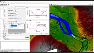
Sediment or morphodynamic modeling steps
I suggest keeping the default value of Sediment data and also reading the Hec-Ras references.


The transport function you selected (Mayer Peter Muller) is developed for 1D sediment transport purposes. The last three functions on the drop-down menu are used for 2D simulation of sediment transport Only. The recommended function is "Wu" because Alex Sanchez from the HEC-RAS development team had been supervised by Prof. Wu and the model was partly developed and tested for accuracy of predictions under his PhD dissertation.
Also, sediment warmup time is highly recommended to be employed to avoid unrealistic erosion associated with starting a model with clear water throughout the domain. Besides, in 2D the warmup period is considered as part of the simulation time period (not a negative time).
Thanks for sharing your information. This is an educational clip and user should check their equations and parameters for their own project. For the warm up, I think I explained same. Maybe the wordphrase was different which is happened in a long recording. I also explained in hydraulic modeling and I believe in HecRas hydraulic warm up is more important and I suggest to have it, but for sediment it depends to your project. Wu transport functions is usually faster than others if you goes into details. But do you believe the MPM equation is just for 1D?! What about MPM equation in other codes rather than Hecras?
We will publish some papers in the future that I recommend you to read about warm up and equations.
Thank you for the video.
Can we get the output map showing the grain size distribution in each cell after the simulation?
Thanks. I think you can see a map like this or near to this if you have appropriate input, just check it and share it with us.
Very interesting video. But one question, sir can I get a such resolution terrain from freely available satellite image?
thank you. It depends on your country. Some countries may have it free for internal use. But generally, no I don't think high resolutions are free. But check them, maybe they provide it for students for free.
Thank you for your response!
Hi Can we get to see the bed level change due to sediment erosion deposition?
If you want the bed change map, yes you can add it it from results
Nice sir
Thanks
thanks]
🙏😊