TRACKING BERYL: An update on potential track and impacts

HTML-код
- Опубликовано: 30 сен 2024
- HURRICANE BERYL UPDATE AS OF SUNDAY AFTERNOON
FOX10 Meteorologist Nicholas Herboso @KnbhWX
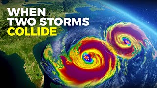
We continue to track Major Hurricane Beryl in the Atlantic. This storm has rapidly strengthened over the past 24 hours into an intense major hurricane. Damaging and potentially catastrophic impacts are expected for portions of the Windward Islands. Hurricane warnings have been issued, and preparations should be rushed to completion tonight. The possible impacts from Beryl include high wind, high waves, storm surge, and flooding rain.
We expect tropical storm conditions to arrive tonight on the Windward Islands. Due to the compact size of Beryl’s core, hurricane force winds will be limited to a small area. The exact track of the eyewall will determine what islands get the strongest winds. At this time, the highest concern is for St. Vincent and the Grenadines, and Grenada. Impacts to the islands should end on Monday afternoon/evening.
The long-range forecast for Hurricane Beryl has the storm continuing on its west-northwest path. It will reach the western Caribbean on Thursday. Based on the current track from the National Hurricane Center, Beryl will near the Gulf of Mexico or the Yucatan Peninsula Thursday night into Friday. Beyond this point, uncertainty increases. Most models have the storm crossing the southwestern Gulf of Mexico then making landfall in Mexico, but a couple models are turning Beryl north into Texas. Residents along the western Gulf Coast should monitor the progress of this system. Right now, no impacts to the central or eastern Gulf Coast are expected. Things can always change, so keep an eye on the forecast.
Elsewhere in the tropics, we have two other disturbances we are tracking. One disturbance in the southwestern Gulf of Mexico may become a brief tropical depression before moving inland over Mexico on Monday morning. The main impact to this region of Mexico will be heavy flooding rain, and significant organization of this disturbance is not expected.
We are also watching a disturbance behind Beryl that may take a similar track. Interests in the Lesser Antilles must watch this system closely.
Follow our team of meteorologists for the latest information…
ON TWITTER (X):
@JasonSmithWX
@jlamberswx
@michaelwhitewx
@matt_barrentine
@KnbhWX
ON FACEBOOK:
Jason Smith FOX10
Meteorologist Jennifer Lambers
Michael White FOX10 News
Matt Barrentine FOX10 News
Nicholas Herboso
For more Local News from WALA: www.fox10tv.com/
For more RUclips Content: / @fox10.news.